TopoQuest Logo
Do you find TopoQuest useful?
Help keep TopoQuest running and adding new maps/features by donating!
Bitcoin:  19c7KJd3qBynnjoSw5npx9KScwjBe4ifkT
Litecoin:  LXs6TkuXGGXo1vDsWCkWVdjQX94eUKd6ui
Home View Maps Find Maps Find Places Resources & Links


Lamb Peak, Idaho Topographic Map

USGS Map Title: Lamb Peak, ID
USGS Map MRC: 47116G3
DRG (GeoTIFF) Download: o47116g3.tif


Neighboring USGS Topographic Map Quads:


  Lakeview, ID  
47116H4
 

  Faset Peak, ID  
47116H3
 

  Cathedral Peak, ID  
47116H2
 

  Cataract Peak, ID  
47116G4
 

  Lamb Peak, ID  
47116G3
 

  Spyglass Peak, ID  
47116G2
 

  Skitwish Peak, ID  
47116F4
 

  Bumblebee Peak, ID  
47116F3
 

  Steamboat Creek, ID  
47116F2


Map MRC Location:

N48°
W117°
N48°
W116°
H8 H7 H6 H5 H4 H3 H2 H1
G8 G7 G6 G5 G4 G3 G2 G1
F8 F7 F6 F5 F4 F3 F2 F1
E8 E7 E6 E5 E4 E3 E2 E1
D8 D7 D6 D5 D4 D3 D2 D1
C8 C7 C6 C5 C4 C3 C2 C1
B8 B7 B6 B5 B4 B3 B2 B1
A8 A7 A6 A5 A4 A3 A2 A1
N47°
W117°
N47°
W116°

Lamb Peak, ID USGS 1:24K Topographic Map Preview:
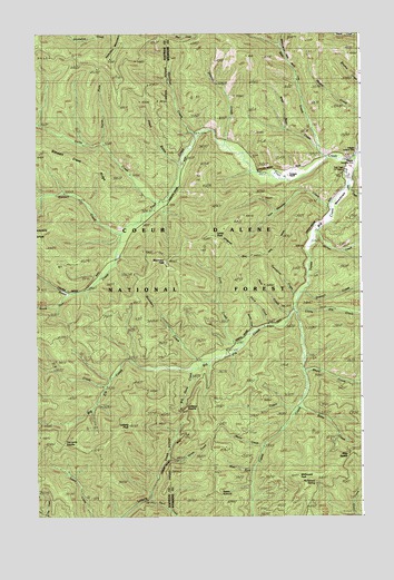
Lamb Peak, ID USGS Topographic Map
Click on map above to begin viewing in our Map Viewer.

This topographic map contains these locations and features:
Feature Name Type Latitude Longitude GNIS ID View Map
Bear CreekStreamN47.8402°W116.2735°377104View Map
Big Elk CreekStreamN47.8035°W116.2760°377513View Map
Big Gene CreekStreamN47.7882°W116.3149°393834View Map
Big MeadowsFlatN47.8294°W116.2591°377567View Map
Boundary CreekStreamN47.7902°W116.3113°378115View Map
Boundary PeakSummitN47.8146°W116.3235°396166View Map
Boundary Peak TrailTrailN47.8182°W116.2882°378125View Map
Callis CreekStreamN47.8316°W116.3246°378731View Map
Coon GulchValleyN47.8424°W116.3216°379665View Map
Dresser CreekStreamN47.8466°W116.3027°380752View Map
Drexall CreekStreamN47.8080°W116.2782°380754View Map
Erickson RanchLocaleN47.8377°W116.2788°381489View Map
First CreekStreamN47.7949°W116.2968°381726View Map
Halsey CreekStreamN47.8238°W116.2674°382837View Map
Hamilton CreekStreamN47.8482°W116.3138°382843View Map
Hamilton MountainSummitN47.8730°W116.3396°396605View Map
Hump CreekStreamN47.7649°W116.3249°383540View Map
Lamb PeakSummitN47.8230°W116.3063°384397View Map
Leiberg PeakSummitN47.7738°W116.3399°384561View Map
Leiberg SaddleGapN47.7777°W116.3191°393833View Map
Little Elk CreekStreamN47.8030°W116.2760°384820View Map
Magee AirportAirportN47.8406°W116.2529°400790View Map
Magee Historic SiteParkN47.8555°W116.2524°398596View Map
Mann CreekStreamN47.7682°W116.2877°386426View Map
McDonald PeakSummitN47.7605°W116.2730°386603View Map
McDonald SpringSpringN47.7587°W116.2684°386606View Map
McGee Ranger StationLocaleN47.8444°W116.2516°386617View Map
New CreekStreamN47.8013°W116.2777°398599View Map
North Fork Callis CreekStreamN47.8469°W116.3488°387665View Map
Porcupine CreekStreamN47.8074°W116.2741°388747View Map
Potter CreekStreamN47.8319°W116.3252°388820View Map
Riley CreekStreamN47.7785°W116.2741°389384View Map
Riley SaddleGapN47.7660°W116.2555°398597View Map
Ryan CreekStreamN47.8357°W116.2560°389751View Map
Second CreekStreamN47.7988°W116.2916°390077View Map
Short CreekStreamN47.7871°W116.2721°390356View Map
South Fork Potter CreekStreamN47.8077°W116.3610°390997View Map
Stewart CreekStreamN47.8232°W116.3424°391449View Map
Stewart Creek RidgeRidgeN47.8430°W116.3632°393806View Map
Stull CreekStreamN47.7541°W116.3321°391562View Map
Tepee SummitSummitN47.7530°W116.3007°391941View Map
Third CreekStreamN47.7996°W116.2857°391998View Map
Tie Lavin SaddleGapN47.7688°W116.3649°398598View Map
Trail Creek Work CenterLocaleN47.8399°W116.2549°392317View Map
U S CreekStreamN47.7835°W116.3468°392590View Map
Van Hoosier CreekStreamN47.8310°W116.2624°392689View Map
West Bear CreekStreamN47.8463°W116.2657°393010View Map
West Fork Tepee CreekStreamN47.7621°W116.2921°393209View Map
Y CreekStreamN47.7771°W116.2757°393727View Map

Note: Coordinates in the location and feature list above are referenced to NAD83 datum.


Copyright (C) 2008-2024 Ryan Niemi / Sunset Dynamics ... All Rights Reserved