TopoQuest Logo
Do you find TopoQuest useful?
Help keep TopoQuest running and adding new maps/features by donating!
Bitcoin:  19c7KJd3qBynnjoSw5npx9KScwjBe4ifkT
Litecoin:  LXs6TkuXGGXo1vDsWCkWVdjQX94eUKd6ui
Home View Maps Find Maps Find Places Resources & Links


Lanark, Illinois Topographic Map

USGS Map Title: Lanark, IL
USGS Map MRC: 42089A7
DRG (GeoTIFF) Download: o42089a7.tif


Neighboring USGS Topographic Map Quads:


  Loran, IL  
42089B8
 

  Boone Branch, IL  
42089B7
 

  Shannon, IL  
42089B6
 

  Mount Carroll, IL  
42089A8
 

  Lanark, IL  
42089A7
 

  Brookville, IL  
42089A6
 

  Fair Haven, IL  
41089H8
 

  Milledgeville, IL  
41089H7
 

  Hazelhurst, IL  
41089H6


Map MRC Location:

N43°
W90°
N43°
W89°
H8 H7 H6 H5 H4 H3 H2 H1
G8 G7 G6 G5 G4 G3 G2 G1
F8 F7 F6 F5 F4 F3 F2 F1
E8 E7 E6 E5 E4 E3 E2 E1
D8 D7 D6 D5 D4 D3 D2 D1
C8 C7 C6 C5 C4 C3 C2 C1
B8 B7 B6 B5 B4 B3 B2 B1
A8 A7 A6 A5 A4 A3 A2 A1
N42°
W90°
N42°
W89°

Lanark, IL USGS 1:24K Topographic Map Preview:
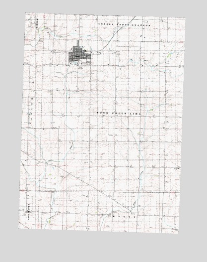
Lanark, IL USGS Topographic Map
Click on map above to begin viewing in our Map Viewer.

This topographic map contains these locations and features:
Feature Name Type Latitude Longitude GNIS ID View Map
Center School (historical)SchoolN42.0672°W89.8035°405837View Map
Chadwick Methodist CemeteryCemeteryN42.0097°W89.8682°1785407View Map
Church of the BrethrenChurchN42.0997°W89.8285°1983894View Map
City of LanarkCivilN42.1019°W89.8328°2395622View Map
Cloverdale School (historical)SchoolN42.1186°W89.7648°406271View Map
Dimon School (historical)SchoolN42.0656°W89.8368°407227View Map
Eastland High SchoolSchoolN42.0967°W89.8298°1785413View Map
Eastwood School (historical)SchoolN42.0678°W89.7640°407721View Map
Faith Reformed ChurchChurchN42.1020°W89.8301°1983895View Map
Grissinger School (historical)SchoolN42.0942°W89.8026°409520View Map
Honberger School (historical)SchoolN42.0345°W89.8412°410469View Map
LanarkPopulated PlaceN42.1022°W89.8335°411788View Map
Lanark City CemeteryCemeteryN42.0967°W89.8262°1785420View Map
Lanark Fire Protection DistrictBuildingN42.1027°W89.8333°2640387View Map
Lanark Police DepartmentBuildingN42.1017°W89.8341°2756827View Map
Lanark Post OfficePost OfficeN42.0961°W89.8404°1785421View Map
Lanark United Methodist ChurchChurchN42.1022°W89.8287°1983897View Map
Libertyville School (historical)SchoolN42.0150°W89.7923°412037View Map
Maple Grove School (historical)SchoolN42.0972°W89.7643°412953View Map
North Otter Creek School (historical)SchoolN42.0375°W89.7818°414634View Map
Reede School (historical)SchoolN42.0372°W89.8704°416492View Map
Rock Creek Post Office (historical)Post OfficeN42.0392°W89.8593°1785437View Map
Rowland School (historical)SchoolN42.1239°W89.8318°417012View Map
Shriner School (historical)SchoolN42.0378°W89.7576°418477View Map
Star School (historical)SchoolN42.0092°W89.8401°419052View Map
Township of Rock Creek-LimaCivilN42.0671°W89.7729°429655View Map
Trinity Lutheran ChurchChurchN42.1003°W89.8285°1983898View Map
Union CemeteryCemeteryN42.0020°W89.7534°1785451View Map
Union Church (historical)ChurchN42.0025°W89.7529°420063View Map
Union School (historical)SchoolN42.0806°W89.8746°420136View Map

Note: Coordinates in the location and feature list above are referenced to NAD83 datum.


Copyright (C) 2008-2025 Ryan Niemi / Sunset Dynamics ... All Rights Reserved