TopoQuest Logo
Do you find TopoQuest useful?
Help keep TopoQuest running and adding new maps/features by donating!
Bitcoin:  19c7KJd3qBynnjoSw5npx9KScwjBe4ifkT
Litecoin:  LXs6TkuXGGXo1vDsWCkWVdjQX94eUKd6ui
Home View Maps Find Maps Find Places Resources & Links


Lancaster, Kentucky Topographic Map

USGS Map Title: Lancaster, KY
USGS Map MRC: 37084E5
DRG (GeoTIFF) Download: o37084e5.tif


Neighboring USGS Topographic Map Quads:


  Bryantsville, KY  
37084F6
 

  Buckeye, KY  
37084F5
 

  Kirksville, KY  
37084F4
 

  Stanford, KY  
37084E6
 

  Lancaster, KY  
37084E5
 

  Paint Lick, KY  
37084E4
 

  Halls Gap, KY  
37084D6
 

  Crab Orchard, KY  
37084D5
 

  Brodhead, KY  
37084D4


Map MRC Location:

N38°
W85°
N38°
W84°
H8 H7 H6 H5 H4 H3 H2 H1
G8 G7 G6 G5 G4 G3 G2 G1
F8 F7 F6 F5 F4 F3 F2 F1
E8 E7 E6 E5 E4 E3 E2 E1
D8 D7 D6 D5 D4 D3 D2 D1
C8 C7 C6 C5 C4 C3 C2 C1
B8 B7 B6 B5 B4 B3 B2 B1
A8 A7 A6 A5 A4 A3 A2 A1
N37°
W85°
N37°
W84°

Lancaster, KY USGS 1:24K Topographic Map Preview:
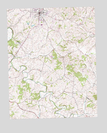
Lancaster, KY USGS Topographic Map
Click on map above to begin viewing in our Map Viewer.

This topographic map contains these locations and features:
Feature Name Type Latitude Longitude GNIS ID View Map
Ashlock CemeteryCemeteryN37.5715°W84.6144°486101View Map
Beasley School (historical)SchoolN37.5683°W84.5459°2564684View Map
Cedar CreekStreamN37.5015°W84.5469°489179View Map
City of LancasterCivilN37.6152°W84.5818°2404880View Map
District 1 Fire Department Station 1BuildingN37.6051°W84.5779°2636537View Map
District 1 Fire Department Station 2BuildingN37.6191°W84.5066°2637138View Map
Drakes CreekStreamN37.5034°W84.5341°491093View Map
Dudderars Mill (historical)LocaleN37.5517°W84.5976°2566636View Map
East Fork Drakes CreekStreamN37.5354°W84.5047°491456View Map
Fentons Plantation (historical)LocaleN37.6202°W84.5055°2564710View Map
Garrard County Ambulance ServiceBuildingN37.6129°W84.5795°2719067View Map
Garrard County Sheriff's OfficeBuildingN37.6184°W84.5792°2767573View Map
GilbertPopulated PlaceN37.5740°W84.5941°508086View Map
Gilberts CreekStreamN37.5706°W84.6161°492821View Map
Gilberts Creek ChurchChurchN37.5681°W84.5455°492822View Map
Gilberts Creek Post Office (historical)Post OfficeN37.5738°W84.5949°2566645View Map
Gilberts Creek Railroad Station (historical)LocaleN37.5731°W84.5953°2566646View Map
GoshenPopulated PlaceN37.5540°W84.5779°2742214View Map
Goshen CemeteryCemeteryN37.5551°W84.5827°493040View Map
Goshen ChurchChurchN37.5537°W84.5774°493043View Map
Goshen School (historical)SchoolN37.5535°W84.5786°2566647View Map
Harmons LickStreamN37.5045°W84.5185°493758View Map
HyattsvillePopulated PlaceN37.6051°W84.5224°508302View Map
Hyattsville Post Office (historical)Post OfficeN37.6053°W84.5218°2564733View Map
Hyattsville Railroad Station (historical)LocaleN37.6046°W84.5217°2564734View Map
LancasterPopulated PlaceN37.6195°W84.5780°495946View Map
Lancaster Fire DepartmentBuildingN37.6201°W84.5771°2636750View Map
Lancaster Police DepartmentBuildingN37.6220°W84.5849°2767501View Map
Lawson School (historical)SchoolN37.5523°W84.5054°2564738View Map
Lawsons ChapelChurchN37.5609°W84.5083°496094View Map
Logan CreekStreamN37.5606°W84.6194°496980View Map
Mount ZeniaSummitN37.5721°W84.6162°2566994View Map
Mount Zenia (historical)Populated PlaceN37.5700°W84.6174°2566653View Map
Naylor CemeteryCemeteryN37.5567°W84.5438°499189View Map
Payne CemeteryCemeteryN37.5706°W84.5144°500290View Map
Point Leavell Post Office (historical)Post OfficeN37.5933°W84.5008°2564766View Map
Point Leavell Railroad Station (historical)LocaleN37.5934°W84.5001°2564767View Map
PreachersvillePopulated PlaceN37.5273°W84.5338°508870View Map
Preachersville CemeteryCemeteryN37.5216°W84.5317°2566668View Map
Preachersville Methodist Church (historical)ChurchN37.5193°W84.5309°2566669View Map
Preachersville Post Office (historical)Post OfficeN37.5282°W84.5343°2566670View Map
Preachersville School (historical)SchoolN37.5285°W84.5338°2566671View Map
Stingy CreekStreamN37.5390°W84.5780°504428View Map
Sweeney Post Office (historical)Post OfficeN37.5673°W84.5470°2564782View Map
Turkey CreekStreamN37.5709°W84.5952°505590View Map
Walnut Flat CreekStreamN37.5240°W84.5797°506165View Map
West Point SchoolSchoolN37.6126°W84.5147°506469View Map
White Oak CreekStreamN37.5931°W84.6183°506613View Map
WRNZ-FM (Lancaster)TowerN37.6017°W84.5741°517970View Map

Note: Coordinates in the location and feature list above are referenced to NAD83 datum.


Copyright (C) 2008-2025 Ryan Niemi / Sunset Dynamics ... All Rights Reserved