TopoQuest Logo
Do you find TopoQuest useful?
Help keep TopoQuest running and adding new maps/features by donating!
Bitcoin:  19c7KJd3qBynnjoSw5npx9KScwjBe4ifkT
Litecoin:  LXs6TkuXGGXo1vDsWCkWVdjQX94eUKd6ui
Home View Maps Find Maps Find Places Resources & Links


Langston, Oklahoma Topographic Map

USGS Map Title: Langston, OK
USGS Map MRC: 35097H3
DRG (GeoTIFF) Download: o35097h3.tif


Neighboring USGS Topographic Map Quads:


  Mulhall, OK  
36097A4
 

  Clear Creek, OK  
36097A3
 

  Stillwater SW, OK  
36097A2
 

  Guthrie North, OK  
35097H4
 

  Langston, OK  
35097H3
 

  Coyle, OK  
35097H2
 

  Guthrie South, OK  
35097G4
 

  Guthrie SE, OK  
35097G3
 

  Meridian, OK  
35097G2


Map MRC Location:

N36°
W98°
N36°
W97°
H8 H7 H6 H5 H4 H3 H2 H1
G8 G7 G6 G5 G4 G3 G2 G1
F8 F7 F6 F5 F4 F3 F2 F1
E8 E7 E6 E5 E4 E3 E2 E1
D8 D7 D6 D5 D4 D3 D2 D1
C8 C7 C6 C5 C4 C3 C2 C1
B8 B7 B6 B5 B4 B3 B2 B1
A8 A7 A6 A5 A4 A3 A2 A1
N35°
W98°
N35°
W97°

Langston, OK USGS 1:24K Topographic Map Preview:
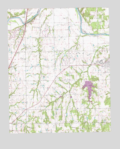
Langston, OK USGS Topographic Map
Click on map above to begin viewing in our Map Viewer.

This topographic map contains these locations and features:
Feature Name Type Latitude Longitude GNIS ID View Map
Beulah Land CemeteryCemeteryN35.9480°W97.2551°2681648View Map
Centerview ChurchChurchN35.9495°W97.3542°1091156View Map
Coulter School (historical)SchoolN35.9281°W97.3175°1819244View Map
Coyle CemeteryCemeteryN35.9644°W97.2553°2681649View Map
Davis and Balls CemeteryCemeteryN35.8844°W97.3005°2704484View Map
Fair Valley Community HallLocaleN35.8848°W97.3714°1092687View Map
Fitzgerald-Soldier Creek Site 2 DamDamN35.9117°W97.2986°1752227View Map
Fitzgerald-Soldier Creek Site 2 ReservoirReservoirN35.9104°W97.2988°1752228View Map
Guthrie Gas and Oil FieldOilfieldN35.9606°W97.3475°1093448View Map
Holy Family CemeteryCemeteryN35.9341°W97.2587°1093861View Map
Iowa City CemeteryCemeteryN35.9492°W97.2650°2704485View Map
KALU-FM (Langston)TowerN35.9437°W97.2614°1102806View Map
Lake LangstonLakeN35.9191°W97.2762°1777570View Map
LangstonPopulated PlaceN35.9451°W97.2553°1094506View Map
Langston DamDamN35.9262°W97.2764°1094507View Map
Langston Fire StationBuildingN35.9408°W97.2589°2658429View Map
Langston Gas and Oil FieldOilfieldN35.9578°W97.2609°1094508View Map
Langston Police DepartmentBuildingN35.9439°W97.2558°2757516View Map
Langston UniversitySchoolN35.9448°W97.2612°1094509View Map
Langston University Police DepartmentBuildingN35.9431°W97.2642°2757931View Map
Lutheran CemeteryCemeteryN35.9443°W97.2996°2704487View Map
Lutheran CemeteryCemeteryN35.9783°W97.3001°2704488View Map
Mount HopeLocaleN35.9084°W97.3378°1819241View Map
Mount Hope CemeteryCemeteryN35.9127°W97.3278°1095570View Map
Mount Hope Church (historical)ChurchN35.9042°W97.3342°1819242View Map
Oakdale Community HallLocaleN35.9856°W97.2550°1096142View Map
Oknoname 083007 DamDamN35.8901°W97.2786°1752659View Map
Oknoname 083007 ReservoirReservoirN35.8888°W97.2791°1752660View Map
Oknoname 083008 DamDamN35.8951°W97.3036°1752661View Map
Oknoname 083008 ReservoirReservoirN35.8928°W97.3043°1752662View Map
Oknoname 083011 DamDamN35.9817°W97.2986°1752667View Map
Oknoname 083011 ReservoirReservoirN35.9778°W97.2992°1752668View Map
Pleasant Hill CemeteryCemeteryN35.8846°W97.2655°1096723View Map
Pleasant Hill Gas and Oil FieldOilfieldN35.8856°W97.2581°1096732View Map
Pleasant ValleyPopulated PlaceN35.9895°W97.3006°1100752View Map
Soldier-Fitzgerald Site 3m DamDamN35.9267°W97.2753°1751016View Map
Soldier-Fitzgerald Site 3m ReservoirReservoirN35.9267°W97.2753°1751017View Map
Town of LangstonCivilN35.9324°W97.2630°2412877View Map
Township of AntelopeCivilN35.9542°W97.2920°1824772View Map
Victory Community HallLocaleN35.9781°W97.3181°1099260View Map

Note: Coordinates in the location and feature list above are referenced to NAD83 datum.


Copyright (C) 2008-2024 Ryan Niemi / Sunset Dynamics ... All Rights Reserved