TopoQuest Logo
Do you find TopoQuest useful?
Help keep TopoQuest running and adding new maps/features by donating!
Bitcoin:  19c7KJd3qBynnjoSw5npx9KScwjBe4ifkT
Litecoin:  LXs6TkuXGGXo1vDsWCkWVdjQX94eUKd6ui
Home View Maps Find Maps Find Places Resources & Links


Langtry, Texas Topographic Map

USGS Map Title: Langtry, TX
USGS Map MRC: 29101G5
DRG (GeoTIFF) Download: o29101g5.tif


Neighboring USGS Topographic Map Quads:


  Pumpville, TX  
29101H6
 

  Harkell Canyon, TX  
29101H5
 

  Still Canyon, TX  
29101H4
 

  Ramsey Canyon, TX  
29101G6
 

  Langtry, TX  
29101G5
 

  Shumla, TX  
29101G4


  Zuberbueler Bend NW, TX  
29101F4


Map MRC Location:

N30°
W102°
N30°
W101°
H8 H7 H6 H5 H4 H3 H2 H1
G8 G7 G6 G5 G4 G3 G2 G1
F8 F7 F6 F5 F4 F3 F2 F1
E8 E7 E6 E5 E4 E3 E2 E1
D8 D7 D6 D5 D4 D3 D2 D1
C8 C7 C6 C5 C4 C3 C2 C1
B8 B7 B6 B5 B4 B3 B2 B1
A8 A7 A6 A5 A4 A3 A2 A1
N29°
W102°
N29°
W101°

Langtry, TX USGS 1:24K Topographic Map Preview:
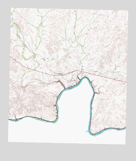
Langtry, TX USGS Topographic Map
Click on map above to begin viewing in our Map Viewer.

This topographic map contains these locations and features:
Feature Name Type Latitude Longitude GNIS ID View Map
Babb CemeteryCemeteryN29.8060°W101.5598°1351370View Map
Billings RanchLocaleN29.8230°W101.5123°1352194View Map
Eagle Nest CreekStreamN29.8094°W101.5496°1373518View Map
G4 CanyonValleyN29.8321°W101.5999°1373789View Map
Home of Judge Roy Bean Law West of the PecosBuildingN29.8096°W101.5601°2029133View Map
Ingram RanchLocaleN29.8458°W101.5556°2109797View Map
J Fisher RanchLocaleN29.8211°W101.6083°2109796View Map
Judge Roy Bean Visitor CenterBuildingN29.8116°W101.5604°1956134View Map
Judge Roy Bean Visitor CenterBuildingN29.8299°W101.5843°2014413View Map
LangtryPopulated PlaceN29.8085°W101.5587°1377171View Map
Langtry Post OfficePost OfficeN29.8089°W101.5598°2731539View Map
Mile CanyonValleyN29.8093°W101.5499°1362835View Map
Obryane RanchLocaleN29.8375°W101.5986°2109795View Map
Osman CanyonValleyN29.8324°W101.6002°1375307View Map
Pump CanyonValleyN29.8007°W101.5661°1365858View Map
Rattlesnake CanyonValleyN29.7712°W101.6168°1375639View Map
Seep CanyonValleyN29.7975°W101.5345°1367933View Map
Seep SpringsSpringN29.8235°W101.5121°1377729View Map
Smokeys VegaFlatN29.7708°W101.6198°1377466View Map

Note: Coordinates in the location and feature list above are referenced to NAD83 datum.


Copyright (C) 2008-2025 Ryan Niemi / Sunset Dynamics ... All Rights Reserved