TopoQuest Logo
Do you find TopoQuest useful?
Help keep TopoQuest running and adding new maps/features by donating!
Bitcoin:  19c7KJd3qBynnjoSw5npx9KScwjBe4ifkT
Litecoin:  LXs6TkuXGGXo1vDsWCkWVdjQX94eUKd6ui
Home View Maps Find Maps Find Places Resources & Links


Laredo, Montana Topographic Map

USGS Map Title: Laredo, MT
USGS Map MRC: 48109D8
DRG (GeoTIFF) Download: o48109d8.tif


Neighboring USGS Topographic Map Quads:


  Kremlin, MT  
48110E1
 

  Fresno Dam, MT  
48109E8
 

  Herron Park, MT  
48109E7
 

  Bailey Reservoir, MT  
48110D1
 

  Laredo, MT  
48109D8
 

  Laredo NE, MT  
48109D7
 

  Box Elder, MT  
48110C1
 

  Cowan Reservoir, MT  
48109C8
 

  Rocky Boy, MT  
48109C7


Map MRC Location:

N49°
W110°
N49°
W109°
H8 H7 H6 H5 H4 H3 H2 H1
G8 G7 G6 G5 G4 G3 G2 G1
F8 F7 F6 F5 F4 F3 F2 F1
E8 E7 E6 E5 E4 E3 E2 E1
D8 D7 D6 D5 D4 D3 D2 D1
C8 C7 C6 C5 C4 C3 C2 C1
B8 B7 B6 B5 B4 B3 B2 B1
A8 A7 A6 A5 A4 A3 A2 A1
N48°
W110°
N48°
W109°

Laredo, MT USGS 1:24K Topographic Map Preview:
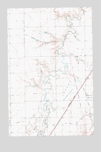
Laredo, MT USGS Topographic Map
Click on map above to begin viewing in our Map Viewer.

This topographic map contains these locations and features:
Feature Name Type Latitude Longitude GNIS ID View Map
31N14E02BA__01 WellWellN48.4797°W109.8794°1635675View Map
31N14E03CDDC01 WellWellN48.4678°W109.8988°1635625View Map
31N14E15BA__01 WellWellN48.4508°W109.9013°1635579View Map
31N14E15DD__01 WellWellN48.4400°W109.8905°1635548View Map
31N14E23BC__01 WellWellN48.4325°W109.8849°1635530View Map
31N14E23BC__02 WellWellN48.4325°W109.8849°1635531View Map
31N14E23CC__01 WellWellN48.4253°W109.8849°1635495View Map
31N14E32DC__01 WellWellN48.3964°W109.9399°1635297View Map
31N14E33BC__01 WellWellN48.4036°W109.9288°1635344View Map
31N14E34AA__01 WellWellN48.4072°W109.8905°1635362View Map
32N14E33DD__01 WellWellN48.4822°W109.9152°1635685View Map
Antelope CouleeValleyN48.4678°W109.9188°768281View Map
Big Gravel Dam Number 1DamN48.4300°W109.8958°798376View Map
Big Jugs DamDamN48.4250°W109.9591°798385View Map
Boyer DamDamN48.4517°W109.9024°795242View Map
Conner CouleeValleyN48.4747°W109.9024°770057View Map
Daniel Number 1 DamDamN48.4683°W109.9574°798377View Map
Daniel Number 2 DamDamN48.4750°W109.9441°798378View Map
Daniel Number 3 DamDamN48.4750°W109.8941°798379View Map
Dry Fork CouleeValleyN48.3867°W109.9327°770812View Map
Gravel CouleeValleyN48.4403°W109.9130°771939View Map
LaredoPopulated PlaceN48.4314°W109.8833°773227View Map
LaredoLocaleN48.4305°W109.8841°1744181View Map
Laredo FlatsFlatN48.4367°W109.8963°773228View Map
Laredo Post Office (historical)Post OfficeN48.4314°W109.8833°1744096View Map
Laredo School (historical)SchoolN48.4314°W109.8833°1744180View Map
Middle CouleeValleyN48.3883°W109.9469°774144View Map
Prairie LakeLakeN48.4513°W109.9006°775444View Map
Schwartz CouleeValleyN48.3967°W109.9588°776295View Map
Spring CouleeValleyN48.4547°W109.9108°776980View Map
Wilfred Tow DamDamN48.4283°W109.8958°795234View Map

Note: Coordinates in the location and feature list above are referenced to NAD83 datum.


Copyright (C) 2008-2025 Ryan Niemi / Sunset Dynamics ... All Rights Reserved