TopoQuest Logo
Do you find TopoQuest useful?
Help keep TopoQuest running and adding new maps/features by donating!
Bitcoin:  19c7KJd3qBynnjoSw5npx9KScwjBe4ifkT
Litecoin:  LXs6TkuXGGXo1vDsWCkWVdjQX94eUKd6ui
Home View Maps Find Maps Find Places Resources & Links


Larsen Creek, Washington Topographic Map

USGS Map Title: Larsen Creek, WA
USGS Map MRC: 47123C6
DRG (GeoTIFF) Download: o47123c6.tif


Neighboring USGS Topographic Map Quads:


  Lake Quinault East, WA  
47123D7
 

  Colonel Bob, WA  
47123D6
 

  Wynoochee Lake, WA  
47123D5
 

  Burnt Hill, WA  
47123C7
 

  Larsen Creek, WA  
47123C6
 

  Grisdale, WA  
47123C5
 

  Railroad Camp, WA  
47123B7
 

  Wynoochee Valley NW, WA  
47123B6
 

  Wynoochee Valley NE, WA  
47123B5


Map MRC Location:

N48°
W124°
N48°
W123°
H8 H7 H6 H5 H4 H3 H2 H1
G8 G7 G6 G5 G4 G3 G2 G1
F8 F7 F6 F5 F4 F3 F2 F1
E8 E7 E6 E5 E4 E3 E2 E1
D8 D7 D6 D5 D4 D3 D2 D1
C8 C7 C6 C5 C4 C3 C2 C1
B8 B7 B6 B5 B4 B3 B2 B1
A8 A7 A6 A5 A4 A3 A2 A1
N47°
W124°
N47°
W123°

Larsen Creek, WA USGS 1:24K Topographic Map Preview:
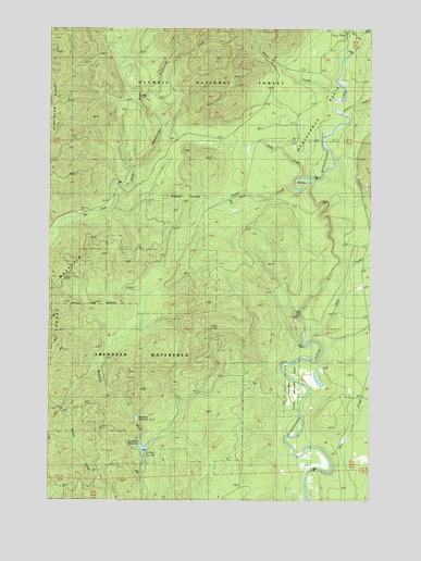
Larsen Creek, WA USGS Topographic Map
Click on map above to begin viewing in our Map Viewer.

This topographic map contains these locations and features:
Feature Name Type Latitude Longitude GNIS ID View Map
Aberdeen ReservoirReservoirN47.2612°W123.7143°1515709View Map
Aberdeen WatershedRidgeN47.2812°W123.7149°1529910View Map
Aberdeen WatershedAreaN47.2887°W123.7166°1530332View Map
Anderson CreekStreamN47.3523°W123.6377°1515873View Map
Big CreekStreamN47.3729°W123.6302°1516491View Map
Falls CreekStreamN47.3356°W123.6513°1519449View Map
Flatbottom CreekStreamN47.3568°W123.7154°1519644View Map
Go-Forth CreekStreamN47.3379°W123.7188°1530338View Map
Grisdale PondLakeN47.2818°W123.6652°1530522View Map
Harris CreekStreamN47.3562°W123.6407°1520568View Map
Larsen CreekStreamN47.3329°W123.6568°1521912View Map
Malinowski DamDamN47.2615°W123.7146°1532377View Map
OxbowBendN47.3345°W123.6524°1529934View Map
Save CreekStreamN47.2920°W123.6491°1525455View Map
WeatherwaxPopulated PlaceN47.3554°W123.6471°1530578View Map
Weatherwax BasinBasinN47.3656°W123.6338°1527866View Map
Wishkah Reservoir Number ThreeReservoirN47.2665°W123.7096°1532902View Map
Wishkah Reservoir Number Three DamDamN47.2665°W123.7096°1532901View Map
Wishkah Reservoir Number TwoReservoirN47.2717°W123.7167°1532109View Map
Wishkah Reservoir Number Two DamDamN47.2715°W123.7163°1532108View Map
Wynoochee Fish BarrierDamN47.3748°W123.6279°1533013View Map

Note: Coordinates in the location and feature list above are referenced to NAD83 datum.


Copyright (C) 2008-2025 Ryan Niemi / Sunset Dynamics ... All Rights Reserved