TopoQuest Logo
Do you find TopoQuest useful?
Help keep TopoQuest running and adding new maps/features by donating!
Bitcoin:  19c7KJd3qBynnjoSw5npx9KScwjBe4ifkT
Litecoin:  LXs6TkuXGGXo1vDsWCkWVdjQX94eUKd6ui
Home View Maps Find Maps Find Places Resources & Links


Las Guijas, Arizona Topographic Map

USGS Map Title: Las Guijas, AZ
USGS Map MRC: 31111F4
DRG (GeoTIFF) Download: o31111f4.tif


Neighboring USGS Topographic Map Quads:


  Baboquivari Peak, AZ  
31111G5
 

  Fresno Wash, AZ  
31111G4
 

  Penitas Hills, AZ  
31111G3
 

  Mildred Peak, AZ  
31111F5
 

  Las Guijas, AZ  
31111F4
 

  Cerro Colorado, AZ  
31111F3
 

  Presumido Peak, AZ  
31111E5
 

  Wilbur Canyon, AZ  
31111E4
 

  Arivaca, AZ  
31111E3


Map MRC Location:

N32°
W112°
N32°
W111°
H8 H7 H6 H5 H4 H3 H2 H1
G8 G7 G6 G5 G4 G3 G2 G1
F8 F7 F6 F5 F4 F3 F2 F1
E8 E7 E6 E5 E4 E3 E2 E1
D8 D7 D6 D5 D4 D3 D2 D1
C8 C7 C6 C5 C4 C3 C2 C1
B8 B7 B6 B5 B4 B3 B2 B1
A8 A7 A6 A5 A4 A3 A2 A1
N31°
W112°
N31°
W111°

Las Guijas, AZ USGS 1:24K Topographic Map Preview:
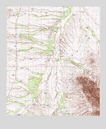
Las Guijas, AZ USGS Topographic Map
Click on map above to begin viewing in our Map Viewer.

This topographic map contains these locations and features:
Feature Name Type Latitude Longitude GNIS ID View Map
Arivaca CreekStreamN31.6348°W111.4248°37149View Map
Arivaca WashStreamN31.7156°W111.4290°25741View Map
Arroyo HondoArroyoN31.7142°W111.4787°815View Map
Arroyo Seco TankReservoirN31.7407°W111.4124°817View Map
Blanco TankReservoirN31.7426°W111.4487°1669View Map
Boice TankReservoirN31.6525°W111.4034°15285View Map
Brown TankReservoirN31.7467°W111.4649°1999View Map
Buena TankReservoirN31.7436°W111.4002°2128View Map
Buenos Aires National Wildlife RefugeParkN31.6403°W111.4595°44997View Map
Cordova TankReservoirN31.6639°W111.4797°3257View Map
Figueroa RanchLocaleN31.6298°W111.4204°4593View Map
Las GuijasPopulated PlaceN31.6704°W111.3820°24489View Map
Las Guijas MineMineN31.6559°W111.3795°6882View Map
Las Guijas MountainsRangeN31.6501°W111.3845°30894View Map
Las Guijas WashStreamN31.6895°W111.4309°6883View Map
Las Guijas WellWellN31.6687°W111.3801°15431View Map
Las Moras WashStreamN31.6345°W111.4734°6885View Map
Lindberg TankReservoirN31.6505°W111.4470°7035View Map
Little Thomas WashStreamN31.7376°W111.4223°7206View Map
Martinez WellWellN31.6765°W111.3912°7753View Map
Middle TankReservoirN31.6899°W111.4692°8003View Map
Mosca TankReservoirN31.7215°W111.4369°15478View Map
North TankReservoirN31.7398°W111.4922°8770View Map
Puertocito WashStreamN31.7156°W111.4290°33222View Map
San Luis WashStreamN31.6348°W111.4248°34020View Map
Santa Margarita WashStreamN31.6845°W111.4432°10943View Map
Seco TankReservoirN31.7136°W111.3912°11038View Map
SecundinoPopulated PlaceN31.6940°W111.4429°24609View Map
Secundino WellWellN31.6945°W111.4457°15584View Map
Shaffer WashStreamN31.7040°W111.4368°11142View Map
Tequila TankReservoirN31.6347°W111.4481°12262View Map
Thomas Canyon WashStreamN31.7329°W111.4282°12394View Map
Tiohuerro TankReservoirN31.6709°W111.4928°12500View Map

Note: Coordinates in the location and feature list above are referenced to NAD83 datum.


Copyright (C) 2008-2025 Ryan Niemi / Sunset Dynamics ... All Rights Reserved