TopoQuest Logo
Do you find TopoQuest useful?
Help keep TopoQuest running and adding new maps/features by donating!
Bitcoin:  19c7KJd3qBynnjoSw5npx9KScwjBe4ifkT
Litecoin:  LXs6TkuXGGXo1vDsWCkWVdjQX94eUKd6ui
Home View Maps Find Maps Find Places Resources & Links


Laurel Hill, Florida Topographic Map

USGS Map Title: Laurel Hill, FL
USGS Map MRC: 30086H4
DRG (GeoTIFF) Download: o30086h4.tif


Neighboring USGS Topographic Map Quads:


  Wing, AL  
31086A5
 

  Watkins Bridge, AL  
31086A4
 

  Florala, AL  
31086A3
 

  Oak Grove, FL  
30086H5
 

  Laurel Hill, FL  
30086H4
 

  Paxton, FL  
30086H3
 

  Crestview North, FL  
30086G5
 

  Dorcas, FL  
30086G4
 

  New Harmony, FL  
30086G3


Map MRC Location:

N31°
W87°
N31°
W86°
H8 H7 H6 H5 H4 H3 H2 H1
G8 G7 G6 G5 G4 G3 G2 G1
F8 F7 F6 F5 F4 F3 F2 F1
E8 E7 E6 E5 E4 E3 E2 E1
D8 D7 D6 D5 D4 D3 D2 D1
C8 C7 C6 C5 C4 C3 C2 C1
B8 B7 B6 B5 B4 B3 B2 B1
A8 A7 A6 A5 A4 A3 A2 A1
N30°
W87°
N30°
W86°

Laurel Hill, FL USGS 1:24K Topographic Map Preview:
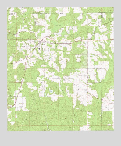
Laurel Hill, FL USGS Topographic Map
Click on map above to begin viewing in our Map Viewer.

This topographic map contains these locations and features:
Feature Name Type Latitude Longitude GNIS ID View Map
Almarante Fire DistrictBuildingN30.9367°W86.4797°2644628View Map
Almerant ChurchChurchN30.9505°W86.4769°277813View Map
Bandy BranchStreamN30.9668°W86.4800°278080View Map
Bay BranchStreamN30.9338°W86.4352°278189View Map
Bethel ChurchChurchN30.9105°W86.4063°278550View Map
Billys BranchStreamN30.9946°W86.4747°166922View Map
Black Gum HeadValleyN30.9982°W86.4741°114426View Map
City of Laurel HillCivilN30.9631°W86.4566°2404890View Map
Coon HeadStreamN30.9152°W86.4997°280754View Map
Cypress PondReservoirN30.9000°W86.4828°281238View Map
Cypress Pond BranchStreamN30.8760°W86.4519°281239View Map
Green BranchStreamN30.9302°W86.4369°283377View Map
Hogpen BranchStreamN30.8907°W86.4566°284120View Map
Laurel HillPopulated PlaceN30.9657°W86.4597°285397View Map
Laurel Hill DivisionCivilN30.9255°W86.4643°1935828View Map
Laurel Hill Post OfficePost OfficeN30.9661°W86.4593°2759170View Map
Laurel Hill SchoolSchoolN30.9587°W86.4621°298322View Map
Laurel Hill Volunteer Fire DepartmentBuildingN30.9672°W86.4584°2644040View Map
Mack BranchStreamN30.9174°W86.4374°286260View Map
Mount Zion CemeteryCemeteryN30.9721°W86.4997°287336View Map
Mount Zion ChurchChurchN30.9755°W86.4697°287366View Map
OkalooPopulated PlaceN30.9157°W86.4861°295502View Map
Perry Reeves PondLakeN30.9512°W86.3990°298116View Map
Rock Hill CemeteryCemeteryN30.8946°W86.4119°289821View Map
SveaPopulated PlaceN30.9677°W86.4033°295659View Map
Travelers Rest ChurchChurchN30.9735°W86.4941°292405View Map
Tyner BaySwampN30.9317°W86.4646°292629View Map
Tyner BranchStreamN30.9271°W86.5000°306529View Map
Ward BayLakeN30.9153°W86.4485°292865View Map
Watson BaySwampN30.9824°W86.4426°292940View Map

Note: Coordinates in the location and feature list above are referenced to NAD83 datum.


Copyright (C) 2008-2025 Ryan Niemi / Sunset Dynamics ... All Rights Reserved