TopoQuest Logo
Do you find TopoQuest useful?
Help keep TopoQuest running and adding new maps/features by donating!
Bitcoin:  19c7KJd3qBynnjoSw5npx9KScwjBe4ifkT
Litecoin:  LXs6TkuXGGXo1vDsWCkWVdjQX94eUKd6ui
Home View Maps Find Maps Find Places Resources & Links


Laveen, Arizona Topographic Map

USGS Map Title: Laveen, AZ
USGS Map MRC: 33112C2
DRG (GeoTIFF) Download: o33112c2.tif


Neighboring USGS Topographic Map Quads:


  Tolleson, AZ  
33112D3
 

  Fowler, AZ  
33112D2
 

  Phoenix, AZ  
33112D1
 

  Avondale SE, AZ  
33112C3
 

  Laveen, AZ  
33112C2
 

  Lone Butte, AZ  
33112C1
 

  Mobile NE, AZ  
33112B3
 

  Montezuma Peak, AZ  
33112B2
 

  Pima Butte, AZ  
33112B1


Map MRC Location:

N34°
W113°
N34°
W112°
H8 H7 H6 H5 H4 H3 H2 H1
G8 G7 G6 G5 G4 G3 G2 G1
F8 F7 F6 F5 F4 F3 F2 F1
E8 E7 E6 E5 E4 E3 E2 E1
D8 D7 D6 D5 D4 D3 D2 D1
C8 C7 C6 C5 C4 C3 C2 C1
B8 B7 B6 B5 B4 B3 B2 B1
A8 A7 A6 A5 A4 A3 A2 A1
N33°
W113°
N33°
W112°

Laveen, AZ USGS 1:24K Topographic Map Preview:
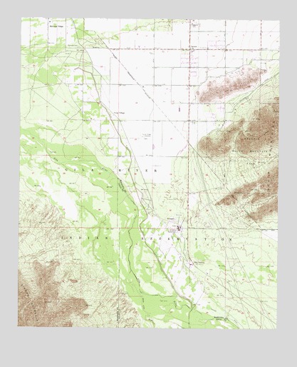
Laveen, AZ USGS Topographic Map
Click on map above to begin viewing in our Map Viewer.

This topographic map contains these locations and features:
Feature Name Type Latitude Longitude GNIS ID View Map
Aguila 18 Hole Championship CourseLocaleN33.3662°W112.1409°2670459View Map
Aguila 9 Hole Golf CourseLocaleN33.3713°W112.1368°2670460View Map
Betty H Fairfax High SchoolSchoolN33.3714°W112.1826°2517787View Map
Canal Primero Branch (historical)CanalN33.3653°W112.2271°14299View Map
Co-Op DitchCanalN33.2809°W112.1854°3045View Map
Co-op VillagePopulated PlaceN33.3364°W112.2079°3046View Map
Co-Op Village CemeteryCemeteryN33.3273°W112.1916°3047View Map
Gila CrossingPopulated PlaceN33.2767°W112.1668°5019View Map
Gila Crossing Census Designated PlaceCensusN33.2730°W112.1627°2612138View Map
Gila Crossing Day SchoolSchoolN33.2756°W112.1676°14504View Map
Gila River Indian Community Fire Department Station 426 KomatkeBuildingN33.2902°W112.1618°2672643View Map
Hoover DitchCanalN33.2567°W112.1540°5930View Map
KomatkePopulated PlaceN33.2934°W112.1754°6767View Map
Komatke Census Designated PlaceCensusN33.2953°W112.1615°2582810View Map
Komatke Health CenterBuildingN33.2880°W112.1561°2667666View Map
LaveenPopulated PlaceN33.3628°W112.1693°6920View Map
Laveen Baptist ChurchChurchN33.3638°W112.1678°2671538View Map
Laveen Elementary SchoolSchoolN33.3623°W112.1673°14670View Map
Laveen Post OfficePost OfficeN33.3620°W112.1686°44843View Map
Maricopa CemeteryCemeteryN33.3634°W112.2227°7695View Map
Maricopa Colony Census Designated PlaceCensusN33.3626°W112.2268°2612141View Map
Maricopa MissionChurchN33.3737°W112.2371°14728View Map
Maricopa PeakSummitN33.3250°W112.1399°14729View Map
Maricopa VillagePopulated PlaceN33.3714°W112.2377°7702View Map
Phoenix Fire Department Station 58BuildingN33.3634°W112.1612°2466283View Map
Saint Johns Census Designated PlaceCensusN33.3044°W112.1947°2612144View Map
Saint Johns Indian SchoolSchoolN33.2900°W112.1735°10713View Map
Saint Johns MissionPopulated PlaceN33.2903°W112.1732°25067View Map
Santa Cruz WashStreamN33.2645°W112.1915°10939View Map
Villa BuenaLocaleN33.3500°W112.2104°23898View Map
Vista Del Sur Accelerated AcademySchoolN33.3706°W112.1448°2517491View Map

Note: Coordinates in the location and feature list above are referenced to NAD83 datum.


Copyright (C) 2008-2024 Ryan Niemi / Sunset Dynamics ... All Rights Reserved