TopoQuest Logo
Do you find TopoQuest useful?
Help keep TopoQuest running and adding new maps/features by donating!
Bitcoin:  19c7KJd3qBynnjoSw5npx9KScwjBe4ifkT
Litecoin:  LXs6TkuXGGXo1vDsWCkWVdjQX94eUKd6ui
Home View Maps Find Maps Find Places Resources & Links


Lea, New Mexico Topographic Map

USGS Map Title: Lea, NM
USGS Map MRC: 32103E5
DRG (GeoTIFF) Download: o32103e5.tif


Neighboring USGS Topographic Map Quads:


  Laguna Gatuna NW, NM  
32103F6
 

  Ironhouse Well, NM  
32103F5
 

  Ironhouse Draw, NM  
32103F4
 

  Laguna Gatuna, NM  
32103E6
 

  Lea, NM  
32103E5
 

  Monument SW, NM  
32103E4
 

  The Divide, NM  
32103D6
 

  Grama Ridge, NM  
32103D5
 

  San Simon Ranch, NM  
32103D4


Map MRC Location:

N33°
W104°
N33°
W103°
H8 H7 H6 H5 H4 H3 H2 H1
G8 G7 G6 G5 G4 G3 G2 G1
F8 F7 F6 F5 F4 F3 F2 F1
E8 E7 E6 E5 E4 E3 E2 E1
D8 D7 D6 D5 D4 D3 D2 D1
C8 C7 C6 C5 C4 C3 C2 C1
B8 B7 B6 B5 B4 B3 B2 B1
A8 A7 A6 A5 A4 A3 A2 A1
N32°
W104°
N32°
W103°

Lea, NM USGS 1:24K Topographic Map Preview:
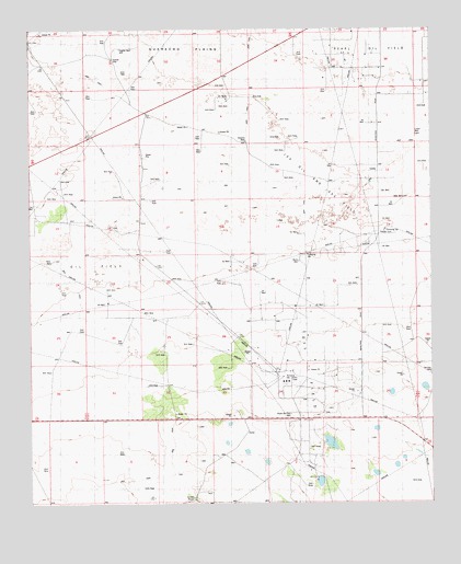
Lea, NM USGS Topographic Map
Click on map above to begin viewing in our Map Viewer.

This topographic map contains these locations and features:
Feature Name Type Latitude Longitude GNIS ID View Map
Berry RanchLocaleN32.5101°W103.5374°886255View Map
China Knob WellWellN32.5012°W103.5755°887544View Map
City Service WellWellN32.5668°W103.5877°887632View Map
Herman WellWellN32.5343°W103.5008°900934View Map
Hughes WellWellN32.6204°W103.5974°898330View Map
LeaPopulated PlaceN32.5223°W103.5333°898565View Map
Lea Oil and Gas FieldOilfieldN32.5765°W103.5158°902286View Map
Lea Post Office (historical)Post OfficeN32.5223°W103.5333°938285View Map
Linam WellWellN32.5971°W103.5133°901185View Map
Middle Lynch Oil FieldOilfieldN32.5426°W103.5452°928990View Map
Nate WellWellN32.5804°W103.5088°900717View Map
North Lynch Oil FieldOilfieldN32.5629°W103.6072°929001View Map
North Oil Field WellWellN32.5237°W103.5444°900955View Map
North WellWellN32.5637°W103.5410°892695View Map
Roberts WellWellN32.5951°W103.5583°894019View Map
South TankReservoirN32.5017°W103.5748°900764View Map
West WellWellN32.5640°W103.6185°900804View Map
West WindmillLocaleN32.5635°W103.6188°896446View Map

Note: Coordinates in the location and feature list above are referenced to NAD83 datum.


Copyright (C) 2008-2025 Ryan Niemi / Sunset Dynamics ... All Rights Reserved