TopoQuest Logo
Do you find TopoQuest useful?
Help keep TopoQuest running and adding new maps/features by donating!
Bitcoin:  19c7KJd3qBynnjoSw5npx9KScwjBe4ifkT
Litecoin:  LXs6TkuXGGXo1vDsWCkWVdjQX94eUKd6ui
Home View Maps Find Maps Find Places Resources & Links


Leefield, Georgia Topographic Map

USGS Map Title: Leefield, GA
USGS Map MRC: 32081D5
DRG (GeoTIFF) Download: o32081d5.tif


Neighboring USGS Topographic Map Quads:


  Dover, GA  
32081E6
 

  Oliver, GA  
32081E5
 

  Kildare, GA  
32081E4
 

  Brooklet, GA  
32081D6
 

  Leefield, GA  
32081D5
 

  Egypt, GA  
32081D4
 

  Denmark, GA  
32081C6
 

  Stilson, GA  
32081C5
 

  Guyton, GA  
32081C4


Map MRC Location:

N33°
W82°
N33°
W81°
H8 H7 H6 H5 H4 H3 H2 H1
G8 G7 G6 G5 G4 G3 G2 G1
F8 F7 F6 F5 F4 F3 F2 F1
E8 E7 E6 E5 E4 E3 E2 E1
D8 D7 D6 D5 D4 D3 D2 D1
C8 C7 C6 C5 C4 C3 C2 C1
B8 B7 B6 B5 B4 B3 B2 B1
A8 A7 A6 A5 A4 A3 A2 A1
N32°
W82°
N32°
W81°

Leefield, GA USGS 1:24K Topographic Map Preview:
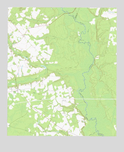
Leefield, GA USGS Topographic Map
Click on map above to begin viewing in our Map Viewer.

This topographic map contains these locations and features:
Feature Name Type Latitude Longitude GNIS ID View Map
Davis PondLakeN32.4509°W81.6034°313358View Map
Fred W Hodges BridgeBridgeN32.4946°W81.5557°350169View Map
Gobar LandingLocaleN32.4677°W81.5418°331828View Map
Jerusalem ChurchChurchN32.4099°W81.5859°316098View Map
Knight CemeteryCemeteryN32.3899°W81.5426°350379View Map
Knight School (historical)SchoolN32.3899°W81.5754°334630View Map
Lane LandingLocaleN32.3924°W81.5346°350381View Map
Lanes CreekStreamN32.3782°W81.5226°316623View Map
Lee Grove ChurchChurchN32.4177°W81.6151°316739View Map
LeefieldPopulated PlaceN32.4182°W81.6134°332200View Map
Leefield Baptist ChurchChurchN32.4185°W81.6150°2502730View Map
Leefield Volunteer Fire DepartmentBuildingN32.4205°W81.6142°2603633View Map
Lees Grove ChurchChurchN32.4121°W81.6184°350385View Map
Mill CreekStreamN32.4216°W81.5423°318226View Map
Mount Zion CemeteryCemeteryN32.4716°W81.6076°350403View Map
Mount Zion ChurchChurchN32.4713°W81.6071°318978View Map
New Hope CemeteryCemeteryN32.4849°W81.6207°350407View Map
New Hope ChurchChurchN32.4832°W81.6190°319395View Map
Ogeechee CreekStreamN32.4957°W81.5562°319917View Map
Pauline School (historical)SchoolN32.4668°W81.6007°334635View Map
River RoadLocaleN32.4088°W81.5615°321629View Map
Scotts Spur (historical)LocaleN32.4141°W81.5832°334639View Map
Shephard PondReservoirN32.4423°W81.5835°341512View Map
Sheppard Lake DamDamN32.4402°W81.5798°341511View Map
Silas Morton CemeteryCemeteryN32.4563°W81.5129°350264View Map
Spring CreekStreamN32.4421°W81.5868°323384View Map
Stokes LakeReservoirN32.4958°W81.5077°340259View Map
Stokes Lake DamDamN32.4968°W81.5098°340258View Map
Walden BranchStreamN32.4655°W81.5312°324753View Map

Note: Coordinates in the location and feature list above are referenced to NAD83 datum.


Copyright (C) 2008-2025 Ryan Niemi / Sunset Dynamics ... All Rights Reserved