TopoQuest Logo
Do you find TopoQuest useful?
Help keep TopoQuest running and adding new maps/features by donating!
Bitcoin:  19c7KJd3qBynnjoSw5npx9KScwjBe4ifkT
Litecoin:  LXs6TkuXGGXo1vDsWCkWVdjQX94eUKd6ui
Home View Maps Find Maps Find Places Resources & Links


Leiter, Wyoming Topographic Map

USGS Map Title: Leiter, WY
USGS Map MRC: 44106F3
DRG (GeoTIFF) Download: o44106f3.tif


Neighboring USGS Topographic Map Quads:


  Shuler Draw, WY  
44106G4
 

  Gardner Gulch, WY  
44106G3
 

  Fawn Draw, WY  
44106G2
 

  Clearmont, WY  
44106F4
 

  Leiter, WY  
44106F3
 

  Arvada, WY  
44106F2
 

  Julio Draw, WY  
44106E4
 

  Arpan Butte, WY  
44106E3
 

  Jewell Draw, WY  
44106E2


Map MRC Location:

N45°
W107°
N45°
W106°
H8 H7 H6 H5 H4 H3 H2 H1
G8 G7 G6 G5 G4 G3 G2 G1
F8 F7 F6 F5 F4 F3 F2 F1
E8 E7 E6 E5 E4 E3 E2 E1
D8 D7 D6 D5 D4 D3 D2 D1
C8 C7 C6 C5 C4 C3 C2 C1
B8 B7 B6 B5 B4 B3 B2 B1
A8 A7 A6 A5 A4 A3 A2 A1
N44°
W107°
N44°
W106°

Leiter, WY USGS 1:24K Topographic Map Preview:
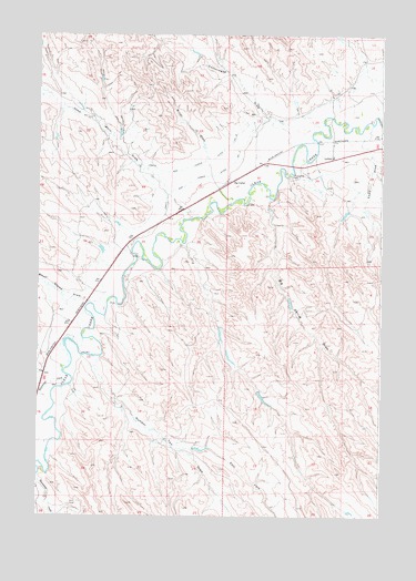
Leiter, WY USGS Topographic Map
Click on map above to begin viewing in our Map Viewer.

This topographic map contains these locations and features:
Feature Name Type Latitude Longitude GNIS ID View Map
Auzoui Number 1 DamDamN44.6283°W106.2989°1606444View Map
Auzqui Number 1 ReservoirReservoirN44.6283°W106.2989°1606445View Map
Big CorralLocaleN44.7119°W106.3056°1585433View Map
Big Corral DrawValleyN44.7053°W106.2923°1585435View Map
Black Stump DrawValleyN44.6808°W106.3570°1585626View Map
Busted Clutch DamDamN44.6583°W106.2906°1606830View Map
Busted Clutch ReservoirReservoirN44.6583°W106.2906°1606831View Map
Cadiz DamDamN44.7050°W106.2573°1606748View Map
Cadiz DrawValleyN44.7200°W106.2548°1586268View Map
Cadiz ReservoirReservoirN44.7044°W106.2558°1606749View Map
Corrals DamDamN44.6816°W106.2789°1606626View Map
Corrals ReservoirReservoirN44.6816°W106.2789°1606627View Map
Cottonwood DrawValleyN44.7283°W106.2923°1587067View Map
Dead Mans DrawValleyN44.7097°W106.3295°1587422View Map
Dick Number 1 DamDamN44.7433°W106.3256°1606602View Map
Dick Reservoir Number 1ReservoirN44.7433°W106.3256°1606603View Map
East Fork Number Two DrawValleyN44.6428°W106.3217°1605266View Map
LeiterPopulated PlaceN44.7180°W106.2692°1597382View Map
Leiter DamDamN44.7033°W106.2506°1606746View Map
Leiter Post OfficePost OfficeN44.7181°W106.2685°2768541View Map
Leiter ReservoirReservoirN44.7033°W106.2506°1606747View Map
Miller DrawValleyN44.7203°W106.3156°1591607View Map
Number Two DrawValleyN44.6641°W106.3542°1584667View Map
Ollie DamDamN44.6683°W106.2989°1606422View Map
Ollie ReservoirReservoirN44.6683°W106.2989°1606423View Map
Pollard Number 1 DamDamN44.7317°W106.2756°1606756View Map
Pollard Reservoir Number 1ReservoirN44.7317°W106.2756°1606757View Map
Pratt and Ferris Ditch Number 2CanalN44.7150°W106.3234°1605532View Map
Pratt and Ferris Ditch Number 3CanalN44.7091°W106.3273°1605533View Map
Whitmeyer CreekStreamN44.6616°W106.3648°1596335View Map

Note: Coordinates in the location and feature list above are referenced to NAD83 datum.


Copyright (C) 2008-2025 Ryan Niemi / Sunset Dynamics ... All Rights Reserved