TopoQuest Logo
Do you find TopoQuest useful?
Help keep TopoQuest running and adding new maps/features by donating!
Bitcoin:  19c7KJd3qBynnjoSw5npx9KScwjBe4ifkT
Litecoin:  LXs6TkuXGGXo1vDsWCkWVdjQX94eUKd6ui
Home View Maps Find Maps Find Places Resources & Links


Lemhi, Idaho Topographic Map

USGS Map Title: Lemhi, ID
USGS Map MRC: 44113G5
DRG (GeoTIFF) Download: o44113g5.tif


Neighboring USGS Topographic Map Quads:


  Tendoy, ID  
44113H6
 

  Agency Creek, ID  
44113H5
 

  Lemhi Pass, MT  
44113H4
 

  Hayden Creek, ID  
44113G6
 

  Lemhi, ID  
44113G5
 

  Goat Mountain, ID  
44113G4
 

  Mogg Mountain, ID  
44113F6
 

  Stroud Creek, ID  
44113F5
 

  West of Leadore, ID  
44113F4


Map MRC Location:

N45°
W114°
N45°
W113°
H8 H7 H6 H5 H4 H3 H2 H1
G8 G7 G6 G5 G4 G3 G2 G1
F8 F7 F6 F5 F4 F3 F2 F1
E8 E7 E6 E5 E4 E3 E2 E1
D8 D7 D6 D5 D4 D3 D2 D1
C8 C7 C6 C5 C4 C3 C2 C1
B8 B7 B6 B5 B4 B3 B2 B1
A8 A7 A6 A5 A4 A3 A2 A1
N44°
W114°
N44°
W113°

Lemhi, ID USGS 1:24K Topographic Map Preview:
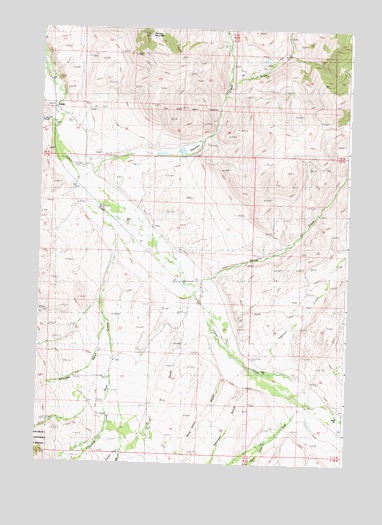
Lemhi, ID USGS Topographic Map
Click on map above to begin viewing in our Map Viewer.

This topographic map contains these locations and features:
Feature Name Type Latitude Longitude GNIS ID View Map
Alder CreekStreamN44.7530°W113.5906°376513View Map
Berg-Green GulchValleyN44.7755°W113.5487°377388View Map
D C GulchValleyN44.7877°W113.5573°380202View Map
Ellsworth-Lower DamDamN44.8383°W113.5642°398926View Map
Ferry CreekStreamN44.7555°W113.5339°381675View Map
LemhiPopulated PlaceN44.8516°W113.6198°396781View Map
Lemhi Post OfficePost OfficeN44.8520°W113.6198°2781806View Map
Lemhi River Salmon TrapLocaleN44.8613°W113.6223°401033View Map
Little Sawmill CreekStreamN44.8491°W113.6220°384940View Map
McFarland Access AreaLocaleN44.8024°W113.5675°401624View Map
Mill CreekStreamN44.7658°W113.5189°386938View Map
Patterson CreekStreamN44.7533°W113.5906°388275View Map
Peterson CreekStreamN44.7780°W113.5362°388372View Map
Ramsey MountainSummitN44.8730°W113.5814°389077View Map
Reese CreekStreamN44.8021°W113.5617°389276View Map
South Fork Yearian CreekStreamN44.8594°W113.5495°391062View Map
Struggle GulchValleyN44.7913°W113.5978°391549View Map
Swanson GulchValleyN44.7721°W113.5406°391739View Map
Swartz CreekStreamN44.7671°W113.5978°391745View Map
Walter CreekStreamN44.7583°W113.5017°392805View Map
Yearian CreekStreamN44.8302°W113.6101°393739View Map
Zeph CreekStreamN44.8146°W113.5939°393781View Map

Note: Coordinates in the location and feature list above are referenced to NAD83 datum.


Copyright (C) 2008-2025 Ryan Niemi / Sunset Dynamics ... All Rights Reserved