TopoQuest Logo
Do you find TopoQuest useful?
Help keep TopoQuest running and adding new maps/features by donating!
Bitcoin:  19c7KJd3qBynnjoSw5npx9KScwjBe4ifkT
Litecoin:  LXs6TkuXGGXo1vDsWCkWVdjQX94eUKd6ui
Home View Maps Find Maps Find Places Resources & Links


Lemmon, South Dakota Topographic Map

USGS Map Title: Lemmon, SD
USGS Map MRC: 45102H2
DRG (GeoTIFF) Download: o45102h2.tif


Neighboring USGS Topographic Map Quads:


  Barths Butte, ND  
46102A3
 

  Cedar Butte, ND  
46102A2
 

  Nason Hill, ND  
46102A1
 

  White Butte, SD  
45102H3
 

  Lemmon, SD  
45102H2
 

  Lemmon NE, SD  
45102H1
 

  Haynes SE, SD  
45102G3
 

  Summerville, SD  
45102G2
 

  Lemmon Lake, SD  
45102G1


Map MRC Location:

N46°
W103°
N46°
W102°
H8 H7 H6 H5 H4 H3 H2 H1
G8 G7 G6 G5 G4 G3 G2 G1
F8 F7 F6 F5 F4 F3 F2 F1
E8 E7 E6 E5 E4 E3 E2 E1
D8 D7 D6 D5 D4 D3 D2 D1
C8 C7 C6 C5 C4 C3 C2 C1
B8 B7 B6 B5 B4 B3 B2 B1
A8 A7 A6 A5 A4 A3 A2 A1
N45°
W103°
N45°
W102°

Lemmon, SD USGS 1:24K Topographic Map Preview:
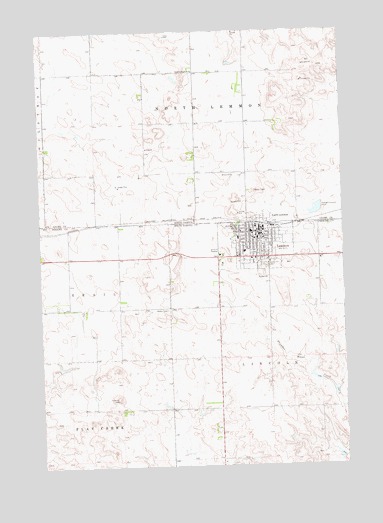
Lemmon, SD USGS Topographic Map
Click on map above to begin viewing in our Map Viewer.

This topographic map contains these locations and features:
Feature Name Type Latitude Longitude GNIS ID View Map
City of LemmonCivilN45.9385°W102.1589°1267457View Map
Five Counties Hospital and Nursing HomeHospitalN45.9400°W102.1685°2610925View Map
Grand River MuseumBuildingN45.9346°W102.1615°2729326View Map
Greenhill CemeteryCemeteryN45.9325°W102.1578°1255356View Map
KBJM-AM (Lemmon)TowerN45.9181°W102.1990°1259343View Map
LemmonPopulated PlaceN45.9408°W102.1593°1256086View Map
Lemmon City HallBuildingN45.9417°W102.1611°2725092View Map
Lemmon Elementary SchoolSchoolN45.9366°W102.1661°2728900View Map
Lemmon Emergency Medical Technician AssociationBuildingN45.9424°W102.1614°2659033View Map
Lemmon Fire DepartmentBuildingN45.9412°W102.1613°2580768View Map
Lemmon High SchoolSchoolN45.9422°W102.1630°2728901View Map
Lemmon Junior High SchoolSchoolN45.9422°W102.1630°2728902View Map
Lemmon Police DepartmentBuildingN45.9438°W102.1591°2755604View Map
Lemmon Post OfficePost OfficeN45.9412°W102.1606°2710518View Map
Lemmon Public LibraryBuildingN45.9416°W102.1611°2723610View Map
North LemmonPopulated PlaceN45.9461°W102.1577°1030466View Map
North Lemmon CemeteryCemeteryN45.9960°W102.2458°2781997View Map
North Lemmon SchoolSchoolN45.9886°W102.1857°1030469View Map
Township of North LemmonCivilN45.9631°W102.1559°1037215View Map

Note: Coordinates in the location and feature list above are referenced to NAD83 datum.


Copyright (C) 2008-2025 Ryan Niemi / Sunset Dynamics ... All Rights Reserved