TopoQuest Logo
Do you find TopoQuest useful?
Help keep TopoQuest running and adding new maps/features by donating!
Bitcoin:  19c7KJd3qBynnjoSw5npx9KScwjBe4ifkT
Litecoin:  LXs6TkuXGGXo1vDsWCkWVdjQX94eUKd6ui
Home View Maps Find Maps Find Places Resources & Links


Leoti, Kansas Topographic Map

USGS Map Title: Leoti, KS
USGS Map MRC: 38101D3
DRG (GeoTIFF) Download: o38101d3.tif


Neighboring USGS Topographic Map Quads:


  Carwood Cemetery, KS  
38101E4
 

  Coronado Cemetery, KS  
38101E3
 

  Pence SW, KS  
38101E2
 

  Leoti NW, KS  
38101D4
 

  Leoti, KS  
38101D3
 

  Marienthal, KS  
38101D2
 

  Leoti SW, KS  
38101C4
 

  Lydia, KS  
38101C3
 

  Modoc SW, KS  
38101C2


Map MRC Location:

N39°
W102°
N39°
W101°
H8 H7 H6 H5 H4 H3 H2 H1
G8 G7 G6 G5 G4 G3 G2 G1
F8 F7 F6 F5 F4 F3 F2 F1
E8 E7 E6 E5 E4 E3 E2 E1
D8 D7 D6 D5 D4 D3 D2 D1
C8 C7 C6 C5 C4 C3 C2 C1
B8 B7 B6 B5 B4 B3 B2 B1
A8 A7 A6 A5 A4 A3 A2 A1
N38°
W102°
N38°
W101°

Leoti, KS USGS 1:24K Topographic Map Preview:
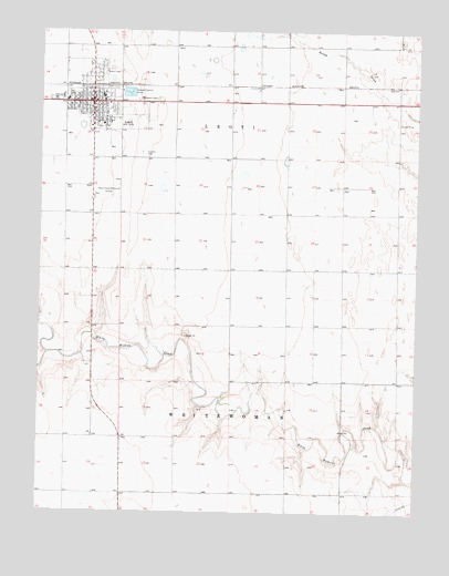
Leoti, KS USGS Topographic Map
Click on map above to begin viewing in our Map Viewer.

This topographic map contains these locations and features:
Feature Name Type Latitude Longitude GNIS ID View Map
Assembly of God ChurchChurchN38.4802°W101.3606°2688805View Map
Christ Covenant Evangelical Presbyterian ChurchChurchN38.4828°W101.3659°2690830View Map
City of LeotiCivilN38.4833°W101.3573°2395684View Map
CoronadoPopulated PlaceN38.4859°W101.3046°484561View Map
First Baptist ChurchChurchN38.4809°W101.3683°2688948View Map
First Presbyterian ChurchChurchN38.4819°W101.3640°2689013View Map
Kingdom Hall of Jehovah's WitnessesChurchN38.4795°W101.3678°2689089View Map
LeotiPopulated PlaceN38.4797°W101.3588°471498View Map
Leoti City HallBuildingN38.4777°W101.3586°2693357View Map
Leoti Country ClubLocaleN38.4834°W101.3360°2694582View Map
Leoti Post OfficePost OfficeN38.4834°W101.3581°2693822View Map
Leoti United Methodist ChurchChurchN38.4806°W101.3659°2689100View Map
Leoti Volunteer Fire DepartmentBuildingN38.4837°W101.3580°2111536View Map
Leoti Wastewater PlantLocaleN38.4838°W101.3462°2693488View Map
Loti CemeteryCemeteryN38.4682°W101.3421°2084856View Map
Mark Hoard Memorial AirportAirportN38.4572°W101.3570°471500View Map
Museum of the Great PlainsBuildingN38.4828°W101.3580°2694283View Map
R B Stewart Elementary SchoolSchoolN38.4830°W101.3547°2427192View Map
Saint Anthony of Padua Catholic ChurchChurchN38.4751°W101.3589°2689162View Map
Township of LeotiCivilN38.4821°W101.3474°485355View Map
Wichita CountyCivilN38.4821°W101.3474°485062View Map
Wichita County Community BuildingBuildingN38.4797°W101.3528°2692961View Map
Wichita County CourthouseBuildingN38.4799°W101.3591°2625142View Map
Wichita County FairgroundsLocaleN38.4788°W101.3522°2692743View Map
Wichita County Health CenterHospitalN38.4754°W101.3551°2499132View Map
Wichita County Health DepartmentBuildingN38.4808°W101.3680°2695074View Map
Wichita County Junior - Senior High SchoolSchoolN38.4825°W101.3684°480720View Map
Wichita County Junior High SchoolSchoolN38.4820°W101.3499°2427194View Map
Wichita County LibraryBuildingN38.4796°W101.3587°2694891View Map
Wichita County Road DepartmentBuildingN38.4811°W101.3530°2693239View Map
Wichita County Sheriff's OfficeBuildingN38.4778°W101.3580°2503969View Map

Note: Coordinates in the location and feature list above are referenced to NAD83 datum.


Copyright (C) 2008-2025 Ryan Niemi / Sunset Dynamics ... All Rights Reserved