TopoQuest Logo
Do you find TopoQuest useful?
Help keep TopoQuest running and adding new maps/features by donating!
Bitcoin:  19c7KJd3qBynnjoSw5npx9KScwjBe4ifkT
Litecoin:  LXs6TkuXGGXo1vDsWCkWVdjQX94eUKd6ui
Home View Maps Find Maps Find Places Resources & Links


Lessley, Mississippi Topographic Map

USGS Map Title: Lessley, MS
USGS Map MRC: 31091B4
DRG (GeoTIFF) Download: o31091b4.tif


Neighboring USGS Topographic Map Quads:


  Fairview, LA  
31091C5
 

  Buck Island, MS  
31091C4
 

  Doloroso, MS  
31091C3
 

  Lake Mary, MS  
31091B5
 

  Lessley, MS  
31091B4
 

  Laneheart, MS  
31091B3
 

  Fort Adams, MS  
31091A5
 

  Pinckneyville, MS  
31091A4
 

  Woodville, MS  
31091A3


Map MRC Location:

N32°
W92°
N32°
W91°
H8 H7 H6 H5 H4 H3 H2 H1
G8 G7 G6 G5 G4 G3 G2 G1
F8 F7 F6 F5 F4 F3 F2 F1
E8 E7 E6 E5 E4 E3 E2 E1
D8 D7 D6 D5 D4 D3 D2 D1
C8 C7 C6 C5 C4 C3 C2 C1
B8 B7 B6 B5 B4 B3 B2 B1
A8 A7 A6 A5 A4 A3 A2 A1
N31°
W92°
N31°
W91°

Lessley, MS USGS 1:24K Topographic Map Preview:
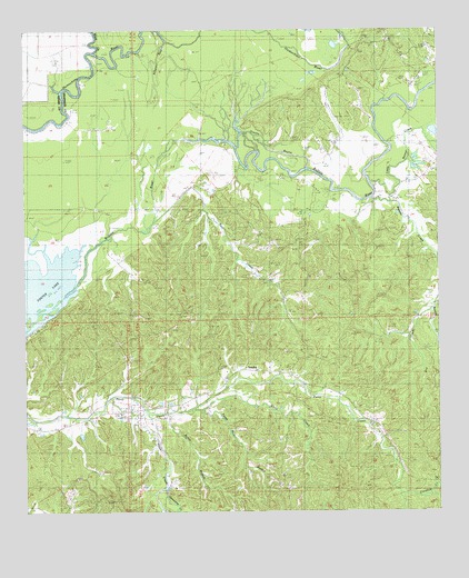
Lessley, MS USGS Topographic Map
Click on map above to begin viewing in our Map Viewer.

This topographic map contains these locations and features:
Feature Name Type Latitude Longitude GNIS ID View Map
Alligator BayouStreamN31.2474°W91.4579°666224View Map
Alligator Bayou Oil FieldOilfieldN31.2249°W91.4729°691021View Map
Bear CreekStreamN31.2063°W91.4657°666636View Map
Beaver CreekStreamN31.2068°W91.3971°666699View Map
Bullet BranchStreamN31.1502°W91.4584°667777View Map
Caroline CreekStreamN31.1302°W91.3890°668079View Map
Courtney CemeteryCemeteryN31.1646°W91.4123°668884View Map
Dixons BayouStreamN31.2138°W91.4171°669302View Map
Dry CreekStreamN31.1780°W91.3804°669410View Map
First Zion ChurchChurchN31.1491°W91.4868°669974View Map
Hays CreekStreamN31.1543°W91.4754°671034View Map
Lake Mary Oil FieldOilfieldN31.1982°W91.4918°711342View Map
LessleyPopulated PlaceN31.1613°W91.4296°672410View Map
Little Beaver CreekStreamN31.2107°W91.3979°672540View Map
Macedonia ChurchChurchN31.2032°W91.4387°686163View Map
Macedonia SchoolSchoolN31.2035°W91.4373°673037View Map
North Lessley Oil FieldOilfieldN31.2016°W91.4573°691028View Map
Oak Hill Church (historical)ChurchN31.1502°W91.4862°686170View Map
Peggy Row BranchStreamN31.1516°W91.4476°675576View Map
Percy Creek SchoolSchoolN31.1580°W91.4198°675611View Map
Pleasant Valley ChurchChurchN31.1768°W91.4559°676132View Map
Pleasant Valley Oil FieldOilfieldN31.1868°W91.4718°691031View Map
Smithland Plantation (historical)LocaleN31.2146°W91.4390°686178View Map
West Fork Homochitto RiverStreamN31.2446°W91.4798°679487View Map
White CreekStreamN31.1518°W91.4509°679582View Map
Yamacrow CreekStreamN31.1318°W91.4587°679912View Map

Note: Coordinates in the location and feature list above are referenced to NAD83 datum.


Copyright (C) 2008-2024 Ryan Niemi / Sunset Dynamics ... All Rights Reserved