TopoQuest Logo
Do you find TopoQuest useful?
Help keep TopoQuest running and adding new maps/features by donating!
Bitcoin:  19c7KJd3qBynnjoSw5npx9KScwjBe4ifkT
Litecoin:  LXs6TkuXGGXo1vDsWCkWVdjQX94eUKd6ui
Home View Maps Find Maps Find Places Resources & Links


Letford, Georgia Topographic Map

USGS Map Title: Letford, GA
USGS Map MRC: 32081A5
DRG (GeoTIFF) Download: o32081a5.tif


Neighboring USGS Topographic Map Quads:


  Groveland, GA  
32081B6
 

  Lanier, GA  
32081B5
 

  Eden, GA  
32081B4
 

  Willie, GA  
32081A6
 

  Letford, GA  
32081A5
 

  Meldrim SW, GA  
32081A4
 

  Taylors Creek, GA  
31081H6
 

  Trinity, GA  
31081H5
 

  Limerick NW, GA  
31081H4


Map MRC Location:

N33°
W82°
N33°
W81°
H8 H7 H6 H5 H4 H3 H2 H1
G8 G7 G6 G5 G4 G3 G2 G1
F8 F7 F6 F5 F4 F3 F2 F1
E8 E7 E6 E5 E4 E3 E2 E1
D8 D7 D6 D5 D4 D3 D2 D1
C8 C7 C6 C5 C4 C3 C2 C1
B8 B7 B6 B5 B4 B3 B2 B1
A8 A7 A6 A5 A4 A3 A2 A1
N32°
W82°
N32°
W81°

Letford, GA USGS 1:24K Topographic Map Preview:
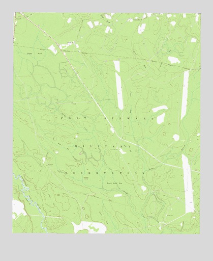
Letford, GA USGS Topographic Map
Click on map above to begin viewing in our Map Viewer.

This topographic map contains these locations and features:
Feature Name Type Latitude Longitude GNIS ID View Map
Alligator BaySwampN32.0188°W81.5987°310472View Map
Beulah Baptist ChurchChurchN32.1080°W81.5841°2502346View Map
Beulah ChurchChurchN32.1083°W81.5837°354698View Map
Boggy Head BaySwampN32.0285°W81.5546°311620View Map
Boggy PondLakeN32.1016°W81.6107°311622View Map
Boggy PondSwampN32.1229°W81.5659°311623View Map
Bonnet BaySwampN32.0494°W81.5901°311647View Map
Brier BaySwampN32.0483°W81.5479°311792View Map
Caney BaySwampN32.0746°W81.5459°312294View Map
Corinth CemeteryCemeteryN32.0108°W81.5223°312976View Map
Corinth Church (historical)ChurchN32.0108°W81.5221°350506View Map
Cross BaySwampN32.1002°W81.5234°313156View Map
Cypress BaySwampN32.0988°W81.5404°313231View Map
Cypress Bay ChurchChurchN32.1219°W81.5423°313232View Map
Hilliard IslandIslandN32.0316°W81.5759°315428View Map
Jones BaySwampN32.0088°W81.5637°316204View Map
Jones LakeReservoirN32.0402°W81.5798°337232View Map
Jones Lake DamDamN32.0402°W81.5798°337231View Map
LetfordPopulated PlaceN32.0388°W81.6012°332206View Map
Little Creek CemeteryCemeteryN32.0485°W81.5548°317043View Map
Little Creek School (historical)SchoolN32.0483°W81.5551°350517View Map
Malden BranchStreamN32.0108°W81.5387°317638View Map
Middle Ground School (historical)SchoolN32.0285°W81.5046°350520View Map

Note: Coordinates in the location and feature list above are referenced to NAD83 datum.


Copyright (C) 2008-2024 Ryan Niemi / Sunset Dynamics ... All Rights Reserved