TopoQuest Logo
Do you find TopoQuest useful?
Help keep TopoQuest running and adding new maps/features by donating!
Bitcoin:  19c7KJd3qBynnjoSw5npx9KScwjBe4ifkT
Litecoin:  LXs6TkuXGGXo1vDsWCkWVdjQX94eUKd6ui
Home View Maps Find Maps Find Places Resources & Links


Lime Mountain, Washington Topographic Map

USGS Map Title: Lime Mountain, WA
USGS Map MRC: 48121B2
DRG (GeoTIFF) Download: o48121b2.tif


Neighboring USGS Topographic Map Quads:


  Huckleberry Mountain, WA  
48121C3
 

  Downey Mountain, WA  
48121C2
 

  Dome Peak, WA  
48121C1
 

  Mount Pugh, WA  
48121B3
 

  Lime Mountain, WA  
48121B2
 

  Gamma Peak, WA  
48121B1
 

  Sloan Peak, WA  
48121A3
 

  Glacier Peak West, WA  
48121A2
 

  Glacier Peak East, WA  
48121A1


Map MRC Location:

N49°
W122°
N49°
W121°
H8 H7 H6 H5 H4 H3 H2 H1
G8 G7 G6 G5 G4 G3 G2 G1
F8 F7 F6 F5 F4 F3 F2 F1
E8 E7 E6 E5 E4 E3 E2 E1
D8 D7 D6 D5 D4 D3 D2 D1
C8 C7 C6 C5 C4 C3 C2 C1
B8 B7 B6 B5 B4 B3 B2 B1
A8 A7 A6 A5 A4 A3 A2 A1
N48°
W122°
N48°
W121°

Lime Mountain, WA USGS 1:24K Topographic Map Preview:
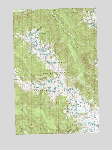
Lime Mountain, WA USGS Topographic Map
Click on map above to begin viewing in our Map Viewer.

This topographic map contains these locations and features:
Feature Name Type Latitude Longitude GNIS ID View Map
Box MountainSummitN48.2293°W121.2151°1516902View Map
Box Mountain LakesLakeN48.2241°W121.2155°1516903View Map
Buckeye BasinBasinN48.2160°W121.1465°1528531View Map
Camp Creek Ridge Trail (historical)TrailN48.1343°W121.2376°1517271View Map
Diamond LakeLakeN48.1819°W121.2445°1518753View Map
East Fork Milk CreekStreamN48.1890°W121.1520°1519114View Map
Fire CreekStreamN48.1529°W121.2451°1519552View Map
Fire Creek PassGapN48.1601°W121.1595°1519554View Map
Fire Creek Trail (historical)TrailN48.1512°W121.1704°1519555View Map
Fire Creek Way (historical)TrailN48.1507°W121.2221°1519556View Map
Fire MountainSummitN48.1659°W121.1937°1519557View Map
Fourteenmile CreekStreamN48.1404°W121.2226°1519740View Map
Glacier CreekStreamN48.1296°W121.2037°1519974View Map
Glacier RidgeRidgeN48.1315°W121.1720°1529379View Map
Glacier Ridge TrailTrailN48.1321°W121.1793°1519991View Map
Grassy PointRidgeN48.1951°W121.1276°1529377View Map
Kennedy PeakSummitN48.1321°W121.1251°1521616View Map
Kennedy RidgeRidgeN48.1293°W121.1629°1529378View Map
Kennedy Ridge TrailTrailN48.1254°W121.1757°1521617View Map
Lime LakeLakeN48.1840°W121.1845°1522111View Map
Lime MountainSummitN48.2137°W121.2221°1522113View Map
Lime RidgeRidgeN48.2032°W121.2048°1522114View Map
Lookout LakeLakeN48.2367°W121.1364°1522429View Map
Meadow Mountain Way (historical)TrailN48.1704°W121.2204°1522974View Map
Mica LakeLakeN48.1661°W121.1599°1523043View Map
Milk CreekStreamN48.2215°W121.1626°1523131View Map
Milk LakeLakeN48.1518°W121.1513°1528600View Map
Milk Lake GlacierGlacierN48.1513°W121.1551°1523139View Map
Milk LakesLakeN48.1992°W121.1906°1523140View Map
Ptarmigan GlacierGlacierN48.1357°W121.1273°1524673View Map
Pumice CreekStreamN48.1479°W121.2362°1524689View Map
Rivord LakeLakeN48.2130°W121.2079°1525078View Map
Suiattle TrailheadLocaleN48.2448°W121.1946°1530000View Map
Sulphur CreekStreamN48.2473°W121.1926°1526693View Map
Sulphur Creek CampgroundLocaleN48.2484°W121.1946°1529999View Map
Sulphur MountainSummitN48.2318°W121.1301°1526696View Map
Sulphur Mountain LakeLakeN48.2454°W121.1382°1526697View Map
Sulphur Mountain Way (historical)TrailN48.2460°W121.1687°1526698View Map
Twin LakesLakeN48.2075°W121.1992°1527542View Map

Note: Coordinates in the location and feature list above are referenced to NAD83 datum.


Copyright (C) 2008-2025 Ryan Niemi / Sunset Dynamics ... All Rights Reserved