TopoQuest Logo
Do you find TopoQuest useful?
Help keep TopoQuest running and adding new maps/features by donating!
Bitcoin:  19c7KJd3qBynnjoSw5npx9KScwjBe4ifkT
Litecoin:  LXs6TkuXGGXo1vDsWCkWVdjQX94eUKd6ui
Home View Maps Find Maps Find Places Resources & Links


Lincoln, Kansas Topographic Map

USGS Map Title: Lincoln, KS
USGS Map MRC: 39098A2
DRG (GeoTIFF) Download: o39098a2.tif


Neighboring USGS Topographic Map Quads:


  Ash Grove, KS  
39098B3
 

  Lincoln NW, KS  
39098B2
 

  Barnard, KS  
39098B1
 

  Vesper, KS  
39098A3
 

  Lincoln, KS  
39098A2
 

  Shady Bend, KS  
39098A1
 

  Wilson NE, KS  
38098H3
 

  Westfall NW, KS  
38098H2
 

  Westfall, KS  
38098H1


Map MRC Location:

N40°
W99°
N40°
W98°
H8 H7 H6 H5 H4 H3 H2 H1
G8 G7 G6 G5 G4 G3 G2 G1
F8 F7 F6 F5 F4 F3 F2 F1
E8 E7 E6 E5 E4 E3 E2 E1
D8 D7 D6 D5 D4 D3 D2 D1
C8 C7 C6 C5 C4 C3 C2 C1
B8 B7 B6 B5 B4 B3 B2 B1
A8 A7 A6 A5 A4 A3 A2 A1
N39°
W99°
N39°
W98°

Lincoln, KS USGS 1:24K Topographic Map Preview:
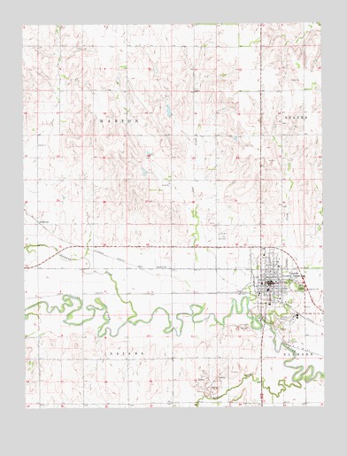
Lincoln, KS USGS Topographic Map
Click on map above to begin viewing in our Map Viewer.

This topographic map contains these locations and features:
Feature Name Type Latitude Longitude GNIS ID View Map
Agmark Grain Elevator Number 13LocaleN39.0350°W98.1432°2695163View Map
Bullfoot CreekStreamN39.0083°W98.1364°472559View Map
City of Lincoln CenterCivilN39.0431°W98.1467°2395714View Map
Crispin's Drug Store MuseumBuildingN39.0400°W98.1463°2694935View Map
Faith Baptist ChurchChurchN39.0410°W98.1498°2690837View Map
Finch TheatreBuildingN39.0405°W98.1470°2694412View Map
First Rural Fire Department of LincolnBuildingN39.0405°W98.1516°2111315View Map
GoldenrodPopulated PlaceN39.0600°W98.2445°484607View Map
Kansas Highway Patrol Troop C LincolnBuildingN39.0410°W98.1448°2504138View Map
Kyne House MuseumBuildingN39.0405°W98.1503°2694228View Map
LincolnPopulated PlaceN39.0408°W98.1448°472553View Map
Lincoln Art CenterBuildingN39.0405°W98.1469°2694229View Map
Lincoln Carnegie LibraryBuildingN39.0390°W98.1457°2694850View Map
Lincoln CemeteryCemeteryN39.0388°W98.1349°472554View Map
Lincoln City HallBuildingN39.0399°W98.1492°2694383View Map
Lincoln Community ChurchChurchN39.0376°W98.1475°2690855View Map
Lincoln CountyCivilN39.0453°W98.2077°485017View Map
Lincoln County Ambulance ServiceBuildingN39.0404°W98.1516°2696591View Map
Lincoln County CourthouseBuildingN39.0407°W98.1451°2625090View Map
Lincoln County Health DepartmentBuildingN39.0394°W98.1483°2695027View Map
Lincoln County HospitalHospitalN39.0455°W98.1440°2499134View Map
Lincoln County JailBuildingN39.0410°W98.1448°2504331View Map
Lincoln County Sheriff's OfficeBuildingN39.0410°W98.1448°2504124View Map
Lincoln Elementary SchoolSchoolN39.0378°W98.1485°480377View Map
Lincoln Fire DepartmentBuildingN39.0405°W98.1516°2111542View Map
Lincoln Historical MuseumBuildingN39.0406°W98.1505°2694230View Map
Lincoln Junior / Senior High SchoolSchoolN39.0432°W98.1365°480378View Map
Lincoln Municipal AirportAirportN39.0557°W98.1691°472555View Map
Lincoln Post OfficePost OfficeN39.0395°W98.1463°2693827View Map
Lincoln United Methodist ChurchChurchN39.0419°W98.1481°2690259View Map
Lincoln Wastewater PlantLocaleN39.0353°W98.1863°2693493View Map
Lincoln Wesleyan ChurchChurchN39.0400°W98.1441°2691024View Map
Lost CreekStreamN39.0356°W98.1573°472556View Map
Pleasant Valley (historical)LocaleN39.0014°W98.2087°482323View Map
Post Rock Scout MuseumBuildingN39.0400°W98.1463°2694246View Map
Saint John SchoolSchoolN39.0494°W98.1503°475251View Map
Saint Patrick Catholic ChurchChurchN39.0416°W98.1499°2690865View Map
Saint Patrick's CemeteryCemeteryN39.0160°W98.1509°472558View Map
Spillman CreekStreamN39.0289°W98.2073°472485View Map
Township of IndianaCivilN39.0015°W98.2064°472545View Map
Township of MarionCivilN39.0889°W98.2057°472489View Map
Walker Products Company Grain Elevator Number 1LocaleN39.0363°W98.1525°2695279View Map
Yauger CreekStreamN39.0270°W98.1484°472557View Map

Note: Coordinates in the location and feature list above are referenced to NAD83 datum.


Copyright (C) 2008-2024 Ryan Niemi / Sunset Dynamics ... All Rights Reserved