TopoQuest Logo
Do you find TopoQuest useful?
Help keep TopoQuest running and adding new maps/features by donating!
Bitcoin:  19c7KJd3qBynnjoSw5npx9KScwjBe4ifkT
Litecoin:  LXs6TkuXGGXo1vDsWCkWVdjQX94eUKd6ui
Home View Maps Find Maps Find Places Resources & Links


Lineville, Iowa Topographic Map

USGS Map Title: Lineville, IA
USGS Map MRC: 40093E5
DRG (GeoTIFF) Download: o40093e5.tif


Neighboring USGS Topographic Map Quads:


  Leon, IA  
40093F6
 

  Woodland, IA  
40093F5
 

  Clio, IA  
40093F4
 

  Pleasanton, IA  
40093E6
 

  Lineville, IA  
40093E5
 

  Cleopatra, MO  
40093E4
 

  Goshen, MO  
40093D6
 

  Princeton, MO  
40093D5
 

  Ravanna, MO  
40093D4


Map MRC Location:

N41°
W94°
N41°
W93°
H8 H7 H6 H5 H4 H3 H2 H1
G8 G7 G6 G5 G4 G3 G2 G1
F8 F7 F6 F5 F4 F3 F2 F1
E8 E7 E6 E5 E4 E3 E2 E1
D8 D7 D6 D5 D4 D3 D2 D1
C8 C7 C6 C5 C4 C3 C2 C1
B8 B7 B6 B5 B4 B3 B2 B1
A8 A7 A6 A5 A4 A3 A2 A1
N40°
W94°
N40°
W93°

Lineville, IA USGS 1:24K Topographic Map Preview:
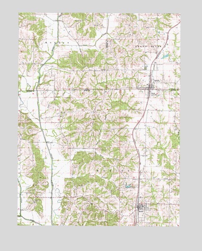
Lineville, IA USGS Topographic Map
Click on map above to begin viewing in our Map Viewer.

This topographic map contains these locations and features:
Feature Name Type Latitude Longitude GNIS ID View Map
Alley CemeteryCemeteryN40.5278°W93.5130°713231View Map
Brush CreekStreamN40.5056°W93.6219°714861View Map
Caleb CreekStreamN40.6067°W93.5969°455048View Map
City of LinevilleCivilN40.5870°W93.5232°2395718View Map
Collier BranchStreamN40.5303°W93.5952°716121View Map
Duncan CemeteryCemeteryN40.5969°W93.5044°456059View Map
Duncan School (historical)SchoolN40.5689°W93.5080°734006View Map
Elm CemeteryCemeteryN40.5931°W93.5734°456329View Map
Evergreen CemeteryCemeteryN40.5928°W93.5272°456418View Map
Fugate CemeteryCemeteryN40.5889°W93.6058°1969694View Map
Garland School (historical)SchoolN40.5511°W93.5697°734004View Map
Gatliff CemeteryCemeteryN40.5917°W93.5616°456862View Map
Girdner CemeteryCemeteryN40.5414°W93.5272°718469View Map
Hickory School (historical)SchoolN40.5675°W93.5805°734003View Map
Hollers CemeteryCemeteryN40.5569°W93.5772°719713View Map
Lick BranchStreamN40.5833°W93.6091°458334View Map
LinevilleLocaleN40.5820°W93.5252°1970541View Map
LinevillePopulated PlaceN40.5814°W93.5238°458412View Map
Lineville Baptist ChurchChurchN40.5814°W93.5238°1970536View Map
Lineville Christian ChurchChurchN40.5814°W93.5238°1970535View Map
Lineville City HallBuildingN40.5814°W93.5238°1970537View Map
Lineville Medical ClinicHospitalN40.5814°W93.5238°1970538View Map
Lineville Post OfficePost OfficeN40.5814°W93.5238°1970539View Map
Lineville Volunteer Fire DepartmentBuildingN40.5812°W93.5248°2371683View Map
Lineville-Clio Junior-Senior High SchoolSchoolN40.5833°W93.5255°1970540View Map
Lions Community ParkParkN40.5236°W93.5333°721139View Map
Lions Community Park LakeReservoirN40.5235°W93.5400°760962View Map
Lions Community Park Lake DamDamN40.5233°W93.5419°760961View Map
Logan CemeteryCemeteryN40.6178°W93.5631°458562View Map
McKinney CemeteryCemeteryN40.5447°W93.5613°722147View Map
MercerPopulated PlaceN40.5114°W93.5322°735721View Map
Mercer High SchoolSchoolN40.5117°W93.5283°2545077View Map
Mercer Post OfficePost OfficeN40.5100°W93.5324°2782870View Map
Mercer Volunteer Fire DepartmentBuildingN40.5115°W93.5317°2621537View Map
Middle Point CemeteryCemeteryN40.5147°W93.6119°722285View Map
Middle Point School (historical)SchoolN40.5245°W93.6102°734028View Map
Mineral Springs BranchStreamN40.5299°W93.5979°459128View Map
Moore CemeteryCemeteryN40.5661°W93.5924°722576View Map
Moore-Gosch Memorial ParkParkN40.6000°W93.5113°1970531View Map
MorganPopulated PlaceN40.6095°W93.6219°467226View Map
Morgan Post Office (historical)Post OfficeN40.6200°W93.6224°1969580View Map
North Mercer Elementary SchoolSchoolN40.5117°W93.5283°2545156View Map
Ragan BranchStreamN40.5436°W93.5697°725060View Map
Sand CreekStreamN40.5639°W93.6087°461389View Map
South LinevillePopulated PlaceN40.5789°W93.5238°726767View Map
South Lineville CemeteryCemeteryN40.5794°W93.5180°726768View Map
Steel CreekStreamN40.6222°W93.5949°461979View Map
Town of MercerCivilN40.5106°W93.5299°2396751View Map
Town of South LinevilleCivilN40.5786°W93.5241°2397667View Map
Township of MarionCivilN40.5266°W93.5557°767010View Map
Township of MorganCivilN40.6088°W93.6145°468405View Map
Upper Girdner School (historical)SchoolN40.5281°W93.5174°734007View Map
White Oak CemeteryCemeteryN40.6207°W93.5762°462982View Map
White Oak CemeteryCemeteryN40.5233°W93.5747°728741View Map
White Oak School (historical)SchoolN40.5220°W93.5794°734005View Map
Yingling CemeteryCemeteryN40.5756°W93.5847°729201View Map

Note: Coordinates in the location and feature list above are referenced to NAD83 datum.


Copyright (C) 2008-2024 Ryan Niemi / Sunset Dynamics ... All Rights Reserved