TopoQuest Logo
Do you find TopoQuest useful?
Help keep TopoQuest running and adding new maps/features by donating!
Bitcoin:  19c7KJd3qBynnjoSw5npx9KScwjBe4ifkT
Litecoin:  LXs6TkuXGGXo1vDsWCkWVdjQX94eUKd6ui
Home View Maps Find Maps Find Places Resources & Links


Lipscomb, Texas Topographic Map

USGS Map Title: Lipscomb, TX
USGS Map MRC: 36100B3
DRG (GeoTIFF) Download: o36100b3.tif


Neighboring USGS Topographic Map Quads:


  Twin Grove, TX  
36100C4
 

  Dugout Creek, TX  
36100C3
 

  Skunk Creek, TX  
36100C2
 

  Barton Corners, TX  
36100B4
 

  Lipscomb, TX  
36100B3
 

  Willow Creek, TX  
36100B2
 

  Lipscomb SW, TX  
36100A4
 

  Glazier, TX  
36100A3
 

  Coburn, TX  
36100A2


Map MRC Location:

N37°
W101°
N37°
W100°
H8 H7 H6 H5 H4 H3 H2 H1
G8 G7 G6 G5 G4 G3 G2 G1
F8 F7 F6 F5 F4 F3 F2 F1
E8 E7 E6 E5 E4 E3 E2 E1
D8 D7 D6 D5 D4 D3 D2 D1
C8 C7 C6 C5 C4 C3 C2 C1
B8 B7 B6 B5 B4 B3 B2 B1
A8 A7 A6 A5 A4 A3 A2 A1
N36°
W101°
N36°
W100°

Lipscomb, TX USGS 1:24K Topographic Map Preview:
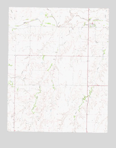
Lipscomb, TX USGS Topographic Map
Click on map above to begin viewing in our Map Viewer.

This topographic map contains these locations and features:
Feature Name Type Latitude Longitude GNIS ID View Map
Chicken CreekStreamN36.2373°W100.2535°1354383View Map
Dugout CreekStreamN36.2400°W100.2940°1356418View Map
Fifth CreekStreamN36.2409°W100.3212°1357323View Map
Fourth CreekStreamN36.2353°W100.3526°1357652View Map
Gene Howe Wildlife Management Area - Murphy UnitParkN36.1798°W100.2585°2028242View Map
Higgins - Lipscomb Volunteer Fire Department Station 2BuildingN36.2314°W100.2723°2551183View Map
Higgins DivisionCivilN36.1493°W100.2648°1938842View Map
LipscombPopulated PlaceN36.2334°W100.2710°1361259View Map
Lipscomb CemeteryCemeteryN36.2298°W100.2530°2769980View Map
Lipscomb Census Designated PlaceCensusN36.2215°W100.2621°2408616View Map
Lipscomb County Sheriff's OfficeBuildingN36.2336°W100.2702°2750442View Map
Lipscomb Post OfficePost OfficeN36.2330°W100.2708°2731690View Map
Little Sand CreekStreamN36.2056°W100.3185°1361460View Map
Saint John's Lutheran CemeteryCemeteryN36.2158°W100.2667°1367180View Map
Sand CreekStreamN36.2400°W100.2862°1367595View Map
Wolf Creek Heritage MuseumBuildingN36.2217°W100.2890°2014557View Map

Note: Coordinates in the location and feature list above are referenced to NAD83 datum.


Copyright (C) 2008-2025 Ryan Niemi / Sunset Dynamics ... All Rights Reserved