TopoQuest Logo
Do you find TopoQuest useful?
Help keep TopoQuest running and adding new maps/features by donating!
Bitcoin:  19c7KJd3qBynnjoSw5npx9KScwjBe4ifkT
Litecoin:  LXs6TkuXGGXo1vDsWCkWVdjQX94eUKd6ui
Home View Maps Find Maps Find Places Resources & Links


Lisbon Falls North, Maine Topographic Map

USGS Map Title: Lisbon Falls North, ME
USGS Map MRC: 44070A1
DRG (GeoTIFF) Download: o44070a1.tif


Neighboring USGS Topographic Map Quads:


  Lake Auburn East, ME  
44070B2
 

  Monmouth, ME  
44070B1
 

  Purgatory, ME  
44069B8
 

  Lewiston, ME  
44070A2
 

  Lisbon Falls North, ME  
44070A1
 

  Bowdoinham, ME  
44069A8
 

  North Pownal, ME  
43070H2
 

  Lisbon Falls South, ME  
43070H1
 

  Brunswick, ME  
43069H8


Map MRC Location:

N45°
W71°
N45°
W70°
H8 H7 H6 H5 H4 H3 H2 H1
G8 G7 G6 G5 G4 G3 G2 G1
F8 F7 F6 F5 F4 F3 F2 F1
E8 E7 E6 E5 E4 E3 E2 E1
D8 D7 D6 D5 D4 D3 D2 D1
C8 C7 C6 C5 C4 C3 C2 C1
B8 B7 B6 B5 B4 B3 B2 B1
A8 A7 A6 A5 A4 A3 A2 A1
N44°
W71°
N44°
W70°

Lisbon Falls North, ME USGS 1:24K Topographic Map Preview:
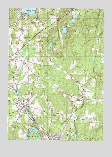
Lisbon Falls North, ME USGS Topographic Map
Click on map above to begin viewing in our Map Viewer.

This topographic map contains these locations and features:
Feature Name Type Latitude Longitude GNIS ID View Map
Agri BogSwampN44.1042°W70.0353°561110View Map
Barker BrookStreamN44.0298°W70.0973°561600View Map
Beaver ParkParkN44.0315°W70.1239°561937View Map
Blake CemeteryCemeteryN44.0136°W70.1203°562548View Map
Blake CornerPopulated PlaceN44.0117°W70.1176°562550View Map
Bowdoin Post OfficePost OfficeN44.0465°W70.0247°1907775View Map
Cliffords AirportAirportN44.0705°W70.0645°582223View Map
Coombs CemeteryCemeteryN44.1190°W70.1039°2736211View Map
Curtis BogLakeN44.1105°W70.0451°564678View Map
Curtis BrookStreamN44.1092°W70.0709°564679View Map
Davis CemeteryCemeteryN44.0631°W70.1169°564805View Map
Davis-Bryent CemeteryCemeteryN44.0727°W70.1087°1908801View Map
Dearing BrookStreamN44.0173°W70.0376°564926View Map
Drinkwater CornerPopulated PlaceN44.1109°W70.0903°579258View Map
Eaton CemeteryCemeteryN44.1225°W70.1105°565752View Map
Farnsworth Mill DamDamN44.0212°W70.0919°1774149View Map
Fisher CemeteryCemeteryN44.0831°W70.0389°566229View Map
Fisher StreamStreamN44.0434°W70.0278°566234View Map
Furbush CemeteryCemeteryN44.1095°W70.0803°566653View Map
Hewey CemeteryCemeteryN44.0743°W70.0700°567990View Map
Higgins CornerPopulated PlaceN44.0390°W70.0337°579405View Map
KettlebottomBasinN44.0537°W70.0159°569136View Map
LisbonPopulated PlaceN44.0315°W70.1045°569643View Map
Lisbon Ambulance ServiceBuildingN44.0178°W70.0926°2666775View Map
Lisbon CemeteryCemeteryN44.0256°W70.1100°2736232View Map
Lisbon CenterPopulated PlaceN44.0198°W70.0934°569644View Map
Lisbon Center CemeteryCemeteryN44.0190°W70.0948°1908893View Map
Lisbon Center Post OfficePost OfficeN44.0192°W70.0937°1908894View Map
Lisbon Community SchoolSchoolN44.0226°W70.0878°2737947View Map
Lisbon Elementary School (historical)SchoolN44.0265°W70.1045°1908895View Map
Lisbon Falls Census Designated PlaceCensusN44.0086°W70.0571°2377927View Map
Lisbon Falls Christian AcademySchoolN44.0051°W70.0781°2738087View Map
Lisbon Fire Department HeadquartersBuildingN44.0252°W70.0993°2552702View Map
Lisbon Fire Department Smith Hose CompanyBuildingN44.0287°W70.1071°2552991View Map
Lisbon High SchoolSchoolN44.0028°W70.0709°1908899View Map
Lisbon Police DepartmentBuildingN44.0253°W70.0996°2735949View Map
Lisbon RidgeLocaleN44.0240°W70.0673°569646View Map
Lisbon RidgeRidgeN44.0309°W70.0670°569647View Map
Lisbon Ridge CemeteryCemeteryN44.0254°W70.0715°2736233View Map
Lisbon United Methodist ChurchChurchN44.0017°W70.0592°1908903View Map
Little Gillespie BrookStreamN44.0226°W70.0337°569795View Map
Loon PondLakeN44.1038°W70.0519°570371View Map
Lower DamDamN44.0311°W70.1030°1774147View Map
Mann HillSummitN44.1244°W70.0423°570700View Map
Marion T Morse SchoolSchoolN44.0006°W70.0601°1908919View Map
Maxwell BrookStreamN44.0901°W70.0989°570924View Map
Middle SchoolSchoolN44.0265°W70.1042°571267View Map
Mount Calvary CemeteryCemeteryN44.0093°W70.0536°563367View Map
No Name BrookStreamN44.0462°W70.1139°572206View Map
Oak Hill Middle SchoolSchoolN44.1121°W70.0982°2737951View Map
Open Door Christian AcademySchoolN44.0284°W70.1041°2738153View Map
Our Lady of the Rosary ChurchChurchN44.1167°W70.1048°1908945View Map
Philip W Sugg Middle SchoolSchoolN44.0010°W70.0701°1908949View Map
Pleasant Hill CemeteryCemeteryN44.1119°W70.0886°573481View Map
Potter BrookStreamN44.0192°W70.0373°573721View Map
Potter CemeteryCemeteryN44.0393°W70.0442°573723View Map
Purington BrookStreamN44.0434°W70.0278°573902View Map
Robinson CornerPopulated PlaceN44.0759°W70.1151°574321View Map
Round PondLakeN44.1159°W70.0883°574496View Map
SabattusPopulated PlaceN44.1198°W70.1076°574628View Map
Sabattus Fire DepartmentBuildingN44.1175°W70.1081°2552827View Map
Sabattus Fire Department SubstationBuildingN44.0718°W70.0861°2553060View Map
Sabattus Police DepartmentBuildingN44.1092°W70.0884°2735926View Map
Sabattus PondReservoirN44.1213°W70.1077°574630View Map
Sabattus Post OfficePost OfficeN44.1152°W70.1021°1908973View Map
Sabattus Primary SchoolSchoolN44.1205°W70.1127°577963View Map
Sabattus RiverStreamN44.0115°W70.0873°574631View Map
Sabattus River ReservoirReservoirN44.0329°W70.1040°1774146View Map
Sabattus River ReservoirReservoirN44.0311°W70.1030°1774148View Map
Sabattus River ReservoirReservoirN44.0201°W70.0912°1774150View Map
Saint Anne CemeteryCemeteryN44.0374°W70.1062°574691View Map
Saint Cyril CemeteryCemeteryN44.0173°W70.0473°574699View Map
Sanborn CemeteryCemeteryN44.1029°W70.1078°574812View Map
Sleeper DamDamN44.1223°W70.1079°1773543View Map
Spear CemeteryCemeteryN44.1036°W70.0590°575987View Map
Sutherland PondLakeN44.0896°W70.0697°576568View Map
Town of LisbonCivilN44.0265°W70.0900°582563View Map
Town of SabattusCivilN44.0950°W70.0662°582704View Map
Upper DamDamN44.0329°W70.1040°1774145View Map
Webster CornerPopulated PlaceN44.0601°W70.0859°577958View Map
West BowdoinPopulated PlaceN44.0473°W70.0248°578029View Map
West Bowdoin Baptist ChurchChurchN44.0495°W70.0206°1907892View Map
West Bowdoin CemeteryCemeteryN44.0496°W70.0224°2737007View Map
West Bowdoin School (historical)SchoolN44.0398°W70.0120°1907894View Map
Whites HillSummitN44.0345°W70.1120°578393View Map
Whitten HillSummitN44.1020°W70.0045°578431View Map
Woodlawn CemeteryCemeteryN44.0593°W70.0094°578676View Map

Note: Coordinates in the location and feature list above are referenced to NAD83 datum.


Copyright (C) 2008-2025 Ryan Niemi / Sunset Dynamics ... All Rights Reserved