TopoQuest Logo
Do you find TopoQuest useful?
Help keep TopoQuest running and adding new maps/features by donating!
Bitcoin:  19c7KJd3qBynnjoSw5npx9KScwjBe4ifkT
Litecoin:  LXs6TkuXGGXo1vDsWCkWVdjQX94eUKd6ui
Home View Maps Find Maps Find Places Resources & Links


Agawam South, Montana Topographic Map

USGS Map Title: Agawam South, MT
USGS Map MRC: 47112H2
DRG (GeoTIFF) Download: o47112h2.tif


Neighboring USGS Topographic Map Quads:


  Pendroy, MT  
48112A3
 

  Agawam North, MT  
48112A2
 

  Gallup City, MT  
48112A1
 

  Bynum, MT  
47112H3
 

  Agawam South, MT  
47112H2
 

  Eyraud Lakes, MT  
47112H1
 

  Teton Buttes, MT  
47112G3
 

  Choteau, MT  
47112G2
 

  Choteau SE, MT  
47112G1


Map MRC Location:

N48°
W113°
N48°
W112°
H8 H7 H6 H5 H4 H3 H2 H1
G8 G7 G6 G5 G4 G3 G2 G1
F8 F7 F6 F5 F4 F3 F2 F1
E8 E7 E6 E5 E4 E3 E2 E1
D8 D7 D6 D5 D4 D3 D2 D1
C8 C7 C6 C5 C4 C3 C2 C1
B8 B7 B6 B5 B4 B3 B2 B1
A8 A7 A6 A5 A4 A3 A2 A1
N47°
W113°
N47°
W112°

Agawam South, MT USGS 1:24K Topographic Map Preview:
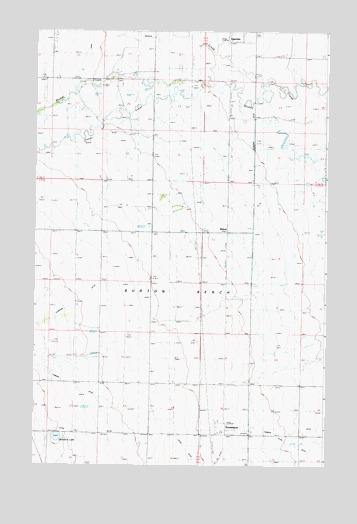
Agawam South, MT USGS Topographic Map
Click on map above to begin viewing in our Map Viewer.

This topographic map contains these locations and features:
Feature Name Type Latitude Longitude GNIS ID View Map
25N04W06____01 WellWellN47.9488°W112.1684°825269View Map
25N04W06____02 WellWellN47.9488°W112.1684°825270View Map
25N04W06____03 WellWellN47.9488°W112.1684°825271View Map
25N04W06BA__01 WellWellN47.9541°W112.1709°825278View Map
25N04W19D___01 WellWellN47.9016°W112.1628°825185View Map
25N05W24CDDD01 WellWellN47.8988°W112.1909°825182View Map
AgawamPopulated PlaceN48.0000°W112.1675°801983View Map
Agawam (historical)LocaleN47.9972°W112.1675°1762052View Map
Agawam Post Office (historical)Post OfficeN47.9972°W112.1675°1762148View Map
Agawam School (historical)SchoolN47.9980°W112.1675°1762053View Map
Burton BenchBenchN47.9119°W112.1834°769426View Map
FarmingtonPopulated PlaceN47.8869°W112.1689°802096View Map
Farmington (historical)LocaleN47.8869°W112.1689°1762112View Map
Farmington Post Office (historical)Post OfficeN47.8869°W112.1689°1762070View Map
Farmington School (historical)SchoolN47.8869°W112.1689°1762086View Map
Foster CreekStreamN47.9847°W112.1795°771537View Map
German Lutheran Church (historical)ChurchN47.8972°W112.1592°1762090View Map
Glendora LakeLakeN47.8831°W112.2400°771804View Map
Jones CreekStreamN47.9855°W112.1539°772892View Map
MalonePopulated PlaceN47.9416°W112.1675°773845View Map

Note: Coordinates in the location and feature list above are referenced to NAD83 datum.


Copyright (C) 2008-2025 Ryan Niemi / Sunset Dynamics ... All Rights Reserved