TopoQuest Logo
Do you find TopoQuest useful?
Help keep TopoQuest running and adding new maps/features by donating!
Bitcoin:  19c7KJd3qBynnjoSw5npx9KScwjBe4ifkT
Litecoin:  LXs6TkuXGGXo1vDsWCkWVdjQX94eUKd6ui
Home View Maps Find Maps Find Places Resources & Links


Little Rock, Iowa Topographic Map

USGS Map Title: Little Rock, IA
USGS Map MRC: 43095D8
DRG (GeoTIFF) Download: o43095d8.tif


Neighboring USGS Topographic Map Quads:


  Ellsworth, MN  
43096E1
 

  Adrian SW, MN  
43095E8
 

  Rushmore, MN  
43095E7
 

  Edna, IA  
43096D1
 

  Little Rock, IA  
43095D8
 

  Sibley West, IA  
43095D7
 

  George West, IA  
43096C1
 

  George East, IA  
43095C8
 

  Ashton, IA  
43095C7


Map MRC Location:

N44°
W96°
N44°
W95°
H8 H7 H6 H5 H4 H3 H2 H1
G8 G7 G6 G5 G4 G3 G2 G1
F8 F7 F6 F5 F4 F3 F2 F1
E8 E7 E6 E5 E4 E3 E2 E1
D8 D7 D6 D5 D4 D3 D2 D1
C8 C7 C6 C5 C4 C3 C2 C1
B8 B7 B6 B5 B4 B3 B2 B1
A8 A7 A6 A5 A4 A3 A2 A1
N43°
W96°
N43°
W95°

Little Rock, IA USGS 1:24K Topographic Map Preview:
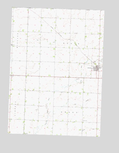
Little Rock, IA USGS Topographic Map
Click on map above to begin viewing in our Map Viewer.

This topographic map contains these locations and features:
Feature Name Type Latitude Longitude GNIS ID View Map
Argo SloughStreamN43.3952°W95.9464°454226View Map
Bethel ChurchChurchN43.4625°W95.9986°454573View Map
Circle S FarmLocaleN43.4336°W95.9244°2722968View Map
City of Little RockCivilN43.4454°W95.8804°2395736View Map
First Baptist Church CemeteryCemeteryN43.3754°W95.9778°1906653View Map
First Presbyterian ChurchChurchN43.4441°W95.8834°1906712View Map
George - Little Rock Middle SchoolSchoolN43.4417°W95.8813°1906761View Map
Goose Lake (historical)LakeN43.4291°W95.9747°464006View Map
Grant Township CemeteryCemeteryN43.3905°W95.8994°463363View Map
H and V FarmsLocaleN43.4219°W95.8822°2722966View Map
L M G FarmsLocaleN43.4308°W95.8989°2722967View Map
Little RockPopulated PlaceN43.4441°W95.8834°458498View Map
Little Rock (historical)LocaleN43.4452°W95.8822°1906757View Map
Little Rock Elementary SchoolSchoolN43.4419°W95.8811°2719739View Map
Little Rock Feed and Grain Company ElevatorLocaleN43.4441°W95.8834°1906758View Map
Little Rock Fire and Rescue ServicesBuildingN43.4443°W95.8829°2371702View Map
Little Rock LibraryBuildingN43.4441°W95.8834°1906760View Map
Little Rock Post OfficePost OfficeN43.4441°W95.8834°1906759View Map
Little Rock River Wildlife Area - North UnitParkN43.4111°W95.9378°1906664View Map
Pleasant View CemeteryCemeteryN43.4439°W95.8759°1906656View Map
River of Redrock ParkParkN43.4333°W95.8797°1906702View Map
Riverview Post Office (historical)Post OfficeN43.4277°W95.8997°466410View Map
Salem Reformed ChurchChurchN43.4441°W95.8834°1906711View Map
Schneidermann FarmLocaleN43.4361°W95.9033°2722964View Map
Sunni Side FarmLocaleN43.3928°W95.8983°2722965View Map
Township of ElginCivilN43.4663°W95.9195°467772View Map
Township of GrantCivilN43.3891°W95.9194°467945View Map
Willida Post Office (historical)Post OfficeN43.3811°W95.9022°466411View Map
Zion CemeteryCemeteryN43.4325°W95.9973°463266View Map

Note: Coordinates in the location and feature list above are referenced to NAD83 datum.


Copyright (C) 2008-2024 Ryan Niemi / Sunset Dynamics ... All Rights Reserved