TopoQuest Logo
Do you find TopoQuest useful?
Help keep TopoQuest running and adding new maps/features by donating!
Bitcoin:  19c7KJd3qBynnjoSw5npx9KScwjBe4ifkT
Litecoin:  LXs6TkuXGGXo1vDsWCkWVdjQX94eUKd6ui
Home View Maps Find Maps Find Places Resources & Links


Little Thunder Reservoir, Wyoming Topographic Map

USGS Map Title: Little Thunder Reservoir, WY
USGS Map MRC: 43105F4
DRG (GeoTIFF) Download: o43105f4.tif


Neighboring USGS Topographic Map Quads:


  Rocky Butte Gulch, WY  
43105G5
 

  Reno Junction, WY  
43105G4
 

  Hilight, WY  
43105G3
 

  Rattlesnake Draw, WY  
43105F5
 

  Little Thunder Reservoir, WY  
43105F4
 

  Reno Reservoir, WY  
43105F3
 

  Reno Flats, WY  
43105E5
 

  Teckla SW, WY  
43105E4
 

  Teckla, WY  
43105E3


Map MRC Location:

N44°
W106°
N44°
W105°
H8 H7 H6 H5 H4 H3 H2 H1
G8 G7 G6 G5 G4 G3 G2 G1
F8 F7 F6 F5 F4 F3 F2 F1
E8 E7 E6 E5 E4 E3 E2 E1
D8 D7 D6 D5 D4 D3 D2 D1
C8 C7 C6 C5 C4 C3 C2 C1
B8 B7 B6 B5 B4 B3 B2 B1
A8 A7 A6 A5 A4 A3 A2 A1
N43°
W106°
N43°
W105°

Little Thunder Reservoir, WY USGS 1:24K Topographic Map Preview:
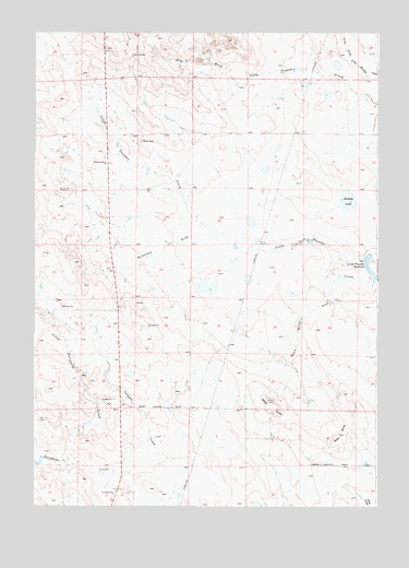
Little Thunder Reservoir, WY USGS Topographic Map
Click on map above to begin viewing in our Map Viewer.

This topographic map contains these locations and features:
Feature Name Type Latitude Longitude GNIS ID View Map
Black ButteSummitN43.6530°W105.4150°1598200View Map
Black Butte DrawValleyN43.6836°W105.3922°1598204View Map
Cottonwood SchoolSchoolN43.7469°W105.4705°1795430View Map
Dale Creek MineMineN43.6277°W105.4736°1746342View Map
Edwards RanchLocaleN43.6502°W105.4500°1604898View Map
Gray ButteSummitN43.6439°W105.3892°1600058View Map
Highway SchoolSchoolN43.7155°W105.4744°1600336View Map
Little Porcupine CreekStreamN43.6391°W105.4855°1601022View Map
Little Thunder ReservoirReservoirN43.6871°W105.3779°1601051View Map
Nicholson DrawValleyN43.6966°W105.4383°1601695View Map
Rochelle LakeLakeN43.7058°W105.3861°1602570View Map
Saint Francis ChurchChurchN43.6286°W105.4708°1602687View Map
Stuart DamDamN43.7283°W105.3839°1606904View Map
Stuart RanchLocaleN43.7214°W105.4611°1595129View Map
Stuart ReservoirReservoirN43.7283°W105.3839°1606905View Map
Thunder Basin Number 10 DamDamN43.6916°W105.3772°1608466View Map
Town of WrightCivilN43.7485°W105.4962°2413513View Map
Underwood RanchLocaleN43.6536°W105.4769°1604933View Map
WrightPopulated PlaceN43.7469°W105.4705°1605008View Map
Wright Junior High SchoolSchoolN43.7469°W105.4705°1795429View Map
Wright PitMineN43.7231°W105.4631°1746341View Map
Wyoming State Maintenance CenterLocaleN43.7169°W105.4744°1604932View Map

Note: Coordinates in the location and feature list above are referenced to NAD83 datum.


Copyright (C) 2008-2025 Ryan Niemi / Sunset Dynamics ... All Rights Reserved