TopoQuest Logo
Do you find TopoQuest useful?
Help keep TopoQuest running and adding new maps/features by donating!
Bitcoin:  19c7KJd3qBynnjoSw5npx9KScwjBe4ifkT
Litecoin:  LXs6TkuXGGXo1vDsWCkWVdjQX94eUKd6ui
Home View Maps Find Maps Find Places Resources & Links


Little Valley, California Topographic Map

USGS Map Title: Little Valley, CA
USGS Map MRC: 40121H2
DRG (GeoTIFF) Download: o40121h2.tif


Neighboring USGS Topographic Map Quads:


  Pittville, CA  
41121A3
 

  Bieber, CA  
41121A2
 

  Hog Valley, CA  
41121A1
 

  Coble Mountain, CA  
40121H3
 

  Little Valley, CA  
40121H2
 

  Dixie Peak, CA  
40121H1
 

  Jellico, CA  
40121G3
 

  Corders Reservoir, CA  
40121G2
 

  Straylor Lake, CA  
40121G1


Map MRC Location:

N41°
W122°
N41°
W121°
H8 H7 H6 H5 H4 H3 H2 H1
G8 G7 G6 G5 G4 G3 G2 G1
F8 F7 F6 F5 F4 F3 F2 F1
E8 E7 E6 E5 E4 E3 E2 E1
D8 D7 D6 D5 D4 D3 D2 D1
C8 C7 C6 C5 C4 C3 C2 C1
B8 B7 B6 B5 B4 B3 B2 B1
A8 A7 A6 A5 A4 A3 A2 A1
N40°
W122°
N40°
W121°

Little Valley, CA USGS 1:24K Topographic Map Preview:
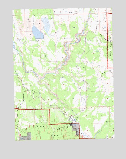
Little Valley, CA USGS Topographic Map
Click on map above to begin viewing in our Map Viewer.

This topographic map contains these locations and features:
Feature Name Type Latitude Longitude GNIS ID View Map
Blacks GulchValleyN40.8877°W121.2441°257179View Map
Bob Creek SpringSpringN40.9379°W121.2489°257311View Map
Clark ValleyValleyN40.9307°W121.1802°258408View Map
Clarks ValleyValleyN40.9327°W121.1797°274672View Map
Deadhorse CanyonValleyN40.9352°W121.1394°259123View Map
DixiePopulated PlaceN40.9441°W121.1719°1658424View Map
First ButteSummitN40.9827°W121.1772°260128View Map
Fourth ButteSummitN40.9904°W121.2319°260311View Map
Horse CreekStreamN40.9329°W121.2166°266823View Map
Hunter SpringSpringN40.9485°W121.1555°261646View Map
Klett HomesteadLocaleN40.9688°W121.2200°1665878View Map
Little ValleyPopulated PlaceN40.8943°W121.1775°262743View Map
Little ValleyValleyN40.8896°W121.1733°262745View Map
Little Valley Census Designated PlaceCensusN40.8931°W121.1781°2611439View Map
Little Valley Volunteer Fire DepartmentBuildingN40.8951°W121.1808°2622294View Map
Loomis ReservoirReservoirN40.9598°W121.1433°262914View Map
North GulchValleyN40.9941°W121.1522°264226View Map
Second ButteSummitN40.9852°W121.1919°265959View Map
Spring GulchValleyN40.9835°W121.1558°267603View Map
Spring Gulch ReservoirReservoirN40.9811°W121.1361°1665908View Map
Sunflower FlatFlatN40.9054°W121.1455°267959View Map
The Round BarnLocaleN40.9282°W121.2380°268210View Map
Third ButteSummitN40.9863°W121.2175°268217View Map
Wilson SpringSpringN40.8773°W121.2435°269191View Map

Note: Coordinates in the location and feature list above are referenced to NAD83 datum.


Copyright (C) 2008-2024 Ryan Niemi / Sunset Dynamics ... All Rights Reserved