TopoQuest Logo
Do you find TopoQuest useful?
Help keep TopoQuest running and adding new maps/features by donating!
Bitcoin:  19c7KJd3qBynnjoSw5npx9KScwjBe4ifkT
Litecoin:  LXs6TkuXGGXo1vDsWCkWVdjQX94eUKd6ui
Home View Maps Find Maps Find Places Resources & Links


Littlefield, Texas Topographic Map

USGS Map Title: Littlefield, TX
USGS Map MRC: 33102H3
DRG (GeoTIFF) Download: o33102h3.tif


Neighboring USGS Topographic Map Quads:


  Amherst, TX  
34102A4
 

  Cofferville, TX  
34102A3
 

  Fieldton, TX  
34102A2
 

  Bull Lake, TX  
33102H4
 

  Littlefield, TX  
33102H3
 

  Spade, TX  
33102H2
 

  Oklahoma Flat, TX  
33102G4
 

  Lums Chapel, TX  
33102G3
 

  Anton, TX  
33102G2


Map MRC Location:

N34°
W103°
N34°
W102°
H8 H7 H6 H5 H4 H3 H2 H1
G8 G7 G6 G5 G4 G3 G2 G1
F8 F7 F6 F5 F4 F3 F2 F1
E8 E7 E6 E5 E4 E3 E2 E1
D8 D7 D6 D5 D4 D3 D2 D1
C8 C7 C6 C5 C4 C3 C2 C1
B8 B7 B6 B5 B4 B3 B2 B1
A8 A7 A6 A5 A4 A3 A2 A1
N33°
W103°
N33°
W102°

Littlefield, TX USGS 1:24K Topographic Map Preview:
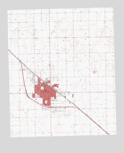
Littlefield, TX USGS Topographic Map
Click on map above to begin viewing in our Map Viewer.

This topographic map contains these locations and features:
Feature Name Type Latitude Longitude GNIS ID View Map
Church of Christ -- Crescent ParkChurchN33.9095°W102.3313°2022616View Map
City of LittlefieldCivilN33.9191°W102.3349°2410844View Map
City of Littlefield Emergency Medical ServicesBuildingN33.9187°W102.3329°2655998View Map
Crescent ParkParkN33.9090°W102.3327°1355349View Map
Dunbar ParkParkN33.9248°W102.3188°1356445View Map
Dunber Community ParkParkN33.9223°W102.3210°2028452View Map
Emmanuel ChurchChurchN33.9245°W102.3332°1357014View Map
First Baptist ChurchChurchN33.9204°W102.3318°2022588View Map
KXDM-FM (Littlefield)TowerN33.9381°W102.3443°1385910View Map
KZZN-AM (Littlefield)TowerN33.9381°W102.3443°1385614View Map
KZZN-AM (Littlefield)TowerN33.9329°W102.3460°1385615View Map
Laguna ParkParkN33.9223°W102.3366°1360828View Map
Lamb County CourthouseBuildingN33.9209°W102.3330°2030541View Map
Lamb County JailBuildingN33.9168°W102.3199°2738831View Map
Lamb County Sheriff's OfficeBuildingN33.9168°W102.3199°2750268View Map
Lamb Healthcare Center HospitalHospitalN33.9117°W102.3442°2015808View Map
LittlefieldPopulated PlaceN33.9173°W102.3249°1361517View Map
Littlefield CemeteryCemeteryN33.9413°W102.3532°1361518View Map
Littlefield City HallBuildingN33.9238°W102.3306°2753252View Map
Littlefield Country ClubLocaleN33.9768°W102.3238°1384598View Map
Littlefield Elementary SchoolSchoolN33.9271°W102.3380°2007924View Map
Littlefield Fire DepartmentBuildingN33.9211°W102.3327°2551951View Map
Littlefield High SchoolSchoolN33.9165°W102.3425°2007925View Map
Littlefield Instructional CenterSchoolN33.9218°W102.3321°2007926View Map
Littlefield Junior High SchoolSchoolN33.9266°W102.3368°2007927View Map
Littlefield Memorial ParkCemeteryN33.9389°W102.3505°2773384View Map
Littlefield Police DepartmentBuildingN33.9207°W102.3330°2750348View Map
Littlefield Post OfficePost OfficeN33.9186°W102.3351°2731614View Map
Littlefield Primary SchoolSchoolN33.9256°W102.3376°2007928View Map
Nazarene ChurchChurchN33.9184°W102.3338°2022617View Map
New Covenant Assembly of God ChurchChurchN33.9137°W102.3243°2022587View Map
New Jerusalem Baptist ChurchChurchN33.9151°W102.3205°2022589View Map
New Life Fellowship ChurchChurchN33.9143°W102.3363°2022618View Map
Parkview Baptist ChurchChurchN33.9320°W102.3452°2022615View Map

Note: Coordinates in the location and feature list above are referenced to NAD83 datum.


Copyright (C) 2008-2025 Ryan Niemi / Sunset Dynamics ... All Rights Reserved