TopoQuest Logo
Do you find TopoQuest useful?
Help keep TopoQuest running and adding new maps/features by donating!
Bitcoin:  19c7KJd3qBynnjoSw5npx9KScwjBe4ifkT
Litecoin:  LXs6TkuXGGXo1vDsWCkWVdjQX94eUKd6ui
Home View Maps Find Maps Find Places Resources & Links


Live Oak Springs, California Topographic Map

USGS Map Title: Live Oak Springs, CA
USGS Map MRC: 32116F3
DRG (GeoTIFF) Download: o32116f3.tif


Neighboring USGS Topographic Map Quads:


  Mount Laguna, CA  
32116G4
 

  Sombrero Peak, CA  
32116G3
 

  Sweeney Pass, CA  
32116G2
 

  Cameron Corners, CA  
32116F4
 

  Live Oak Springs, CA  
32116F3
 

  Jacumba, CA  
32116F2
 

  Campo, CA  
32116E4
 

  Tierra del Sol, CA  
32116E3


Map MRC Location:

N33°
W117°
N33°
W116°
H8 H7 H6 H5 H4 H3 H2 H1
G8 G7 G6 G5 G4 G3 G2 G1
F8 F7 F6 F5 F4 F3 F2 F1
E8 E7 E6 E5 E4 E3 E2 E1
D8 D7 D6 D5 D4 D3 D2 D1
C8 C7 C6 C5 C4 C3 C2 C1
B8 B7 B6 B5 B4 B3 B2 B1
A8 A7 A6 A5 A4 A3 A2 A1
N32°
W117°
N32°
W116°

Live Oak Springs, CA USGS 1:24K Topographic Map Preview:
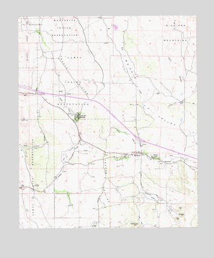
Live Oak Springs, CA USGS Topographic Map
Click on map above to begin viewing in our Map Viewer.

This topographic map contains these locations and features:
Feature Name Type Latitude Longitude GNIS ID View Map
BoulevardPopulated PlaceN32.6637°W116.2736°239605View Map
Boulevard Census Designated PlaceCensusN32.6640°W116.2896°2582949View Map
Boulevard Fire and Rescue Department Station 47BuildingN32.6698°W116.2894°2665000View Map
Boulevard Post OfficePost OfficeN32.6686°W116.2970°2769327View Map
CAL FIRE White Star Fire StationBuildingN32.6475°W116.3175°2664771View Map
Calexico LodgePopulated PlaceN32.6662°W116.2809°1660411View Map
Campo Indian ReservationCivilN32.6737°W116.3632°270242View Map
Campo Reservation Fire Protection DepartmentBuildingN32.6511°W116.3655°2664891View Map
Clover Flats Elementary SchoolSchoolN32.6689°W116.2909°240716View Map
Diabold CanyonValleyN32.6503°W116.3695°241484View Map
Goat MountainSummitN32.6359°W116.2636°1660685View Map
High BridgeBridgeN32.6492°W116.3742°252068View Map
Hill ValleyValleyN32.6445°W116.3625°243464View Map
Lark CanyonValleyN32.6909°W116.2609°244593View Map
Little ValleyValleyN32.6259°W116.2886°244964View Map
Live Oak SpringsPopulated PlaceN32.6906°W116.3345°1660931View Map
ManzanitaPopulated PlaceN32.6689°W116.2897°245461View Map
Music MountainSummitN32.6301°W116.2656°1661082View Map
Old George MountainSummitN32.6320°W116.2622°1661138View Map
Pueblo Siding (historical)LocaleN32.6337°W116.3709°1682451View Map
Saint Carmel CemeteryCemeteryN32.6504°W116.3648°248567View Map
San Diego County Sheriff's Office BoulevardBuildingN32.6697°W116.2894°2756512View Map
Tecate DivideRidgeN32.6951°W116.3222°250290View Map
Tule CreekStreamN32.6928°W116.2853°250675View Map
Walker CreekStreamN32.6662°W116.2820°251135View Map

Note: Coordinates in the location and feature list above are referenced to NAD83 datum.


Copyright (C) 2008-2025 Ryan Niemi / Sunset Dynamics ... All Rights Reserved