TopoQuest Logo
Do you find TopoQuest useful?
Help keep TopoQuest running and adding new maps/features by donating!
Bitcoin:  19c7KJd3qBynnjoSw5npx9KScwjBe4ifkT
Litecoin:  LXs6TkuXGGXo1vDsWCkWVdjQX94eUKd6ui
Home View Maps Find Maps Find Places Resources & Links


Locate, Montana Topographic Map

USGS Map Title: Locate, MT
USGS Map MRC: 46105D3
DRG (GeoTIFF) Download: o46105d3.tif


Neighboring USGS Topographic Map Quads:


  Corral Butte, MT  
46105E4
 

  Spring Draw, MT  
46105E3
 

  Flat Top Butte SW, MT  
46105E2
 

  Buck Mountain, MT  
46105D4
 

  Locate, MT  
46105D3
 

  Hogan Creek, MT  
46105D2
 

  Locate SW, MT  
46105C4
 

  Locate SE, MT  
46105C3
 

  Red Knob, MT  
46105C2


Map MRC Location:

N47°
W106°
N47°
W105°
H8 H7 H6 H5 H4 H3 H2 H1
G8 G7 G6 G5 G4 G3 G2 G1
F8 F7 F6 F5 F4 F3 F2 F1
E8 E7 E6 E5 E4 E3 E2 E1
D8 D7 D6 D5 D4 D3 D2 D1
C8 C7 C6 C5 C4 C3 C2 C1
B8 B7 B6 B5 B4 B3 B2 B1
A8 A7 A6 A5 A4 A3 A2 A1
N46°
W106°
N46°
W105°

Locate, MT USGS 1:24K Topographic Map Preview:
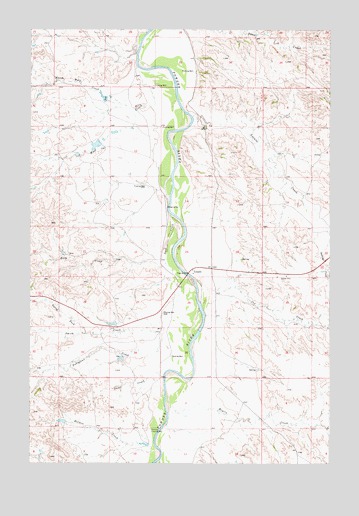
Locate, MT USGS Topographic Map
Click on map above to begin viewing in our Map Viewer.

This topographic map contains these locations and features:
Feature Name Type Latitude Longitude GNIS ID View Map
08N51E09ACAC01 WellWellN46.4675°W105.3497°816393View Map
08N51E10DDAA01 WellWellN46.4606°W105.3214°816371View Map
08N51E10DDAD01 WellWellN46.4600°W105.3222°816369View Map
08N51E14CBBD01 WellWellN46.4489°W105.3141°816321View Map
08N51E14DC__01 WellWellN46.4456°W105.3086°816300View Map
08N51E15ABDA01 WellWellN46.4550°W105.3275°816351View Map
08N51E22DD__01 WellWellN46.4314°W105.3244°816230View Map
08N51E23DD__01 WellWellN46.4314°W105.3033°816229View Map
08N51E25BACA01 WellWellN46.4264°W105.2939°816201View Map
08N51E26BBBA01 WellWellN46.4283°W105.3189°816209View Map
08N51E26CC__01 WellWellN46.4169°W105.3191°816144View Map
08N51E33CACB01 WellWellN46.4044°W105.3569°816064View Map
08N53E33AABA01 WellWellN46.4031°W105.3430°816059View Map
Bixler Number 2 DamDamN46.4150°W105.3389°796821View Map
Bixler Number 5 DamDamN46.3883°W105.3622°796762View Map
Cox CreekStreamN46.4281°W105.3069°770242View Map
Deep CreekStreamN46.4467°W105.3169°770553View Map
Fortyfour CreekStreamN46.4144°W105.3191°771528View Map
Griffin Number 2 DamDamN46.4817°W105.3455°796760View Map
Holmes CreekStreamN46.3822°W105.3233°772483View Map
Holmes Flowing WellWellN46.3844°W105.3250°772484View Map
LocateLocaleN46.4303°W105.3080°773522View Map
Locate CreekStreamN46.4747°W105.3083°773523View Map
Locate Creek BridgeBridgeN46.4750°W105.3044°1716941View Map
Locate Post Office (historical)Post OfficeN46.4306°W105.3078°1716859View Map
Locate SchoolSchoolN46.4297°W105.3075°1716914View Map
Meyers CreekStreamN46.3917°W105.3166°774122View Map
North Fork Smith CreekStreamN46.4125°W105.3517°774812View Map
North Wolf CreekStreamN46.4781°W105.3305°774868View Map
Odegard Number 2 DamDamN46.4683°W105.3505°796761View Map
Powder River BridgeBridgeN46.4294°W105.3097°1716942View Map
Powder River Historical MarkerParkN46.4300°W105.2753°1721482View Map
Rabbidge CreekStreamN46.4394°W105.2505°775520View Map
Short CreekStreamN46.4008°W105.3208°776511View Map
Smith CreekStreamN46.4325°W105.3189°776672View Map
Wolf CreekStreamN46.4892°W105.3311°778633View Map

Note: Coordinates in the location and feature list above are referenced to NAD83 datum.


Copyright (C) 2008-2025 Ryan Niemi / Sunset Dynamics ... All Rights Reserved