TopoQuest Logo
Do you find TopoQuest useful?
Help keep TopoQuest running and adding new maps/features by donating!
Bitcoin:  19c7KJd3qBynnjoSw5npx9KScwjBe4ifkT
Litecoin:  LXs6TkuXGGXo1vDsWCkWVdjQX94eUKd6ui
Home View Maps Find Maps Find Places Resources & Links


Logan, Kansas Topographic Map

USGS Map Title: Logan, KS
USGS Map MRC: 39099F5
DRG (GeoTIFF) Download: o39099f5.tif


Neighboring USGS Topographic Map Quads:


  Almena SW, KS  
39099G6
 

  Prairie View, KS  
39099G5
 

  Stuttgart, KS  
39099G4
 

  Densmore, KS  
39099F6
 

  Logan, KS  
39099F5
 

  Speed, KS  
39099F4
 

  Logan SW, KS  
39099E6
 

  Logan SE, KS  
39099E5
 

  Glade SW, KS  
39099E4


Map MRC Location:

N40°
W100°
N40°
W99°
H8 H7 H6 H5 H4 H3 H2 H1
G8 G7 G6 G5 G4 G3 G2 G1
F8 F7 F6 F5 F4 F3 F2 F1
E8 E7 E6 E5 E4 E3 E2 E1
D8 D7 D6 D5 D4 D3 D2 D1
C8 C7 C6 C5 C4 C3 C2 C1
B8 B7 B6 B5 B4 B3 B2 B1
A8 A7 A6 A5 A4 A3 A2 A1
N39°
W100°
N39°
W99°

Logan, KS USGS 1:24K Topographic Map Preview:
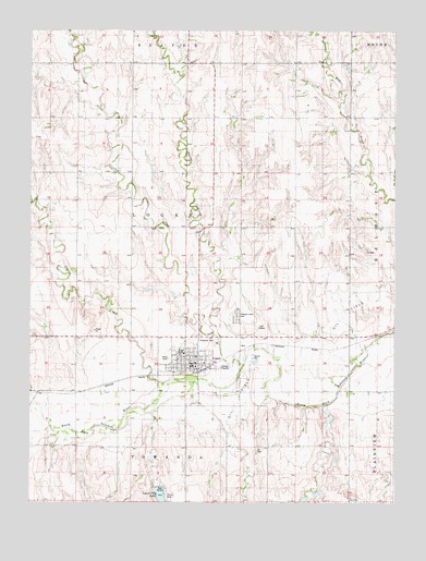
Logan, KS USGS Topographic Map
Click on map above to begin viewing in our Map Viewer.

This topographic map contains these locations and features:
Feature Name Type Latitude Longitude GNIS ID View Map
Almena Agri - Services Grain Elevator Number 2LocaleN39.6605°W99.5657°2695367View Map
Beaver CreekStreamN39.6720°W99.5618°471920View Map
Cactus CreekStreamN39.6572°W99.5768°472019View Map
Church of the TransfigurationChurchN39.6636°W99.5715°2689868View Map
City of LoganCivilN39.6616°W99.5672°2395745View Map
Crooked CreekStreamN39.6620°W99.5526°471921View Map
Dane G Hansen Memorial MuseumBuildingN39.6611°W99.5684°2694957View Map
First Christian ChurchChurchN39.6636°W99.5682°2690338View Map
LoganPopulated PlaceN39.6617°W99.5704°472023View Map
Logan Area Historical MuseumBuildingN39.6619°W99.5699°2694332View Map
Logan City DamDamN39.6300°W99.5804°479966View Map
Logan City HallBuildingN39.6619°W99.5683°2693183View Map
Logan City LakeReservoirN39.6271°W99.5804°472022View Map
Logan Elementary SchoolSchoolN39.6656°W99.5740°472025View Map
Logan High SchoolSchoolN39.6649°W99.5740°472024View Map
Logan Post OfficePost OfficeN39.6614°W99.5695°2693830View Map
Logan Public LibraryBuildingN39.6619°W99.5686°2694771View Map
Logan United Methodist ChurchChurchN39.6641°W99.5709°2689474View Map
Logan Volunteer Fire DepartmentBuildingN39.6624°W99.5693°2111561View Map
Logan Wastewater Treatment FacilityLocaleN39.6520°W99.5549°2691963View Map
Old Logan CemeteryCemeteryN39.6723°W99.5743°2673343View Map
Pleasant View CemeteryCemeteryN39.6743°W99.5544°472026View Map
Rangeland Co - Operative Grain Elevator Number 3LocaleN39.6605°W99.5657°2695185View Map
Saint John Catholic ChurchChurchN39.6620°W99.5655°2690553View Map
Saint Peters Evangelical Lutheran CemeteryCemeteryN39.7267°W99.5211°2673344View Map
Township of LoganCivilN39.6978°W99.5719°472020View Map

Note: Coordinates in the location and feature list above are referenced to NAD83 datum.


Copyright (C) 2008-2025 Ryan Niemi / Sunset Dynamics ... All Rights Reserved