TopoQuest Logo
Do you find TopoQuest useful?
Help keep TopoQuest running and adding new maps/features by donating!
Bitcoin:  19c7KJd3qBynnjoSw5npx9KScwjBe4ifkT
Litecoin:  LXs6TkuXGGXo1vDsWCkWVdjQX94eUKd6ui
Home View Maps Find Maps Find Places Resources & Links


Logan Pass, Montana Topographic Map

USGS Map Title: Logan Pass, MT
USGS Map MRC: 48113F6
DRG (GeoTIFF) Download: o48113f6.tif


Neighboring USGS Topographic Map Quads:


  Ahern Pass, MT  
48113G7
 

  Many Glacier, MT  
48113G6
 

  Lake Sherburne, MT  
48113G5
 

  Mount Cannon, MT  
48113F7
 

  Logan Pass, MT  
48113F6
 

  Rising Sun, MT  
48113F5
 

  Lake McDonald East, MT  
48113E7
 

  Mount Jackson, MT  
48113E6
 

  Mount Stimson, MT  
48113E5


Map MRC Location:

N49°
W114°
N49°
W113°
H8 H7 H6 H5 H4 H3 H2 H1
G8 G7 G6 G5 G4 G3 G2 G1
F8 F7 F6 F5 F4 F3 F2 F1
E8 E7 E6 E5 E4 E3 E2 E1
D8 D7 D6 D5 D4 D3 D2 D1
C8 C7 C6 C5 C4 C3 C2 C1
B8 B7 B6 B5 B4 B3 B2 B1
A8 A7 A6 A5 A4 A3 A2 A1
N48°
W114°
N48°
W113°

Logan Pass, MT USGS 1:24K Topographic Map Preview:
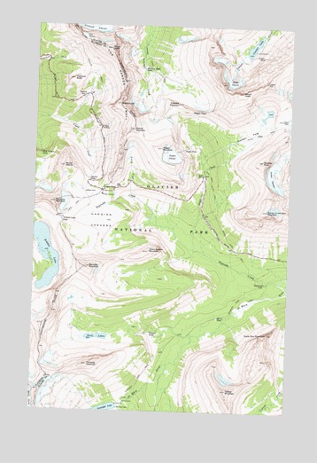
Logan Pass, MT USGS Topographic Map
Click on map above to begin viewing in our Map Viewer.

This topographic map contains these locations and features:
Feature Name Type Latitude Longitude GNIS ID View Map
Big DriftCliffN48.6975°W113.7093°768780View Map
Bird Woman FallsFallsN48.7080°W113.7476°768888View Map
Bishops CapSummitN48.7247°W113.7097°768903View Map
Cataract MountainSummitN48.7246°W113.6819°769676View Map
Citadel MountainSummitN48.6319°W113.6547°769884View Map
Clements MountainSummitN48.6924°W113.7410°781372View Map
CrackerSummitN48.7322°W113.6382°770264View Map
Cracker LakeLakeN48.7438°W113.6444°770267View Map
Cracker MineMineN48.7397°W113.6426°770269View Map
Deadwood FallsFallsN48.6667°W113.6373°770535View Map
Dusty Star MountainSummitN48.6502°W113.6353°770925View Map
Florence FallsFallsN48.6507°W113.6928°771474View Map
Fusillade MountainSummitN48.6399°W113.7232°771660View Map
Gem GlacierGlacierN48.7466°W113.7279°771735View Map
Going-to-the-Sun MountainSummitN48.6904°W113.6367°771825View Map
Gunsight Pass TrailTrailN48.6344°W113.6979°784415View Map
Hanging GardensBasinN48.6866°W113.7148°772118View Map
Haystack ButteSummitN48.7327°W113.7327°772281View Map
Heavy Runner MountainSummitN48.6768°W113.6948°772301View Map
Hidden LakeLakeN48.6759°W113.7451°772374View Map
Hidden Lake PassGapN48.6866°W113.7368°772375View Map
Hidden Lake TrailTrailN48.6908°W113.7315°772376View Map
Logan PassGapN48.6966°W113.7182°773554View Map
Lunch CreekStreamN48.6941°W113.7007°773761View Map
Matahpi PeakSummitN48.7064°W113.6392°773922View Map
Mirror PondLakeN48.6555°W113.6599°774276View Map
Morning Eagle FallsFallsN48.7360°W113.6984°774389View Map
Mount GouldSummitN48.7426°W113.7150°771879View Map
Mount OberlinSummitN48.7042°W113.7364°774910View Map
Mount SiyehSummitN48.7284°W113.6500°776602View Map
Oberlin FallsFallsN48.6997°W113.7234°774909View Map
Piegan FallsFallsN48.7100°W113.6781°775209View Map
Piegan GlacierGlacierN48.7076°W113.6845°775210View Map
Piegan MountainSummitN48.7103°W113.6893°775211View Map
Piegan PassGapN48.7197°W113.6887°775212View Map
Pollock MountainSummitN48.7164°W113.7028°775340View Map
Preston ParkFlatN48.7150°W113.6474°767974View Map
Reynolds CreekStreamN48.6672°W113.6296°775735View Map
Reynolds MountainSummitN48.6715°W113.7237°775738View Map
Sexton GlacierGlacierN48.7010°W113.6340°776387View Map
Siyeh BendPopulated PlaceN48.7016°W113.6676°776596View Map
Siyeh Bend Cut-Off TrailTrailN48.6994°W113.6637°776597View Map
Siyeh CreekStreamN48.6778°W113.6721°776598View Map
Siyeh GlacierGlacierN48.7333°W113.6547°776599View Map
Siyeh PassGapN48.7205°W113.6298°776600View Map
Triple ArchesArchN48.7175°W113.7182°777766View Map
Twin LakesLakeN48.6490°W113.7148°777857View Map
Weeping WallCliffN48.7269°W113.7284°778170View Map

Note: Coordinates in the location and feature list above are referenced to NAD83 datum.


Copyright (C) 2008-2024 Ryan Niemi / Sunset Dynamics ... All Rights Reserved