TopoQuest Logo
Do you find TopoQuest useful?
Help keep TopoQuest running and adding new maps/features by donating!
Bitcoin:  19c7KJd3qBynnjoSw5npx9KScwjBe4ifkT
Litecoin:  LXs6TkuXGGXo1vDsWCkWVdjQX94eUKd6ui
Home View Maps Find Maps Find Places Resources & Links


Loma East, Montana Topographic Map

USGS Map Title: Loma East, MT
USGS Map MRC: 47110H4
DRG (GeoTIFF) Download: o47110h4.tif


Neighboring USGS Topographic Map Quads:


  Day School, MT  
48110A5
 

  Kenilworth SW, MT  
48110A4
 

  Boggs Island, MT  
48110A3
 

  Loma West, MT  
47110H5
 

  Loma East, MT  
47110H4
 

  Stranahan, MT  
47110H3
 

  O'Hanlon Coulee, MT  
47110G5
 

  Rocky Lake, MT  
47110G4
 

  Stranahan SE, MT  
47110G3


Map MRC Location:

N48°
W111°
N48°
W110°
H8 H7 H6 H5 H4 H3 H2 H1
G8 G7 G6 G5 G4 G3 G2 G1
F8 F7 F6 F5 F4 F3 F2 F1
E8 E7 E6 E5 E4 E3 E2 E1
D8 D7 D6 D5 D4 D3 D2 D1
C8 C7 C6 C5 C4 C3 C2 C1
B8 B7 B6 B5 B4 B3 B2 B1
A8 A7 A6 A5 A4 A3 A2 A1
N47°
W111°
N47°
W110°

Loma East, MT USGS 1:24K Topographic Map Preview:
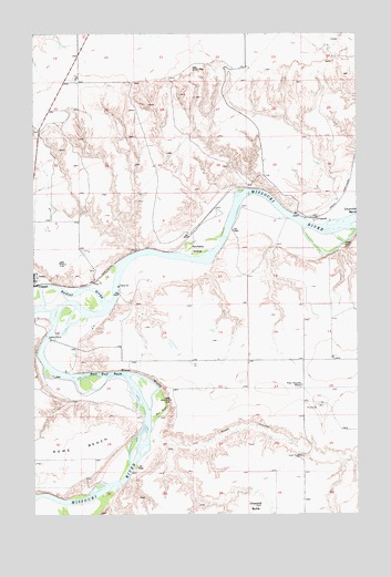
Loma East, MT USGS Topographic Map
Click on map above to begin viewing in our Map Viewer.

This topographic map contains these locations and features:
Feature Name Type Latitude Longitude GNIS ID View Map
Archers IslandIslandN47.9441°W110.4377°768328View Map
Black Bluff RapidsRapidsN47.9116°W110.4727°768914View Map
Black BluffsCliffN47.9108°W110.4563°768915View Map
Chappell (historical)LocaleN47.9347°W110.4991°769761View Map
Chouteau CountyCivilN47.8806°W110.4352°1719619View Map
Churchill BendBendN47.9505°W110.3752°769877View Map
Churchill ButteSummitN47.8772°W110.4155°769878View Map
Crow Coulee Post Office (historical)Post OfficeN47.9144°W110.4174°1750104View Map
East Ophir (historical)LocaleN47.9305°W110.4674°1750098View Map
Fort Piegan (historical)LocaleN47.9272°W110.4952°1750082View Map
LippardPopulated PlaceN47.9516°W110.3910°773383View Map
Lippard (historical)LocaleN47.9516°W110.3910°1750147View Map
Loma Census Designated PlaceCensusN47.9512°W110.4887°2408119View Map
Loma FerryLocaleN47.9214°W110.4955°773567View Map
Marias RiverStreamN47.9294°W110.4724°799001View Map
Montana Crossroads Historical MarkerParkN47.9750°W110.4980°1813132View Map
North Ophir (historical)LocaleN47.9347°W110.4780°1750097View Map
Ophir (historical)Populated PlaceN47.9319°W110.4730°1750096View Map
Rowe BayouGutN47.9016°W110.4516°775988View Map
Rowe CouleeValleyN47.8939°W110.4510°775989View Map
Triple L Reservoir DamDamN47.9200°W110.4474°798539View Map
West Wayside School (historical)SchoolN47.9086°W110.3974°778315View Map

Note: Coordinates in the location and feature list above are referenced to NAD83 datum.


Copyright (C) 2008-2024 Ryan Niemi / Sunset Dynamics ... All Rights Reserved