TopoQuest Logo
Do you find TopoQuest useful?
Help keep TopoQuest running and adding new maps/features by donating!
Bitcoin:  19c7KJd3qBynnjoSw5npx9KScwjBe4ifkT
Litecoin:  LXs6TkuXGGXo1vDsWCkWVdjQX94eUKd6ui
Home View Maps Find Maps Find Places Resources & Links


Lone Indian Peak, Montana Topographic Map

USGS Map Title: Lone Indian Peak, MT
USGS Map MRC: 45111B2
DRG (GeoTIFF) Download: o45111b2.tif


Neighboring USGS Topographic Map Quads:


  Gallatin Peak, MT  
45111C3
 

  Hidden Lake, MT  
45111C2
 

  The Sentinel, MT  
45111C1
 

  Ousel Falls, MT  
45111B3
 

  Lone Indian Peak, MT  
45111B2
 

  Ramshorn Peak, MT  
45111B1
 

  Lincoln Mountain, MT  
45111A3
 

  Sunshine Point, MT  
45111A2
 

  Big Horn Peak, MT  
45111A1


Map MRC Location:

N46°
W112°
N46°
W111°
H8 H7 H6 H5 H4 H3 H2 H1
G8 G7 G6 G5 G4 G3 G2 G1
F8 F7 F6 F5 F4 F3 F2 F1
E8 E7 E6 E5 E4 E3 E2 E1
D8 D7 D6 D5 D4 D3 D2 D1
C8 C7 C6 C5 C4 C3 C2 C1
B8 B7 B6 B5 B4 B3 B2 B1
A8 A7 A6 A5 A4 A3 A2 A1
N45°
W112°
N45°
W111°

Lone Indian Peak, MT USGS 1:24K Topographic Map Preview:
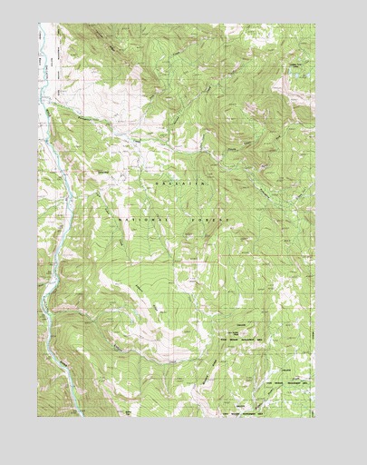
Lone Indian Peak, MT USGS Topographic Map
Click on map above to begin viewing in our Map Viewer.

This topographic map contains these locations and features:
Feature Name Type Latitude Longitude GNIS ID View Map
Beaver CreekStreamN45.2263°W111.2494°779600View Map
Blizzard RidgeRidgeN45.1360°W111.1744°780115View Map
Buck CreekStreamN45.1677°W111.2422°780504View Map
Eaglehead MountainSummitN45.2241°W111.1258°782772View Map
Eaglehead MountainSummitN45.2249°W111.1352°794887View Map
Elkhorn CreekStreamN45.1572°W111.2447°783129View Map
Elkhorn RidgeRidgeN45.1622°W111.2022°806015View Map
First CreekStreamN45.2147°W111.2119°806019View Map
Fourth CreekStreamN45.2058°W111.1694°806016View Map
Gallatin State Wildlife Management AreaParkN45.1255°W111.1674°807065View Map
Golden Trout LakesLakeN45.2335°W111.1341°784083View Map
Half Way Inn (historical)LocaleN45.1944°W111.2347°1743870View Map
Lemon BridgeBridgeN45.1944°W111.2355°1737910View Map
LemondropSummitN45.2027°W111.2244°806014View Map
Levinski RidgeRidgeN45.2477°W111.2222°806322View Map
Lone Indian PeakSummitN45.1516°W111.1597°786477View Map
Lower BasinBasinN45.2374°W111.2455°786658View Map
McGill CampgroundLocaleN45.1713°W111.2413°794560View Map
North Fork Porcupine CreekStreamN45.2035°W111.1622°788228View Map
Porcupine BridgeBridgeN45.2260°W111.2494°1737897View Map
Porcupine CreekStreamN45.2294°W111.2480°789098View Map
Porcupine Forest Service StationLocaleN45.2247°W111.2427°794885View Map
Porcupine RanchLocaleN45.2247°W111.2444°789109View Map
Prohibition RockPillarN45.1255°W111.2175°1743663View Map
Rainbow RanchLocaleN45.1949°W111.2372°789348View Map
Red CliffCliffN45.1666°W111.2397°1743664View Map
Red Cliff BridgeBridgeN45.1741°W111.2425°1737894View Map
Red Cliff CampLocaleN45.1697°W111.2425°789445View Map
Rhyolite MineMineN45.2110°W111.2413°803003View Map
Second CreekStreamN45.2124°W111.1930°806018View Map
State Game Range HeadquartersLocaleN45.2260°W111.2444°794884View Map
Third CreekStreamN45.2091°W111.1777°806017View Map
Twin Cabin CreekStreamN45.1955°W111.2355°792500View Map

Note: Coordinates in the location and feature list above are referenced to NAD83 datum.


Copyright (C) 2008-2025 Ryan Niemi / Sunset Dynamics ... All Rights Reserved