TopoQuest Logo
Do you find TopoQuest useful?
Help keep TopoQuest running and adding new maps/features by donating!
Bitcoin:  19c7KJd3qBynnjoSw5npx9KScwjBe4ifkT
Litecoin:  LXs6TkuXGGXo1vDsWCkWVdjQX94eUKd6ui
Home View Maps Find Maps Find Places Resources & Links


Lone Pine Ridge, Idaho Topographic Map

USGS Map Title: Lone Pine Ridge, ID
USGS Map MRC: 43111D6
DRG (GeoTIFF) Download: o43111d6.tif


Neighboring USGS Topographic Map Quads:


  Rigby SE, ID  
43111E7
 

  Poplar, ID  
43111E6
 

  Heise SE, ID  
43111E5
 

  Ozone, ID  
43111D7
 

  Lone Pine Ridge, ID  
43111D6
 

  Point Lookout, ID  
43111D5
 

  Bone, ID  
43111C7
 

  Jumpoff Hill, ID  
43111C6
 

  Castle Rock, ID  
43111C5


Map MRC Location:

N44°
W112°
N44°
W111°
H8 H7 H6 H5 H4 H3 H2 H1
G8 G7 G6 G5 G4 G3 G2 G1
F8 F7 F6 F5 F4 F3 F2 F1
E8 E7 E6 E5 E4 E3 E2 E1
D8 D7 D6 D5 D4 D3 D2 D1
C8 C7 C6 C5 C4 C3 C2 C1
B8 B7 B6 B5 B4 B3 B2 B1
A8 A7 A6 A5 A4 A3 A2 A1
N43°
W112°
N43°
W111°

Lone Pine Ridge, ID USGS 1:24K Topographic Map Preview:
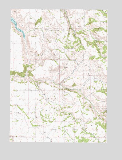
Lone Pine Ridge, ID USGS Topographic Map
Click on map above to begin viewing in our Map Viewer.

This topographic map contains these locations and features:
Feature Name Type Latitude Longitude GNIS ID View Map
Bear CreekStreamN43.4563°W111.7277°371397View Map
Big Horse ButteSummitN43.3907°W111.7102°395103View Map
Blue CreekStreamN43.4796°W111.6680°371610View Map
Bulls ForkStreamN43.4316°W111.7158°378493View Map
Deer CreekStreamN43.4777°W111.7319°372359View Map
DehlinPopulated PlaceN43.3844°W111.7097°376147View Map
Dehlin Post Office (historical)Post OfficeN43.3844°W111.7097°2027031View Map
Dehlin SchoolSchoolN43.3799°W111.6863°372376View Map
Dogtooth HollowValleyN43.4832°W111.6727°372434View Map
GuyazPopulated PlaceN43.4816°W111.6466°396600View Map
Indian ForkStreamN43.4252°W111.6600°383676View Map
Little Horse ButteSummitN43.3910°W111.7047°395631View Map
Lone Pine RidgeRidgeN43.4621°W111.6752°395641View Map
Pipe CreekStreamN43.4302°W111.6855°374421View Map
Pipe Creek SchoolSchoolN43.4527°W111.6561°374422View Map
Red ButteSummitN43.4027°W111.7405°394990View Map
Skelly HillSummitN43.4855°W111.6627°397169View Map
Spring CreekStreamN43.4810°W111.6488°391200View Map
Tex CreekStreamN43.4380°W111.7280°391951View Map
Tex Creek Wildlife Management AreaReserveN43.4680°W111.6786°399279View Map

Note: Coordinates in the location and feature list above are referenced to NAD83 datum.


Copyright (C) 2008-2025 Ryan Niemi / Sunset Dynamics ... All Rights Reserved