TopoQuest Logo
Do you find TopoQuest useful?
Help keep TopoQuest running and adding new maps/features by donating!
Bitcoin:  19c7KJd3qBynnjoSw5npx9KScwjBe4ifkT
Litecoin:  LXs6TkuXGGXo1vDsWCkWVdjQX94eUKd6ui
Home View Maps Find Maps Find Places Resources & Links


Bathgate, North Dakota Topographic Map

USGS Map Title: Bathgate, ND
USGS Map MRC: 48097H4
DRG (GeoTIFF) Download: o48097h4.tif


Neighboring USGS Topographic Map Quads:


  Neche, ND  
48097H5
 

  Bathgate, ND  
48097H4
 

  Bathgate NE, ND  
48097H3
 

  Cavalier, ND  
48097G5
 

  Hamilton, ND  
48097G4
 

  Bathgate SE, ND  
48097G3


Map MRC Location:

N49°
W98°
N49°
W97°
H8 H7 H6 H5 H4 H3 H2 H1
G8 G7 G6 G5 G4 G3 G2 G1
F8 F7 F6 F5 F4 F3 F2 F1
E8 E7 E6 E5 E4 E3 E2 E1
D8 D7 D6 D5 D4 D3 D2 D1
C8 C7 C6 C5 C4 C3 C2 C1
B8 B7 B6 B5 B4 B3 B2 B1
A8 A7 A6 A5 A4 A3 A2 A1
N48°
W98°
N48°
W97°

Bathgate, ND USGS 1:24K Topographic Map Preview:
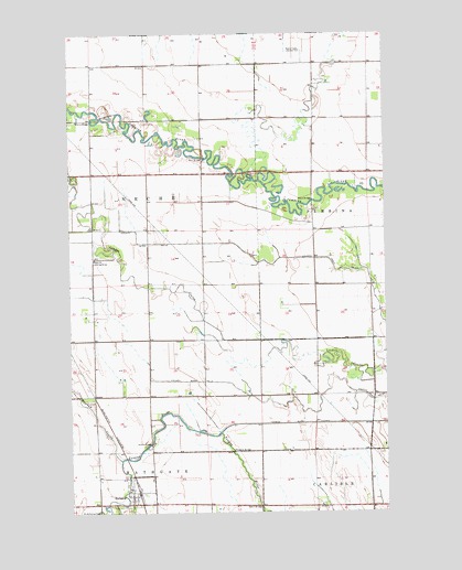
Bathgate, ND USGS Topographic Map
Click on map above to begin viewing in our Map Viewer.

This topographic map contains these locations and features:
Feature Name Type Latitude Longitude GNIS ID View Map
Austin BridgeBridgeN48.8928°W97.4687°1027771View Map
BathgatePopulated PlaceN48.8772°W97.4762°1027828View Map
Bathgate Fire DepartmentBuildingN48.8776°W97.4751°2658823View Map
Bathgate Post OfficePost OfficeN48.8798°W97.4761°2741718View Map
Black BridgeBridgeN48.9564°W97.4037°1028020View Map
Bonaime Field (historical)AirportN48.9375°W97.4920°1033560View Map
City of BathgateCivilN48.8803°W97.4738°1035924View Map
County Ditch Number 17CanalN48.9092°W97.4492°1028487View Map
County Ditch Number 42CanalN48.9403°W97.4223°1028502View Map
County Drain Number 33CanalN48.9019°W97.4017°1027633View Map
County Drain Number 42CanalN48.9380°W97.3940°1028515View Map
Horsley Airstrip (historical)AirportN48.9836°W97.4643°2650620View Map
Kain BridgeBridgeN48.9675°W97.4462°1029706View Map
KWBA-TV (Pembina)TowerN48.9950°W97.4076°1033473View Map
Meagher BridgeBridgeN48.8908°W97.4362°1030168View Map
Morris BridgeBridgeN48.9778°W97.4909°1030289View Map
Rosebud CouleeValleyN48.8889°W97.4806°1030987View Map
Seblin BridgeBridgeN48.8767°W97.4256°1032010View Map
Tongue River CutoffCanalN48.8980°W97.3881°1032504View Map
Township of NecheCivilN48.9422°W97.4834°1036736View Map

Note: Coordinates in the location and feature list above are referenced to NAD83 datum.


Copyright (C) 2008-2025 Ryan Niemi / Sunset Dynamics ... All Rights Reserved