TopoQuest Logo
Do you find TopoQuest useful?
Help keep TopoQuest running and adding new maps/features by donating!
Bitcoin:  19c7KJd3qBynnjoSw5npx9KScwjBe4ifkT
Litecoin:  LXs6TkuXGGXo1vDsWCkWVdjQX94eUKd6ui
Home View Maps Find Maps Find Places Resources & Links


Lone Star, Louisiana Topographic Map

USGS Map Title: Lone Star, LA
USGS Map MRC: 30091A2
DRG (GeoTIFF) Download: o30091a2.tif


Neighboring USGS Topographic Map Quads:


  Bayou Sorrel, LA  
30091B3
 

  White Castle, LA  
30091B2
 

  Carville, LA  
30091B1
 

  Pigeon, LA  
30091A3
 

  Lone Star, LA  
30091A2
 

  Belle Rose, LA  
30091A1
 

  Centerville NE, LA  
29091H3
 

  Pierre Part, LA  
29091H2
 

  Napoleonville, LA  
29091H1


Map MRC Location:

N31°
W92°
N31°
W91°
H8 H7 H6 H5 H4 H3 H2 H1
G8 G7 G6 G5 G4 G3 G2 G1
F8 F7 F6 F5 F4 F3 F2 F1
E8 E7 E6 E5 E4 E3 E2 E1
D8 D7 D6 D5 D4 D3 D2 D1
C8 C7 C6 C5 C4 C3 C2 C1
B8 B7 B6 B5 B4 B3 B2 B1
A8 A7 A6 A5 A4 A3 A2 A1
N30°
W92°
N30°
W91°

Lone Star, LA USGS 1:24K Topographic Map Preview:
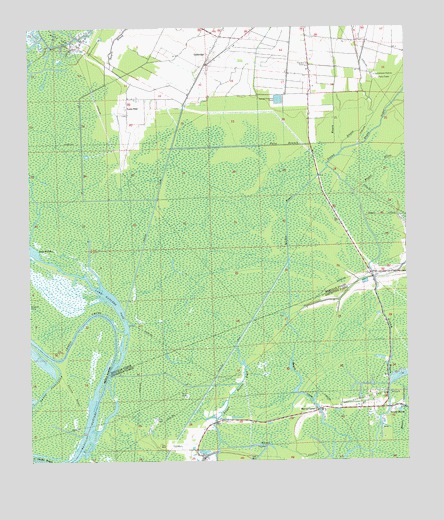
Lone Star, LA USGS Topographic Map
Click on map above to begin viewing in our Map Viewer.

This topographic map contains these locations and features:
Feature Name Type Latitude Longitude GNIS ID View Map
Bay NatchezBayN30.0105°W91.2309°532376View Map
Bayou BijouGutN30.0844°W91.1345°532444View Map
Bayou BlackStreamN30.1116°W91.2190°532448View Map
Bayou ChoupiqueGutN30.0163°W91.1262°532524View Map
Bayou CorneStreamN30.0024°W91.1454°532540View Map
Bayou CornePopulated PlaceN30.0146°W91.1551°542962View Map
Bayou Corne Census Designated PlaceCensusN30.0159°W91.1528°2761293View Map
Bayou CrouixGutN30.0038°W91.1659°532550View Map
Bayou CrouixStreamN30.0527°W91.1357°532551View Map
Bayou SigurStreamN30.0896°W91.1459°532777View Map
Bayou TigreStreamN30.1199°W91.2423°532794View Map
Chopin ChuteStreamN30.0183°W91.2276°533938View Map
False Branch BayouCanalN30.0913°W91.1579°534898View Map
GoldridgePopulated PlaceN30.1158°W91.1904°543243View Map
Grand BayouPopulated PlaceN30.0152°W91.1307°543252View Map
Grand Bayou Oil and Gas FieldOilfieldN30.0016°W91.1723°552884View Map
Lake NatchezLakeN30.0545°W91.2367°555461View Map
Lake Natchez PassChannelN30.0444°W91.2209°536288View Map
Lone StarPopulated PlaceN30.1021°W91.2170°555132View Map
Muddy BayouCanalN30.0669°W91.1643°537475View Map
Natchez Bay Gas FieldOilfieldN30.0080°W91.2001°552893View Map
Possum BayouStreamN30.0260°W91.2404°538356View Map
Saint John the Baptist ChurchChurchN30.1158°W91.1879°557201View Map
Ward EightCivilN30.0124°W91.1551°544908View Map
White Castle Volunteer Fire DepartmentBuildingN30.1227°W91.1856°2691675View Map

Note: Coordinates in the location and feature list above are referenced to NAD83 datum.


Copyright (C) 2008-2024 Ryan Niemi / Sunset Dynamics ... All Rights Reserved