TopoQuest Logo
Do you find TopoQuest useful?
Help keep TopoQuest running and adding new maps/features by donating!
Bitcoin:  19c7KJd3qBynnjoSw5npx9KScwjBe4ifkT
Litecoin:  LXs6TkuXGGXo1vDsWCkWVdjQX94eUKd6ui
Home View Maps Find Maps Find Places Resources & Links


Longview, Illinois Topographic Map

USGS Map Title: Longview, IL
USGS Map MRC: 39088H1
DRG (GeoTIFF) Download: o39088h1.tif


Neighboring USGS Topographic Map Quads:


  Urbana, IL  
40088A2
 

  Saint Joseph, IL  
40088A1
 

  Homer, IL  
40087A8
 

  Villa Grove NW, IL  
39088H2
 

  Longview, IL  
39088H1
 

  Allerton, IL  
39087H8
 

  Villa Grove, IL  
39088G2
 

  Murdock, IL  
39088G1
 

  Newman, IL  
39087G8


Map MRC Location:

N40°
W89°
N40°
W88°
H8 H7 H6 H5 H4 H3 H2 H1
G8 G7 G6 G5 G4 G3 G2 G1
F8 F7 F6 F5 F4 F3 F2 F1
E8 E7 E6 E5 E4 E3 E2 E1
D8 D7 D6 D5 D4 D3 D2 D1
C8 C7 C6 C5 C4 C3 C2 C1
B8 B7 B6 B5 B4 B3 B2 B1
A8 A7 A6 A5 A4 A3 A2 A1
N39°
W89°
N39°
W88°

Longview, IL USGS 1:24K Topographic Map Preview:
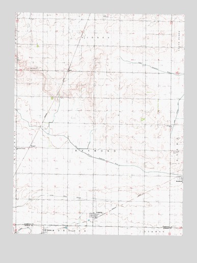
Longview, IL USGS Topographic Map
Click on map above to begin viewing in our Map Viewer.

This topographic map contains these locations and features:
Feature Name Type Latitude Longitude GNIS ID View Map
BlockPopulated PlaceN39.9684°W88.0856°422474View Map
BongardPopulated PlaceN39.9242°W88.1237°422486View Map
FairlandPopulated PlaceN39.8764°W88.1017°408176View Map
Immaculate Conception CemeteryCemeteryN39.9234°W88.1237°1810761View Map
Immaculate Conception ChurchChurchN39.9236°W88.1234°1748037View Map
Immanuel ChurchChurchN39.9373°W88.0089°410791View Map
Immanuel Lutheran CemeteryCemeteryN39.9361°W88.0092°1810762View Map
Justus Airport (historical)AirportN39.9967°W88.0599°427811View Map
Little Vermilion DitchCanalN39.9517°W88.0036°412425View Map
LongviewPopulated PlaceN39.8867°W88.0664°412619View Map
Longview Post OfficePost OfficeN39.8850°W88.0641°2788475View Map
Longview Volunteer Fire DepartmentBuildingN39.8856°W88.0634°2682086View Map
Lynn Grove CemeteryCemeteryN39.9684°W88.1137°412767View Map
Pleasant Hill ChurchChurchN39.9520°W88.0661°415838View Map
Saint John CemeteryCemeteryN39.9223°W88.0048°1748046View Map
Saint John ChurchChurchN39.9231°W88.0064°417347View Map
Saint Paul ChurchLocaleN39.9828°W88.0673°417704View Map
Township of RaymondCivilN39.9235°W88.0663°429621View Map
Village of LongviewCivilN39.8859°W88.0663°2398473View Map

Note: Coordinates in the location and feature list above are referenced to NAD83 datum.


Copyright (C) 2008-2024 Ryan Niemi / Sunset Dynamics ... All Rights Reserved