TopoQuest Logo
Do you find TopoQuest useful?
Help keep TopoQuest running and adding new maps/features by donating!
Bitcoin:  19c7KJd3qBynnjoSw5npx9KScwjBe4ifkT
Litecoin:  LXs6TkuXGGXo1vDsWCkWVdjQX94eUKd6ui
Home View Maps Find Maps Find Places Resources & Links


Lookout Mountain, Colorado Topographic Map

USGS Map Title: Lookout Mountain, CO
USGS Map MRC: 37106H4
DRG (GeoTIFF) Download: o37106h4.tif


Neighboring USGS Topographic Map Quads:


  Grouse Creek, CO  
38106A5
 

  Lake Mountain, CO  
38106A4
 

  Laughlin Gulch, CO  
38106A3
 

  Bowers Peak, CO  
37106H5
 

  Lookout Mountain, CO  
37106H4
 

  Lime Creek, CO  
37106H3
 

  Pine Cone Knob, CO  
37106G5
 

  Twin Mountains, CO  
37106G4
 

  Twin Mountains SE, CO  
37106G3


Map MRC Location:

N38°
W107°
N38°
W106°
H8 H7 H6 H5 H4 H3 H2 H1
G8 G7 G6 G5 G4 G3 G2 G1
F8 F7 F6 F5 F4 F3 F2 F1
E8 E7 E6 E5 E4 E3 E2 E1
D8 D7 D6 D5 D4 D3 D2 D1
C8 C7 C6 C5 C4 C3 C2 C1
B8 B7 B6 B5 B4 B3 B2 B1
A8 A7 A6 A5 A4 A3 A2 A1
N37°
W107°
N37°
W106°

Lookout Mountain, CO USGS 1:24K Topographic Map Preview:
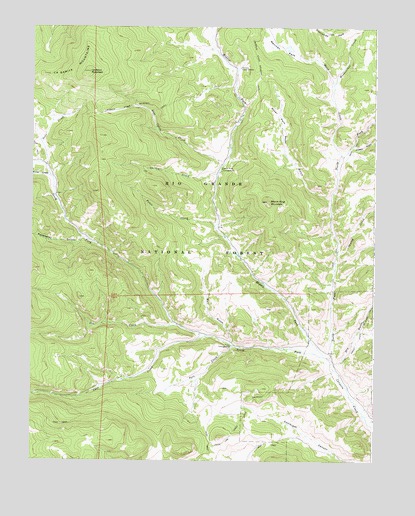
Lookout Mountain, CO USGS Topographic Map
Click on map above to begin viewing in our Map Viewer.

This topographic map contains these locations and features:
Feature Name Type Latitude Longitude GNIS ID View Map
Bull GulchValleyN37.9095°W106.4277°189539View Map
Carnero Guard StationLocaleN37.9883°W106.4248°189530View Map
Cave CreekStreamN37.9111°W106.4361°189523View Map
Cecilia CreekStreamN37.9564°W106.4328°189528View Map
Deer CreekStreamN37.9600°W106.4950°189526View Map
Dry GulchValleyN37.9033°W106.3895°189545View Map
Fence CreekStreamN37.9428°W106.4336°189538View Map
Laughlin Stock DrivewayTrailN37.9767°W106.4553°189517View Map
Lime Creek Stock DrivewayTrailN37.9183°W106.3775°203394View Map
Lookout MountainSummitN37.9869°W106.4795°189525View Map
Lost Cabin CreekStreamN37.9600°W106.4309°189527View Map
Mann CreekStreamN37.9628°W106.3873°189533View Map
Masauernez CreekStreamN37.9836°W106.3906°189532View Map
Mexican ParkFlatN37.9956°W106.4136°203392View Map
Middle Fork Carnero CreekStreamN37.9050°W106.3934°189529View Map
North Fork Carnero CreekStreamN37.9044°W106.3909°189537View Map
Oso CreekStreamN37.9142°W106.4467°189516View Map
Paradise DamDamN37.9517°W106.3906°199608View Map
Paradise ReservoirReservoirN37.9517°W106.3906°199609View Map
Poison GulchValleyN37.9658°W106.3832°189536View Map
Poso CampgroundLocaleN37.9081°W106.4275°189542View Map
Poso CreekStreamN37.9083°W106.4261°189543View Map
Prong CreekStreamN37.9567°W106.4934°189513View Map
Raspberry GulchValleyN37.9393°W106.4818°189514View Map
Royal GulchValleyN37.9502°W106.3913°189535View Map
Royal ParkFlatN37.9744°W106.4109°189534View Map
Sawlog CreekStreamN37.9350°W106.3889°189541View Map
South Fork Carnero CreekStreamN37.9050°W106.3934°189510View Map
Storm King CampgroundLocaleN37.9592°W106.4311°189531View Map
Storm King MountainSummitN37.9497°W106.4142°189540View Map
Sunnyside ParkFlatN37.9983°W106.3931°203393View Map

Note: Coordinates in the location and feature list above are referenced to NAD83 datum.


Copyright (C) 2008-2025 Ryan Niemi / Sunset Dynamics ... All Rights Reserved