TopoQuest Logo
Do you find TopoQuest useful?
Help keep TopoQuest running and adding new maps/features by donating!
Bitcoin:  19c7KJd3qBynnjoSw5npx9KScwjBe4ifkT
Litecoin:  LXs6TkuXGGXo1vDsWCkWVdjQX94eUKd6ui
Home View Maps Find Maps Find Places Resources & Links


Loon Lake, Montana Topographic Map

USGS Map Title: Loon Lake, MT
USGS Map MRC: 48115A2
DRG (GeoTIFF) Download: o48115a2.tif


Neighboring USGS Topographic Map Quads:


  Fisher Mountain, MT  
48115B3
 

  Calx Mountain, MT  
48115B2
 

  Deer Creek, MT  
48115B1
 

  Kenelty Mountain, MT  
48115A3
 

  Loon Lake, MT  
48115A2
 

  Thompson Lakes, MT  
48115A1
 

  Miller Lake, MT  
47115H3
 

  Mantrap Fork, MT  
47115H2
 

  Bend, MT  
47115H1


Map MRC Location:

N49°
W116°
N49°
W115°
H8 H7 H6 H5 H4 H3 H2 H1
G8 G7 G6 G5 G4 G3 G2 G1
F8 F7 F6 F5 F4 F3 F2 F1
E8 E7 E6 E5 E4 E3 E2 E1
D8 D7 D6 D5 D4 D3 D2 D1
C8 C7 C6 C5 C4 C3 C2 C1
B8 B7 B6 B5 B4 B3 B2 B1
A8 A7 A6 A5 A4 A3 A2 A1
N48°
W116°
N48°
W115°

Loon Lake, MT USGS 1:24K Topographic Map Preview:
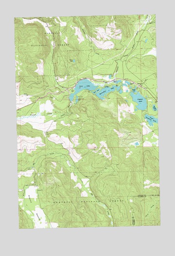
Loon Lake, MT USGS Topographic Map
Click on map above to begin viewing in our Map Viewer.

This topographic map contains these locations and features:
Feature Name Type Latitude Longitude GNIS ID View Map
Barnum CreekStreamN48.1219°W115.1307°779377View Map
Bootjack LakeLakeN48.0849°W115.1520°780233View Map
Crystal LakeLakeN48.0744°W115.1413°781965View Map
Elk CreekStreamN48.0361°W115.2391°783072View Map
Elk ParkFlatN48.0366°W115.2391°783108View Map
Fisher River Valley Fire and Rescue Battalion 1BuildingN48.0830°W115.1390°2546685View Map
Happys InnPopulated PlaceN48.0833°W115.1404°784542View Map
Happys Inn Census Designated PlaceCensusN48.0638°W115.1350°2583813View Map
Horseshoe LakeLakeN48.0801°W115.1706°785077View Map
Lavon LakeLakeN48.0744°W115.1422°785990View Map
Leon LakeLakeN48.0804°W115.1798°786054View Map
Lilypad LakeLakeN48.0857°W115.1599°786120View Map
Little Loon LakeLakeN48.0752°W115.1968°786322View Map
Loon LakeLakeN48.0824°W115.1919°786562View Map
Loon Lake MineMineN48.0533°W115.1996°804100View Map
Myron LakeLakeN48.0985°W115.1989°787892View Map
Potter MineMineN48.0805°W115.2427°804073View Map
Rainbow LakeLakeN48.0695°W115.1287°789339View Map
Sipes CreekStreamN48.1219°W115.1327°790554View Map
Thompson Chain of Lakes Fishing Access SiteLocaleN48.0627°W115.1296°1744301View Map
Wabuno CreekStreamN48.0983°W115.1593°792736View Map

Note: Coordinates in the location and feature list above are referenced to NAD83 datum.


Copyright (C) 2008-2025 Ryan Niemi / Sunset Dynamics ... All Rights Reserved