TopoQuest Logo
Do you find TopoQuest useful?
Help keep TopoQuest running and adding new maps/features by donating!
Bitcoin:  19c7KJd3qBynnjoSw5npx9KScwjBe4ifkT
Litecoin:  LXs6TkuXGGXo1vDsWCkWVdjQX94eUKd6ui
Home View Maps Find Maps Find Places Resources & Links


Lowden, Iowa Topographic Map

USGS Map Title: Lowden, IA
USGS Map MRC: 41090G8
DRG (GeoTIFF) Download: o41090g8.tif


Neighboring USGS Topographic Map Quads:


  Clarence, IA  
41091H1
 

  Oxford Junction, IA  
41090H8
 

  Lost Nation, IA  
41090H7
 

  Tipton East, IA  
41091G1
 

  Lowden, IA  
41090G8
 

  Wheatland, IA  
41090G7
 

  Lime City, IA  
41091F1
 

  Bennett, IA  
41090F8
 

  Dixon, IA  
41090F7


Map MRC Location:

N42°
W91°
N42°
W90°
H8 H7 H6 H5 H4 H3 H2 H1
G8 G7 G6 G5 G4 G3 G2 G1
F8 F7 F6 F5 F4 F3 F2 F1
E8 E7 E6 E5 E4 E3 E2 E1
D8 D7 D6 D5 D4 D3 D2 D1
C8 C7 C6 C5 C4 C3 C2 C1
B8 B7 B6 B5 B4 B3 B2 B1
A8 A7 A6 A5 A4 A3 A2 A1
N41°
W91°
N41°
W90°

Lowden, IA USGS 1:24K Topographic Map Preview:
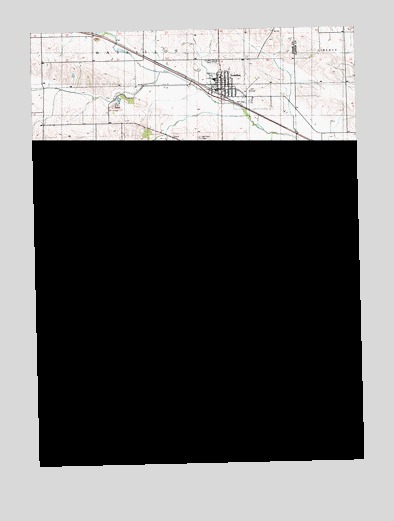
Lowden, IA USGS Topographic Map
Click on map above to begin viewing in our Map Viewer.

This topographic map contains these locations and features:
Feature Name Type Latitude Longitude GNIS ID View Map
City of LowdenCivilN41.8591°W90.9235°2395777View Map
Elliott Parr GraveCemeteryN41.8445°W90.9460°2001689View Map
Fairview CemeteryCemeteryN41.8156°W90.9865°456487View Map
Harwell Post Office (historical)Post OfficeN41.8500°W90.9643°2001546View Map
Hickey SchoolLocaleN41.8734°W90.9960°457420View Map
Homigrahusen CemeteryCemeteryN41.8089°W90.8757°2000849View Map
InlandLocaleN41.7570°W90.9279°466078View Map
Inland CemeteryCemeteryN41.7595°W90.9276°457816View Map
Inland Post Office (historical)Post OfficeN41.7542°W90.9071°2001545View Map
Lithgow Post Office (historical)Post OfficeN41.8084°W90.9460°2001544View Map
LithgroveLocaleN41.7903°W90.9960°466079View Map
LowdenPopulated PlaceN41.8575°W90.9282°458651View Map
LowdenLocaleN41.8556°W90.9268°2001636View Map
Lowden CemeteryCemeteryN41.8659°W90.9290°458652View Map
Lowden Emergency RescueBuildingN41.8573°W90.9271°2599972View Map
Lowden Family Medical ClinicHospitalN41.8575°W90.9285°2001637View Map
Lowden Fire DepartmentBuildingN41.8574°W90.9270°2001635View Map
Lowden Post OfficePost OfficeN41.8575°W90.9235°2001633View Map
Lowden Public LibraryBuildingN41.8578°W90.9282°2001634View Map
Lowden QuarryMineN41.8533°W90.9681°2571528View Map
Memorial ParkParkN41.8614°W90.9296°464944View Map
North Cedar Elementary SchoolSchoolN41.8606°W90.9293°2001642View Map
North Cedar Lowden Elementary SchoolSchoolN41.8604°W90.9293°464945View Map
Parker School (historical)SchoolN41.7575°W90.8790°465136View Map
Pioneer CemeteryCemeteryN41.7712°W90.8786°460181View Map
Red Oak School (historical)SchoolN41.7859°W90.8813°465147View Map
Rosette Post Office (historical)Post OfficeN41.8084°W90.9863°2001547View Map
Three-Thirty Golf and Country ClubLocaleN41.8584°W90.9154°2001641View Map
Townsend Wildlife AreaParkN41.8167°W90.9543°2001519View Map
Township of SpringfieldCivilN41.8169°W90.9559°468740View Map
Trinity Lutheran ChurchChurchN41.8611°W90.9271°2001639View Map
University of Iowa Health Care CenterHospitalN41.8575°W90.9285°2001638View Map
Van Horn CemeteryCemeteryN41.8439°W90.9354°462532View Map
Zion Church CemeteryCemeteryN41.8297°W90.9071°1825058View Map
Zion United Church of ChristChurchN41.8578°W90.9254°2001640View Map

Note: Coordinates in the location and feature list above are referenced to NAD83 datum.


Copyright (C) 2008-2024 Ryan Niemi / Sunset Dynamics ... All Rights Reserved