TopoQuest Logo
Do you find TopoQuest useful?
Help keep TopoQuest running and adding new maps/features by donating!
Bitcoin:  19c7KJd3qBynnjoSw5npx9KScwjBe4ifkT
Litecoin:  LXs6TkuXGGXo1vDsWCkWVdjQX94eUKd6ui
Home View Maps Find Maps Find Places Resources & Links


Lowry, Montana Topographic Map

USGS Map Title: Lowry, MT
USGS Map MRC: 47112E1
DRG (GeoTIFF) Download: o47112e1.tif


Neighboring USGS Topographic Map Quads:


  Sevenmile Hill, MT  
47112F2
 

  Freezeout Lake, MT  
47112F1
 

  Cleiv, MT  
47111F8
 

  Golden Ridge, MT  
47112E2
 

  Lowry, MT  
47112E1
 

  Fairfield, MT  
47111E8
 

  Bowmans Corners NW, MT  
47112D2
 

  Bowmans Corners NE, MT  
47112D1
 

  Simms, MT  
47111D8


Map MRC Location:

N48°
W113°
N48°
W112°
H8 H7 H6 H5 H4 H3 H2 H1
G8 G7 G6 G5 G4 G3 G2 G1
F8 F7 F6 F5 F4 F3 F2 F1
E8 E7 E6 E5 E4 E3 E2 E1
D8 D7 D6 D5 D4 D3 D2 D1
C8 C7 C6 C5 C4 C3 C2 C1
B8 B7 B6 B5 B4 B3 B2 B1
A8 A7 A6 A5 A4 A3 A2 A1
N47°
W113°
N47°
W112°

Lowry, MT USGS 1:24K Topographic Map Preview:
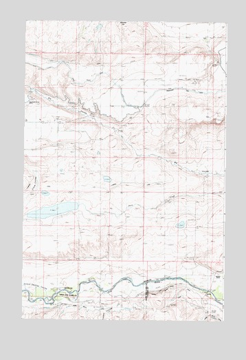
Lowry, MT USGS Topographic Map
Click on map above to begin viewing in our Map Viewer.

This topographic map contains these locations and features:
Feature Name Type Latitude Longitude GNIS ID View Map
20N03W04B___01 WellWellN47.5208°W112.0031°823576View Map
21N03W05A___01 WellWellN47.6077°W112.0131°824030View Map
21N03W05DADC01 WellWellN47.6011°W112.0108°823992View Map
21N03W06CCCA01 WellWellN47.5980°W112.0497°823971View Map
21N03W06DDAA01 WellWellN47.6005°W112.0300°823987View Map
21N04W01CACC01 WellWellN47.6013°W112.0661°823994View Map
21N04W01CACC02 WellWellN47.6011°W112.0658°823993View Map
21N04W02CADA01 WellWellN47.6019°W112.0836°824000View Map
21N04W11AAAA01 WellWellN47.5969°W112.0725°823967View Map
21N04W11AABA01 WellWellN47.5966°W112.0750°823965View Map
22N03W28CBBB01 WellWellN47.6247°W112.0083°824122View Map
22N03W31A___01 WellWellN47.6225°W112.0344°824120View Map
22N03W31AABB01 WellWellN47.5005°W112.0333°823428View Map
22N03W31D___01 WellWellN47.6152°W112.0344°824073View Map
22N03W32A___01 WellWellN47.6225°W112.0133°824119View Map
22N03W32DACA01 WellWellN47.6169°W112.0125°824092View Map
22N03W33CCDD01 WellWellN47.6122°W112.0036°824054View Map
Big Coulee DropCanalN47.5944°W112.1236°768773View Map
Fairfield DivisionCivilN47.6198°W112.0803°1940609View Map
Freak Out DamDamN47.6200°W112.0742°798452View Map
Hamilton RanchLocaleN47.5197°W112.0036°772103View Map
Loomis (historical)LocaleN47.5086°W112.0644°1789143View Map
Loomis CouleeValleyN47.5047°W112.0683°801100View Map
LowryPopulated PlaceN47.5124°W112.0097°773748View Map
Lowry (historical)LocaleN47.5111°W112.0119°1761792View Map
Lowry Post Office (historical)Post OfficeN47.5202°W112.0056°1762065View Map
Sun River BridgeBridgeN47.5127°W112.0097°1761794View Map
Turnbull DropCanalN47.6027°W112.0736°777807View Map
Upper Turnbull DropCanalN47.6052°W112.0975°777943View Map

Note: Coordinates in the location and feature list above are referenced to NAD83 datum.


Copyright (C) 2008-2025 Ryan Niemi / Sunset Dynamics ... All Rights Reserved