TopoQuest Logo
Do you find TopoQuest useful?
Help keep TopoQuest running and adding new maps/features by donating!
Bitcoin:  19c7KJd3qBynnjoSw5npx9KScwjBe4ifkT
Litecoin:  LXs6TkuXGGXo1vDsWCkWVdjQX94eUKd6ui
Home View Maps Find Maps Find Places Resources & Links


Lucerne, Missouri Topographic Map

USGS Map Title: Lucerne, MO
USGS Map MRC: 40093D3
DRG (GeoTIFF) Download: o40093d3.tif


Neighboring USGS Topographic Map Quads:


  Cleopatra, MO  
40093E4
 

  Powersville, MO  
40093E3
 

  Saint John, MO  
40093E2
 

  Ravanna, MO  
40093D4
 

  Lucerne, MO  
40093D3
 

  Pollock NW, MO  
40093D2
 

  Half Rock, MO  
40093C4
 

  Harris, MO  
40093C3
 

  Pollock SW, MO  
40093C2


Map MRC Location:

N41°
W94°
N41°
W93°
H8 H7 H6 H5 H4 H3 H2 H1
G8 G7 G6 G5 G4 G3 G2 G1
F8 F7 F6 F5 F4 F3 F2 F1
E8 E7 E6 E5 E4 E3 E2 E1
D8 D7 D6 D5 D4 D3 D2 D1
C8 C7 C6 C5 C4 C3 C2 C1
B8 B7 B6 B5 B4 B3 B2 B1
A8 A7 A6 A5 A4 A3 A2 A1
N40°
W94°
N40°
W93°

Lucerne, MO USGS 1:24K Topographic Map Preview:
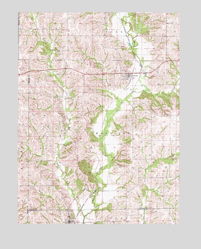
Lucerne, MO USGS Topographic Map
Click on map above to begin viewing in our Map Viewer.

This topographic map contains these locations and features:
Feature Name Type Latitude Longitude GNIS ID View Map
Barber CreekStreamN40.3792°W93.3235°713635View Map
Buchannan School (historical)SchoolN40.4506°W93.3419°733767View Map
Busby CemeteryCemeteryN40.4775°W93.3463°715103View Map
Elm BranchStreamN40.4528°W93.2880°717504View Map
Fairview School (historical)SchoolN40.4911°W93.3555°733766View Map
Fillmore School (historical)SchoolN40.4050°W93.3280°733768View Map
Howard CemeteryCemeteryN40.4136°W93.2566°719913View Map
Lick BranchStreamN40.4500°W93.3383°721015View Map
Little West Locust CreekStreamN40.3842°W93.2763°721357View Map
Long BranchStreamN40.4464°W93.2963°721502View Map
LucernePopulated PlaceN40.4639°W93.2922°721660View Map
Lucerne Post OfficePost OfficeN40.4639°W93.2894°2783149View Map
Medicine Creek Fire Protection DistrictBuildingN40.3754°W93.3353°2620676View Map
Medicine Creek Township Fire DepartmentBuildingN40.4626°W93.2895°2620302View Map
NewtownPopulated PlaceN40.3764°W93.3349°723348View Map
Newtown Post OfficePost OfficeN40.3758°W93.3354°2783094View Map
Old Busby CemeteryCemeteryN40.4717°W93.3474°723718View Map
Snyder School (historical)SchoolN40.4864°W93.3080°733769View Map
Town of NewtownCivilN40.3763°W93.3336°2396816View Map
Township of MedicineCivilN40.4278°W93.2819°767243View Map
Village of LucerneCivilN40.4640°W93.2912°2399198View Map
West Putnam SchoolSchoolN40.4936°W93.2602°735908View Map
Wilkes School (historical)SchoolN40.4047°W93.2813°733770View Map

Note: Coordinates in the location and feature list above are referenced to NAD83 datum.


Copyright (C) 2008-2024 Ryan Niemi / Sunset Dynamics ... All Rights Reserved