TopoQuest Logo
Do you find TopoQuest useful?
Help keep TopoQuest running and adding new maps/features by donating!
Bitcoin:  19c7KJd3qBynnjoSw5npx9KScwjBe4ifkT
Litecoin:  LXs6TkuXGGXo1vDsWCkWVdjQX94eUKd6ui
Home View Maps Find Maps Find Places Resources & Links


Ludlow, Maine Topographic Map

USGS Map Title: Ludlow, ME
USGS Map MRC: 46068B1
DRG (GeoTIFF) Download: o46068b1.tif


Neighboring USGS Topographic Map Quads:


  Saint Croix Lake, ME  
46068C2
 

  North Brook Ridge, ME  
46068C1
 

  Harvey, ME  
46067C8
 

  Smyrna Mills, ME  
46068B2
 

  Ludlow, ME  
46068B1
 

  Twin Brook, ME  
46067B8
 

  Oakfield, ME  
46068A2
 

  Meduxnekeag Lake, ME  
46068A1
 

  Linneus, ME  
46067A8


Map MRC Location:

N47°
W69°
N47°
W68°
H8 H7 H6 H5 H4 H3 H2 H1
G8 G7 G6 G5 G4 G3 G2 G1
F8 F7 F6 F5 F4 F3 F2 F1
E8 E7 E6 E5 E4 E3 E2 E1
D8 D7 D6 D5 D4 D3 D2 D1
C8 C7 C6 C5 C4 C3 C2 C1
B8 B7 B6 B5 B4 B3 B2 B1
A8 A7 A6 A5 A4 A3 A2 A1
N46°
W69°
N46°
W68°

Ludlow, ME USGS 1:24K Topographic Map Preview:
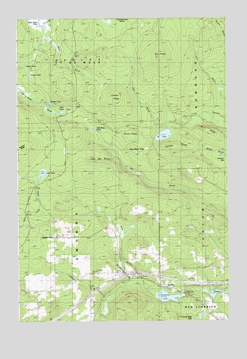
Ludlow, ME USGS Topographic Map
Click on map above to begin viewing in our Map Viewer.

This topographic map contains these locations and features:
Feature Name Type Latitude Longitude GNIS ID View Map
Amish CemeteryCemeteryN46.1486°W68.0869°2678661View Map
B LakeLakeN46.2017°W68.0378°561035View Map
B RidgeRidgeN46.2048°W68.0131°561036View Map
Beaver PondLakeN46.2306°W68.1197°561954View Map
Bradbury LakeLakeN46.1362°W68.0072°562848View Map
Bull RidgeRidgeN46.2348°W68.0389°563164View Map
Cochrane LakeLakeN46.1350°W68.0358°564140View Map
Collis BrookStreamN46.2475°W68.1072°564239View Map
Duck PondLakeN46.1862°W68.1100°565360View Map
Dunn BrookStreamN46.1389°W68.0481°565413View Map
Gardiner RidgeRidgeN46.1967°W68.0359°566692View Map
Hale BrookStreamN46.2095°W68.0203°567434View Map
Half Moon PondLakeN46.2045°W68.0792°567453View Map
Hidden PondLakeN46.2150°W68.1052°568000View Map
Innes Beaver PondSwampN46.1970°W68.0481°568653View Map
Interchange 61CrossingN46.1445°W68.0603°1910428View Map
Kennedy Tote RoadTrailN46.2137°W68.0836°569119View Map
Lamb Brook DamDamN46.1633°W68.0203°1774408View Map
Lamb Brook PondReservoirN46.1635°W68.0220°1774409View Map
Limestone BrookStreamN46.1342°W68.0714°569590View Map
Little Mill BrookStreamN46.1923°W68.0650°569907View Map
Longfellow SchoolSchoolN46.1467°W68.0147°570333View Map
LudlowPopulated PlaceN46.1406°W68.0400°570579View Map
Marley BrookStreamN46.1398°W68.0575°570791View Map
McCain SchoolSchoolN46.1253°W68.0034°570947View Map
Mud PondLakeN46.2115°W68.0983°571936View Map
Number Seven RidgeRidgeN46.2153°W68.0670°572542View Map
Pierce Tote RoadTrailN46.2309°W68.0339°573321View Map
Rocky RidgeRidgeN46.2023°W68.0520°574412View Map
Smyrna CenterPopulated PlaceN46.1601°W68.1014°579703View Map
Stewart CemeteryCemeteryN46.1600°W68.0998°2678659View Map
Thousand Acre SwampSwampN46.2459°W68.0628°577046View Map
Town of SmyrnaCivilN46.1651°W68.1037°582727View Map
Yerxa CemeteryCemeteryN46.1439°W68.0545°578760View Map

Note: Coordinates in the location and feature list above are referenced to NAD83 datum.


Copyright (C) 2008-2025 Ryan Niemi / Sunset Dynamics ... All Rights Reserved