TopoQuest Logo
Do you find TopoQuest useful?
Help keep TopoQuest running and adding new maps/features by donating!
Bitcoin:  19c7KJd3qBynnjoSw5npx9KScwjBe4ifkT
Litecoin:  LXs6TkuXGGXo1vDsWCkWVdjQX94eUKd6ui
Home View Maps Find Maps Find Places Resources & Links


Luverne, Minnesota Topographic Map

USGS Map Title: Luverne, MN
USGS Map MRC: 43096F2
DRG (GeoTIFF) Download: o43096f2.tif


Neighboring USGS Topographic Map Quads:


  Jasper SE, MN  
43096G3
 

  Edgerton South, MN  
43096G2
 

  Kenneth, MN  
43096G1
 

  Hills NE, MN  
43096F3
 

  Luverne, MN  
43096F2
 

  Magnolia, MN  
43096F1
 

  Hills, MN  
43096E3
 

  Ash Creek, MN  
43096E2
 

  Ellsworth, MN  
43096E1


Map MRC Location:

N44°
W97°
N44°
W96°
H8 H7 H6 H5 H4 H3 H2 H1
G8 G7 G6 G5 G4 G3 G2 G1
F8 F7 F6 F5 F4 F3 F2 F1
E8 E7 E6 E5 E4 E3 E2 E1
D8 D7 D6 D5 D4 D3 D2 D1
C8 C7 C6 C5 C4 C3 C2 C1
B8 B7 B6 B5 B4 B3 B2 B1
A8 A7 A6 A5 A4 A3 A2 A1
N43°
W97°
N43°
W96°

Luverne, MN USGS 1:24K Topographic Map Preview:
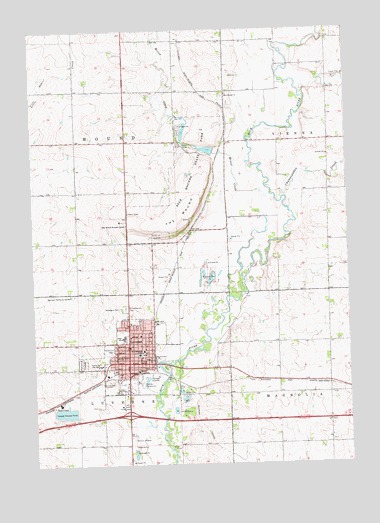
Luverne, MN USGS Topographic Map
Click on map above to begin viewing in our Map Viewer.

This topographic map contains these locations and features:
Feature Name Type Latitude Longitude GNIS ID View Map
American Reformed ChurchChurchN43.6672°W96.2131°2049120View Map
Bethany Lutheran ChurchChurchN43.6616°W96.2120°2049117View Map
Blue Mound CemeteryCemeteryN43.7317°W96.1720°2049070View Map
Blue Mound ChurchChurchN43.7316°W96.1720°640294View Map
Blue Mound Wayside ChapelChurchN43.6941°W96.2125°640295View Map
Blue Mounds State ParkParkN43.7069°W96.1870°640297View Map
Brown Church (historical)ChurchN43.6547°W96.2114°2049122View Map
Champepadan CreekStreamN43.7016°W96.1503°659988View Map
Christian Reformed ChurchChurchN43.6594°W96.2114°2049116View Map
City of LuverneCivilN43.6533°W96.2146°2395787View Map
First Assembly of God ChurchChurchN43.6416°W96.2420°2049123View Map
First Baptist ChurchChurchN43.6666°W96.2045°2049121View Map
First Presbyterian ChurchChurchN43.6652°W96.2131°2049119View Map
Grace Lutheran ChurchChurchN43.6589°W96.2125°2049115View Map
Hawkinson ParkParkN43.6580°W96.2189°644742View Map
Hinkly House MuseumBuildingN43.6561°W96.2095°2049098View Map
Holy Trinity Episcopal ChurchChurchN43.6561°W96.2075°2049113View Map
Interchange 12CrossingN43.6394°W96.2128°2049075View Map
Kingdom Hall of Jehovah's WitnessesChurchN43.6541°W96.2128°2049124View Map
KQAD-AM (Luverne)TowerN43.6502°W96.1722°662941View Map
LuverneLocaleN43.6555°W96.2025°2049106View Map
LuvernePopulated PlaceN43.6541°W96.2128°647310View Map
Luverne City HallBuildingN43.6547°W96.2075°2049095View Map
Luverne City ParkParkN43.6527°W96.1975°2049103View Map
Luverne Community HospitalHospitalN43.6569°W96.2059°2049111View Map
Luverne Country ClubLocaleN43.6458°W96.1781°2049094View Map
Luverne Fire DepartmentBuildingN43.6556°W96.2070°2049096View Map
Luverne High SchoolSchoolN43.6616°W96.2145°2049125View Map
Luverne Post OfficePost OfficeN43.6555°W96.2048°2049100View Map
Luverne Wastewater Treatment FacilityLocaleN43.6506°W96.2014°2702860View Map
Maplewood CemeteryCemeteryN43.6544°W96.2311°647505View Map
Mary Jane Good Samaritan HomeHospitalN43.6536°W96.2239°2049107View Map
Minnesota Veterans HomeHospitalN43.6689°W96.2117°2049108View Map
Mound CreekStreamN43.7027°W96.1556°648147View Map
North Mound Creek PoolReservoirN43.7205°W96.1896°1776086View Map
North Mound Creek Pool DamDamN43.7183°W96.1903°1776085View Map
Norwegian CemeteryCemeteryN43.6700°W96.2156°648755View Map
Redbird FieldParkN43.6527°W96.2003°2049102View Map
Restlawn Memorial GardensCemeteryN43.6741°W96.2342°649942View Map
Rock County AmbulanceBuildingN43.6726°W96.2104°2721361View Map
Rock County Community LibraryBuildingN43.6541°W96.2117°2049097View Map
Rock County CourthouseBuildingN43.6566°W96.2073°2049105View Map
Rock County Historical MuseumBuildingN43.6550°W96.2095°2049099View Map
Rock County Sheriff's OfficeBuildingN43.6646°W96.2020°2049104View Map
Rock County Waterfowl Production AreaParkN43.7069°W96.1576°2776744View Map
Rock River DamDamN43.6508°W96.1969°1776778View Map
Rock River ReservoirReservoirN43.6500°W96.1970°1776779View Map
Saint Catherine CemeteryCemeteryN43.6697°W96.2139°650547View Map
Saint Catherine ChurchChurchN43.6575°W96.2075°2049114View Map
Saint Catherines SchoolSchoolN43.6577°W96.2073°650548View Map
Saint John Lutheran ChurchChurchN43.6622°W96.2081°2049118View Map
Sanford Luverne Medical CenterHospitalN43.6722°W96.2106°2049110View Map
Schoeman ParkParkN43.6255°W96.2120°2049093View Map
Sioux Valley Clinic LuverneHospitalN43.6569°W96.2059°2049109View Map
South Mound Creek PoolReservoirN43.7153°W96.1805°1776084View Map
South Mound Creek Pool DamDamN43.7150°W96.1770°1776083View Map
The MoundSummitN43.6947°W96.1906°653111View Map
Township of LuverneCivilN43.6284°W96.2347°664841View Map
Township of MoundCivilN43.7179°W96.2324°665050View Map
United Methodist ChurchChurchN43.6547°W96.2098°2049112View Map
Vans DairyLocaleN43.7258°W96.1567°2664399View Map
Verne Drive Inn TheatreLocaleN43.6333°W96.2114°2049101View Map
Verne Drive-InLocaleN43.6325°W96.2117°2630561View Map

Note: Coordinates in the location and feature list above are referenced to NAD83 datum.


Copyright (C) 2008-2024 Ryan Niemi / Sunset Dynamics ... All Rights Reserved