TopoQuest Logo
Do you find TopoQuest useful?
Help keep TopoQuest running and adding new maps/features by donating!
Bitcoin:  19c7KJd3qBynnjoSw5npx9KScwjBe4ifkT
Litecoin:  LXs6TkuXGGXo1vDsWCkWVdjQX94eUKd6ui
Home View Maps Find Maps Find Places Resources & Links


Lynx Pass, Colorado Topographic Map

USGS Map Title: Lynx Pass, CO
USGS Map MRC: 40106A6
DRG (GeoTIFF) Download: o40106a6.tif


Neighboring USGS Topographic Map Quads:


  Green Ridge, CO  
40106B7
 

  Gore Mountain, CO  
40106B6
 

  Tyler Mountain, CO  
40106B5
 

  Toponas, CO  
40106A7
 

  Lynx Pass, CO  
40106A6
 

  Gore Pass, CO  
40106A5
 

  Blue Hill, CO  
39106H7
 

  McCoy, CO  
39106H6
 

  Radium, CO  
39106H5


Map MRC Location:

N41°
W107°
N41°
W106°
H8 H7 H6 H5 H4 H3 H2 H1
G8 G7 G6 G5 G4 G3 G2 G1
F8 F7 F6 F5 F4 F3 F2 F1
E8 E7 E6 E5 E4 E3 E2 E1
D8 D7 D6 D5 D4 D3 D2 D1
C8 C7 C6 C5 C4 C3 C2 C1
B8 B7 B6 B5 B4 B3 B2 B1
A8 A7 A6 A5 A4 A3 A2 A1
N40°
W107°
N40°
W106°

Lynx Pass, CO USGS 1:24K Topographic Map Preview:
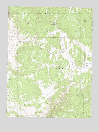
Lynx Pass, CO USGS Topographic Map
Click on map above to begin viewing in our Map Viewer.

This topographic map contains these locations and features:
Feature Name Type Latitude Longitude GNIS ID View Map
Allen DitchCanalN40.0769°W106.7203°172483View Map
Black CreekStreamN40.0033°W106.6867°173163View Map
Bulkley DamDamN40.0397°W106.7489°200610View Map
Bulkley ReservoirReservoirN40.0420°W106.7490°173146View Map
Deadman GulchValleyN40.0850°W106.7114°173149View Map
Deadman ParkFlatN40.1153°W106.7284°196777View Map
Decker CreekStreamN40.0667°W106.6567°173137View Map
Horse CreekStreamN40.0400°W106.6561°173138View Map
Iron SpringSpringN40.0564°W106.6470°173141View Map
Jolley CreekStreamN40.0611°W106.6359°173155View Map
Lagunita LakeLakeN40.1075°W106.6807°196778View Map
Little Henry CreekStreamN40.0358°W106.6389°173157View Map
Little Rock CreekStreamN40.0564°W106.6525°173151View Map
Long ParkFlatN40.0305°W106.6881°173144View Map
Lynx PassGapN40.1083°W106.6931°173145View Map
Lynx Pass CampgroundLocaleN40.1053°W106.6831°196779View Map
Lynx Pass Forest Service StationBuildingN40.1094°W106.6831°196780View Map
Maggie DitchCanalN40.0736°W106.7325°172485View Map
Morris DamDamN40.0833°W106.7006°200734View Map
Morris ReservoirReservoirN40.0847°W106.7011°200735View Map
Morrison Divide TrailTrailN40.1125°W106.7214°173123View Map
Porcupine CreekStreamN40.0978°W106.6731°173150View Map
Reid ReservoirReservoirN40.0172°W106.7449°196773View Map
Rock Creek CampgroundLocaleN40.0611°W106.6381°173140View Map
Shoe and Stocking CampgroundLocaleN40.0508°W106.6539°173143View Map
Shoe and Stocking CreekStreamN40.0508°W106.6545°173153View Map
Tepee CreekStreamN40.0911°W106.6250°173121View Map
Tepee Creek TrailTrailN40.1083°W106.6464°173120View Map
Tie CreekStreamN40.1111°W106.6803°196781View Map
Tonier Gulch DamDamN40.0933°W106.7423°200742View Map
Tonier Gulch ReservoirReservoirN40.0936°W106.7414°200743View Map
Toponas Creek CampgroundLocaleN40.0775°W106.7025°173142View Map
Whiskey CreekStreamN40.0117°W106.6773°173165View Map

Note: Coordinates in the location and feature list above are referenced to NAD83 datum.


Copyright (C) 2008-2024 Ryan Niemi / Sunset Dynamics ... All Rights Reserved