TopoQuest Logo
Do you find TopoQuest useful?
Help keep TopoQuest running and adding new maps/features by donating!
Bitcoin:  19c7KJd3qBynnjoSw5npx9KScwjBe4ifkT
Litecoin:  LXs6TkuXGGXo1vDsWCkWVdjQX94eUKd6ui
Home View Maps Find Maps Find Places Resources & Links


Maggie Summit, Nevada Topographic Map

USGS Map Title: Maggie Summit, NV
USGS Map MRC: 41116F1
DRG (GeoTIFF) Download: o41116f1.tif


Neighboring USGS Topographic Map Quads:


  Dry Creek Reservoir, NV  
41116G2
 

  Ungina Wongo, NV  
41116G1
 

  Mountain City, NV  
41115G8
 

  Bull Run Reservoir, NV  
41116F2
 

  Maggie Summit, NV  
41116F1
 

  Badger Creek, NV  
41115F8
 

  Deep Creek, NV  
41116E2
 

  Chicken Creek Summit, NV  
41116E1
 

  McAfee Peak, NV  
41115E8


Map MRC Location:

N42°
W117°
N42°
W116°
H8 H7 H6 H5 H4 H3 H2 H1
G8 G7 G6 G5 G4 G3 G2 G1
F8 F7 F6 F5 F4 F3 F2 F1
E8 E7 E6 E5 E4 E3 E2 E1
D8 D7 D6 D5 D4 D3 D2 D1
C8 C7 C6 C5 C4 C3 C2 C1
B8 B7 B6 B5 B4 B3 B2 B1
A8 A7 A6 A5 A4 A3 A2 A1
N41°
W117°
N41°
W116°

Maggie Summit, NV USGS 1:24K Topographic Map Preview:
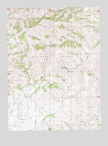
Maggie Summit, NV USGS Topographic Map
Click on map above to begin viewing in our Map Viewer.

This topographic map contains these locations and features:
Feature Name Type Latitude Longitude GNIS ID View Map
Alder GulchValleyN41.6680°W116.0876°858679View Map
Alexander CreekStreamN41.6941°W116.0223°858682View Map
AuraLocaleN41.6593°W116.1006°862501View Map
Aura King MineMineN41.6849°W116.1037°858759View Map
Aura Mining DistrictCivilN41.6980°W116.0695°855917View Map
Aura Post Office (historical)Post OfficeN41.6593°W116.1006°864524View Map
Big Four MineMineN41.6818°W116.0762°855645View Map
Blue Jacket CreekStreamN41.6655°W116.0887°858960View Map
Bull Run BasinBasinN41.6316°W116.1081°859073View Map
California GulchValleyN41.6777°W116.0987°859127View Map
Cap Winn CreekStreamN41.6405°W116.0743°859147View Map
Central Pacific MineMineN41.6980°W116.0693°857308View Map
Columbia (historical)Populated PlaceN41.6782°W116.0781°862972View Map
Columbia BasinBasinN41.6652°W116.0920°862502View Map
Columbia CreekStreamN41.6263°W116.0918°859308View Map
Columbia Post Office (historical)Post OfficeN41.6782°W116.0781°864351View Map
Columbia Queen MineMineN41.6818°W116.0784°855640View Map
Columbia RanchLocaleN41.6763°W116.0795°859309View Map
Columbia SummitGapN41.6718°W116.0651°862500View Map
Doby George CreekStreamN41.6402°W116.0745°859532View Map
Golden Eagle MineMineN41.6888°W116.0479°859847View Map
H Ireland RanchLocaleN41.7024°W116.0170°848342View Map
Humboldt MineMineN41.6966°W116.1187°855642View Map
Hutch CreekStreamN41.7066°W116.0106°860083View Map
Infidel MineMineN41.6821°W116.0834°855641View Map
Maggie GulchValleyN41.6846°W116.0423°860448View Map
Maggie Gulch CreekStreamN41.6846°W116.0406°862992View Map
Maggie SummitSummitN41.6760°W116.0495°860449View Map
North Fork Cape Winn CreekStreamN41.6307°W116.0456°860760View Map
Pennsylvania HillSummitN41.7385°W116.0751°860913View Map
Polaris GulchValleyN41.6952°W116.1070°855644View Map
Polaris MineMineN41.6963°W116.1126°855643View Map
Porter MineMineN41.6980°W116.0693°857310View Map
Sheep CreekStreamN41.6938°W116.0220°861347View Map
Spring CreekStreamN41.6874°W116.0365°861542View Map
Timber GulchValleyN41.7027°W116.0168°861735View Map
Timber Gulch CreekStreamN41.7030°W116.0159°862991View Map
Town Treasure MineMineN41.6980°W116.0693°857309View Map
Twin CreekStreamN41.6907°W116.0306°861808View Map

Note: Coordinates in the location and feature list above are referenced to NAD83 datum.


Copyright (C) 2008-2024 Ryan Niemi / Sunset Dynamics ... All Rights Reserved