TopoQuest Logo
Do you find TopoQuest useful?
Help keep TopoQuest running and adding new maps/features by donating!
Bitcoin:  19c7KJd3qBynnjoSw5npx9KScwjBe4ifkT
Litecoin:  LXs6TkuXGGXo1vDsWCkWVdjQX94eUKd6ui
Home View Maps Find Maps Find Places Resources & Links


Mahon Creek, Oregon Topographic Map

USGS Map Title: Mahon Creek, OR
USGS Map MRC: 43118E5
DRG (GeoTIFF) Download: o43118e5.tif


Neighboring USGS Topographic Map Quads:


  Buchanan, OR  
43118F6
 

  Stinkingwater Pass, OR  
43118F5
 

  Bartlett Mountain, OR  
43118F4
 

  Carson Point, OR  
43118E6
 

  Mahon Creek, OR  
43118E5
 

  Coleman Mountain, OR  
43118E4
 

  Warm Springs Butte, OR  
43118D6
 

  Crane, OR  
43118D5
 

  Tin Can Ridge, OR  
43118D4


Map MRC Location:

N44°
W119°
N44°
W118°
H8 H7 H6 H5 H4 H3 H2 H1
G8 G7 G6 G5 G4 G3 G2 G1
F8 F7 F6 F5 F4 F3 F2 F1
E8 E7 E6 E5 E4 E3 E2 E1
D8 D7 D6 D5 D4 D3 D2 D1
C8 C7 C6 C5 C4 C3 C2 C1
B8 B7 B6 B5 B4 B3 B2 B1
A8 A7 A6 A5 A4 A3 A2 A1
N43°
W119°
N43°
W118°

Mahon Creek, OR USGS 1:24K Topographic Map Preview:
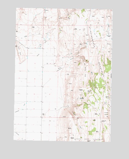
Mahon Creek, OR USGS Topographic Map
Click on map above to begin viewing in our Map Viewer.

This topographic map contains these locations and features:
Feature Name Type Latitude Longitude GNIS ID View Map
Angle ReservoirReservoirN43.6053°W118.5457°1116954View Map
Aspen ReservoirReservoirN43.5096°W118.5191°1117072View Map
Big Spring DrawValleyN43.5771°W118.5363°1117677View Map
Big Spring ReservoirReservoirN43.5478°W118.5370°1117678View Map
Bog SpringSpringN43.6159°W118.5581°1117899View Map
Box CanyonValleyN43.5368°W118.5349°1117999View Map
Crane Creek ReservoirReservoirN43.5193°W118.5113°1119510View Map
Crowcamp HillsRangeN43.5249°W118.5024°1157830View Map
Crowcamp MountainSummitN43.5238°W118.5055°1119584View Map
Crowcamp ReservoirReservoirN43.5406°W118.5398°1119585View Map
Curtis CreekStreamN43.5710°W118.6180°1119644View Map
Devine FlatFlatN43.6018°W118.5038°1119910View Map
Devine Flat SpringsSpringN43.6003°W118.5043°1119911View Map
Hornbeck SpringSpringN43.6041°W118.5684°1129704View Map
Irving SpringSpringN43.6071°W118.6039°1122287View Map
Laton PointSummitN43.5821°W118.6194°1136463View Map
Mahon CreekStreamN43.5618°W118.5938°1123692View Map
Mahon Creek ReservoirReservoirN43.5475°W118.5309°1123694View Map
McDonald SpringSpringN43.5000°W118.5300°1123941View Map
McDonald WaterholeLakeN43.5031°W118.5469°1123943View Map
Miller Brothers RanchLocaleN43.5332°W118.5621°1638243View Map
Rector ReservoirReservoirN43.5262°W118.5209°1125862View Map
Rector SpringSpringN43.5204°W118.5223°1125864View Map
Riley SpringSpringN43.6235°W118.5884°1126023View Map
Rim Rock ReservoirReservoirN43.5120°W118.5506°1126028View Map
Ritterbusch FlatFlatN43.5924°W118.5324°1126052View Map
Rock Hill ReservoirReservoirN43.5420°W118.5071°1126189View Map
Stinkingwater MountainsRidgeN43.5643°W118.5119°1127614View Map
Tule SpringSpringN43.5917°W118.5421°1128285View Map

Note: Coordinates in the location and feature list above are referenced to NAD83 datum.


Copyright (C) 2008-2025 Ryan Niemi / Sunset Dynamics ... All Rights Reserved