TopoQuest Logo
Do you find TopoQuest useful?
Help keep TopoQuest running and adding new maps/features by donating!
Bitcoin:  19c7KJd3qBynnjoSw5npx9KScwjBe4ifkT
Litecoin:  LXs6TkuXGGXo1vDsWCkWVdjQX94eUKd6ui
Home View Maps Find Maps Find Places Resources & Links


Malad City West, Idaho Topographic Map

USGS Map Title: Malad City West, ID
USGS Map MRC: 42112B3
DRG (GeoTIFF) Download: o42112b3.tif


Neighboring USGS Topographic Map Quads:


  Daniels, ID  
42112C4
 

  Elkhorn Peak, ID  
42112C3
 

  Malad Summit, ID  
42112C2
 

  Ireland Springs, ID  
42112B4
 

  Malad City West, ID  
42112B3
 

  Malad City East, ID  
42112B2
 

  Grover Canyon, ID  
42112A4
 

  Samaria, ID  
42112A3
 

  Henderson Creek, ID  
42112A2


Map MRC Location:

N43°
W113°
N43°
W112°
H8 H7 H6 H5 H4 H3 H2 H1
G8 G7 G6 G5 G4 G3 G2 G1
F8 F7 F6 F5 F4 F3 F2 F1
E8 E7 E6 E5 E4 E3 E2 E1
D8 D7 D6 D5 D4 D3 D2 D1
C8 C7 C6 C5 C4 C3 C2 C1
B8 B7 B6 B5 B4 B3 B2 B1
A8 A7 A6 A5 A4 A3 A2 A1
N42°
W113°
N42°
W112°

Malad City West, ID USGS 1:24K Topographic Map Preview:
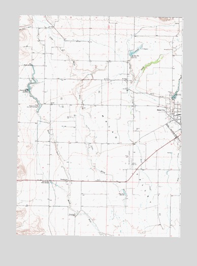
Malad City West, ID USGS Topographic Map
Click on map above to begin viewing in our Map Viewer.

This topographic map contains these locations and features:
Feature Name Type Latitude Longitude GNIS ID View Map
Big Malad SpringSpringN42.2215°W112.3650°377563View Map
Billy Snipe ReservoirReservoirN42.1499°W112.2928°377636View Map
Crowther Brothers Reservoir Public Fishing AreaLocaleN42.2041°W112.2550°401236View Map
Crowther DamDamN42.2049°W112.2575°398641View Map
Crowthers ReservoirReservoirN42.2060°W112.2555°397597View Map
Davis CreekStreamN42.2130°W112.2872°380275View Map
Deep CreekStreamN42.1438°W112.2508°380382View Map
GwenfordPopulated PlaceN42.1363°W112.3300°382783View Map
John Evans CanyonValleyN42.2430°W112.3675°383950View Map
Lower Pleasantview ReservoirReservoirN42.1949°W112.3602°386239View Map
Malad CityPopulated PlaceN42.1916°W112.2508°396844View Map
Malad City AirportAirportN42.1691°W112.2892°400868View Map
Malad City DivisionCivilN42.2288°W112.3134°1936755View Map
Malad Elementary SchoolSchoolN42.1949°W112.2516°400984View Map
Malad PrecinctCivilN42.1931°W112.2508°2663947View Map
Malad SubstationLocaleN42.1566°W112.3111°400287View Map
Nell J Redfield Memorial HospitalHospitalN42.1893°W112.2502°2721854View Map
PleasantviewPopulated PlaceN42.1560°W112.3377°397051View Map
Pleasantview Warm SpringsSpringN42.1553°W112.3486°388608View Map
Saint John DamDamN42.2274°W112.2894°398608View Map
Saint John Reservoir Public Fishing AreaLocaleN42.2274°W112.2900°401670View Map
Saint JohnsPopulated PlaceN42.2138°W112.2919°374858View Map
Saint Johns ReservoirReservoirN42.2289°W112.2889°389833View Map
Samaria Number One Lower DamDamN42.1949°W112.3602°398610View Map
Samaria Number Two Upper DamDamN42.2066°W112.3675°398611View Map
Spring CreekStreamN42.2083°W112.2536°391192View Map
Upper Pleasantview ReservoirReservoirN42.2071°W112.3667°392645View Map

Note: Coordinates in the location and feature list above are referenced to NAD83 datum.


Copyright (C) 2008-2024 Ryan Niemi / Sunset Dynamics ... All Rights Reserved