TopoQuest Logo
Do you find TopoQuest useful?
Help keep TopoQuest running and adding new maps/features by donating!
Bitcoin:  19c7KJd3qBynnjoSw5npx9KScwjBe4ifkT
Litecoin:  LXs6TkuXGGXo1vDsWCkWVdjQX94eUKd6ui
Home View Maps Find Maps Find Places Resources & Links


Malta East, Montana Topographic Map

USGS Map Title: Malta East, MT
USGS Map MRC: 48107C7
DRG (GeoTIFF) Download: o48107c7.tif


Neighboring USGS Topographic Map Quads:


  Malta NW, MT  
48107D8
 

  Malta NE, MT  
48107D7
 

  Lake Bowdoin, MT  
48107D6
 

  Malta West, MT  
48107C8
 

  Malta East, MT  
48107C7
 

  Clanton Coulee, MT  
48107C6
 

  Bennett Lake NW, MT  
48107B8
 

  Bennett Lake, MT  
48107B7
 

  Content NW, MT  
48107B6


Map MRC Location:

N49°
W108°
N49°
W107°
H8 H7 H6 H5 H4 H3 H2 H1
G8 G7 G6 G5 G4 G3 G2 G1
F8 F7 F6 F5 F4 F3 F2 F1
E8 E7 E6 E5 E4 E3 E2 E1
D8 D7 D6 D5 D4 D3 D2 D1
C8 C7 C6 C5 C4 C3 C2 C1
B8 B7 B6 B5 B4 B3 B2 B1
A8 A7 A6 A5 A4 A3 A2 A1
N48°
W108°
N48°
W107°

Malta East, MT USGS 1:24K Topographic Map Preview:
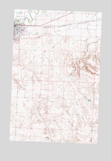
Malta East, MT USGS Topographic Map
Click on map above to begin viewing in our Map Viewer.

This topographic map contains these locations and features:
Feature Name Type Latitude Longitude GNIS ID View Map
28N30E03CBAA01 WellWellN48.3022°W107.8479°1634722View Map
Black Coulee School (historical)SchoolN48.2972°W107.7862°1721999View Map
Bowdoin CanalCanalN48.3669°W107.7584°769134View Map
Cattle Brands Historical MarkerParkN48.3606°W107.8312°1721858View Map
City of MaltaCivilN48.3555°W107.8708°2410916View Map
Community ChurchChurchN48.3567°W107.8709°1721799View Map
Dodson South Canal BridgeBridgeN48.3494°W107.8743°1721775View Map
Drabbels DamDamN48.2917°W107.7690°796420View Map
Drabbels ReservoirReservoirN48.2903°W107.7671°770742View Map
Equity Co-operative Association ElevatorLocaleN48.3597°W107.8659°1721793View Map
Gonzales CouleeValleyN48.3083°W107.7943°771848View Map
Hiline Trailer ParkPopulated PlaceN48.3672°W107.8446°1721787View Map
Hillbilly DamDamN48.3350°W107.8107°798271View Map
Hillcrest ParkParkN48.3467°W107.8673°1721790View Map
KMMR-FM (Malta)TowerN48.2547°W107.8223°806698View Map
Legg Addition ParkParkN48.3528°W107.8562°1721789View Map
MaltaPopulated PlaceN48.3597°W107.8743°773850View Map
MaltaLocaleN48.3603°W107.8737°1722040View Map
Malta City Park Rest AreaLocaleN48.3619°W107.8740°1721788View Map
Malta Elementary SchoolSchoolN48.3528°W107.8701°1722029View Map
Malta High SchoolSchoolN48.3556°W107.8701°1722027View Map
Malta Junior High SchoolSchoolN48.3561°W107.8696°1722028View Map
Malta Post OfficePost OfficeN48.3582°W107.8713°1722039View Map
Malta Stock Yards (historical)LocaleN48.3622°W107.7979°1722038View Map
Milk River BridgeBridgeN48.3636°W107.8737°1721776View Map
Morton CouleeValleyN48.3497°W107.8159°774401View Map
Murray Trailer ParkPopulated PlaceN48.3500°W107.8715°1721786View Map
Olive Lutheran Church (historical)ChurchN48.3597°W107.8743°1721794View Map
Olson Number 2 DamDamN48.2533°W107.7923°796444View Map
Phillips County AmbulanceBuildingN48.3581°W107.8733°2637888View Map
Phillips County CemeteryCemeteryN48.3520°W107.8650°1721785View Map
Phillips County Family Health ClinicHospitalN48.3578°W107.8593°1721820View Map
Phillips County Good Samaritan Retirement CenterHospitalN48.3578°W107.8593°1721819View Map
Phillips County HospitalHospitalN48.3572°W107.8596°1721821View Map
Phillips County Public LibraryBuildingN48.3567°W107.8737°1721818View Map
Phillips County Volunteer Fire Company Malta StationBuildingN48.3583°W107.8732°1721779View Map
PR-36 DamDamN48.2583°W107.8373°795862View Map
R and G Quality Feeds Incorporated ElevatorLocaleN48.3597°W107.8643°1721919View Map
Riverside Trailer CourtPopulated PlaceN48.3611°W107.8743°1721816View Map
Saint Marys Episcopal ChurchChurchN48.3561°W107.8662°1721795View Map
Southwick School (historical)SchoolN48.2997°W107.8562°1722000View Map
The Church of Jesus Christ of Latter Day SaintsChurchN48.3567°W107.8618°1721796View Map
Trafton ParkParkN48.3625°W107.8709°1721791View Map
Trafton Park CampgroundLocaleN48.3619°W107.8740°1721824View Map
Ugland School (historical)SchoolN48.3683°W107.8609°1721946View Map

Note: Coordinates in the location and feature list above are referenced to NAD83 datum.


Copyright (C) 2008-2025 Ryan Niemi / Sunset Dynamics ... All Rights Reserved